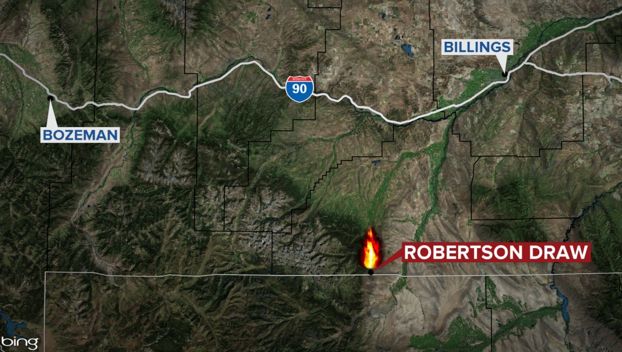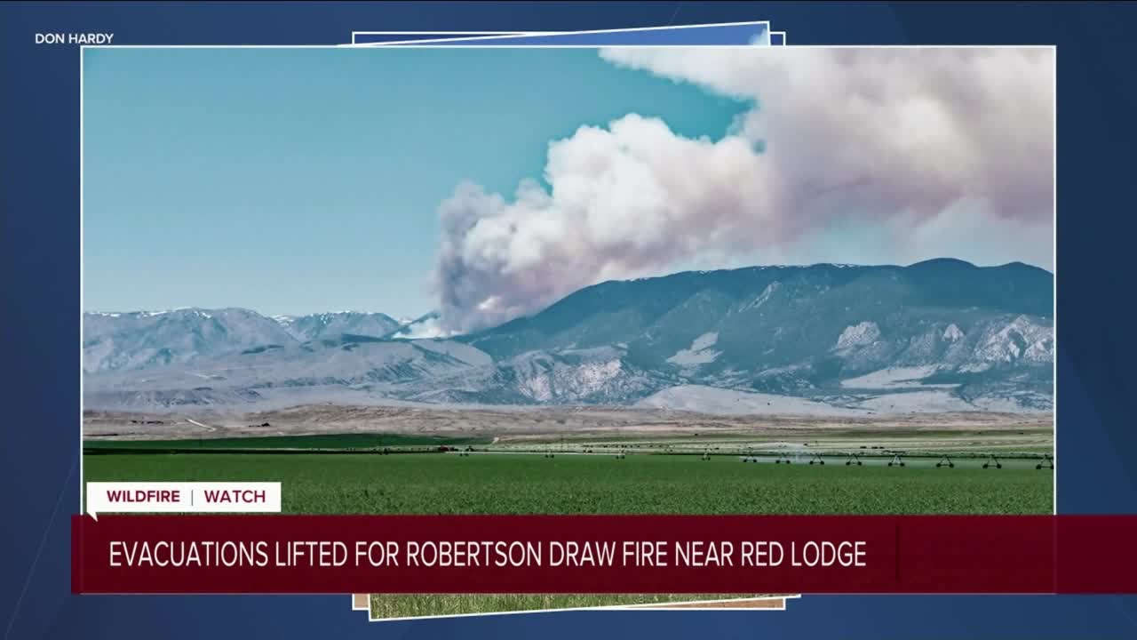


GREAT FALLS — The Robertson Draw Fire south of Red Lodge grew to an estimated 2,000 acres overnight and officials reinstated evacuation orders on Tuesday morning. A Type 3 incident command is currently managing the fire, but authorities said a Type 2 management team has been ordered.
The fire started Sunday at about 3:30 p.m. and is centered about 12 miles south of Red Lodge near the Wyoming state line. The cause of the fire has not yet been determined. There have been no reported injuries as of Tuesday morning.
"Firefighters are anticipating a critical fire weather day as the hot, dry, and windy weather conditions persist," a news release states. "With the expected weather, active fire behavior and continued growth is anticipated."
On Tuesday the U.S. Forest Service said there are about 80 firefighters working to suppress the fire. Resources include handcrews, engines, helicopters, a rappel crew, and support personnel. Air tankers are supporting the incident.
"Additional aircraft and crews will be arriving today to assist the firefighting effort," the news release states. "Today’s operational goals are to keep the fire north of Line Creek, West of the Forest Service boundary along the face of the Beartooths, South of South Grove Creek and East of the Line Creek Plateau."
The evacuations were ordered in the Gold Creek and Ruby Creek areas, the same areas that were initially evacuated Monday afternoon before the order was lifted later that evening.
Evacuation warnings have been issued for the North and South Fork Grove areas, the area west of Meeteetse Trail Road, and the east side of Highway 212 from Meeteetse Trail Road to Westminster Spires Church Camp, according to a U.S. Forest Service news release.
USDA Forest Service recreation residences in Corral Creek, Spring Creek, Snow Creek, and Sheep Creek are also being warned to be prepared to evacuate. An evacuation warning is issued from the county sheriff and alerts people to be ready to go if needed. People with medical, functional, or other needs should consider evacuating if possible.
Closures are in place for the area south of Highway 212, east to the area along the Beartooth Front and south to the Wyoming border. This does not include the campgrounds and homes along East Side Road. Line Creek Road is closed in Wyoming. Meeteetse Trail Road, Grove Creek Road, Robertson Draw Road are closed to the public with local access only.
A public meeting on Facebook Live is planned for Tuesday at 6 p.m. on the Custer Gallatin National Forest’s Facebook page.
Click here for more information on the Inciweb site.