GREAT FALLS — A thunderstorm cell moved over portions of the Electric City and north-central Montana Tuesday afternoon, bringing pea-sized hail and heavy rain to the Riverview area and Cut Bank, according to the National Weather Service (NWS).
In a Facebook post, NWS Great Falls described a weak cold front moving downward from Canada through north-central Montana. “Showers and thunderstorms will continue to increase in areal coverage this afternoon, before dissipating this evening,” the post said, adding “A few thunderstorms could become strong to severe.”
An update around 4:30 p.m. stated: “A pair of potentially severe thunderstorms will track [southeast] across northern Cascade and [southwest] Chouteau counties.” NWS Great Falls estimated hail up to 1 inch in diameter and strong wind gusts from Benton Lake to Floweree.
NWS Great Falls also identified the “primary threats” of the thunderstorm cell moving through the Great Falls area as strong to severe winds, up to 60 miles per hour, as well as chances of hail verging from quarter- to pea-size.
All thunderstorms bring the certainty of lightning, and the most dangerous conditions are being forecast east of the Rocky Mountain Front in areas like Great Falls, Cut Bank, Lewistown and Havre. The thunderstorm cell is moving in southeast from Canada, creating what NWS Great Falls classifies as a “Marginal Risk” of severe weather.
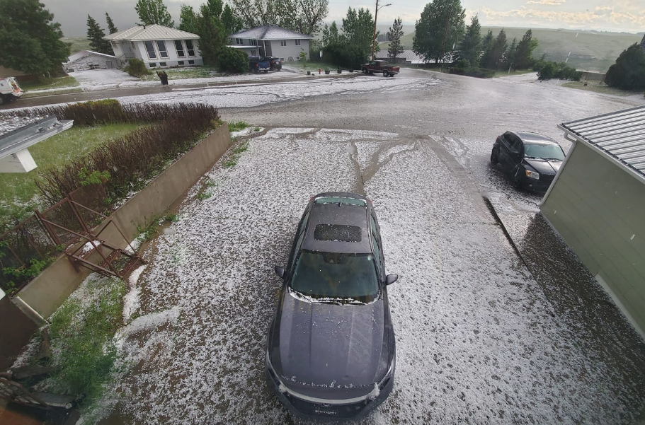
Several MTN viewers sent in photos and video of changing conditions in and around the northwest side of the Great Falls area and Cut Bank on Tuesday afternoon.
Follow our STORMTracker Weather page for continuous updates on changing weather conditions in and around central and north-central Montana.