



HELENA — Montana is home to some of the country's most important wildlife habitats, but thousands of miles of roads cut across the paths of animals.
Watch how a statewide tool maps animal-versus-vehicle collision hotspots below:
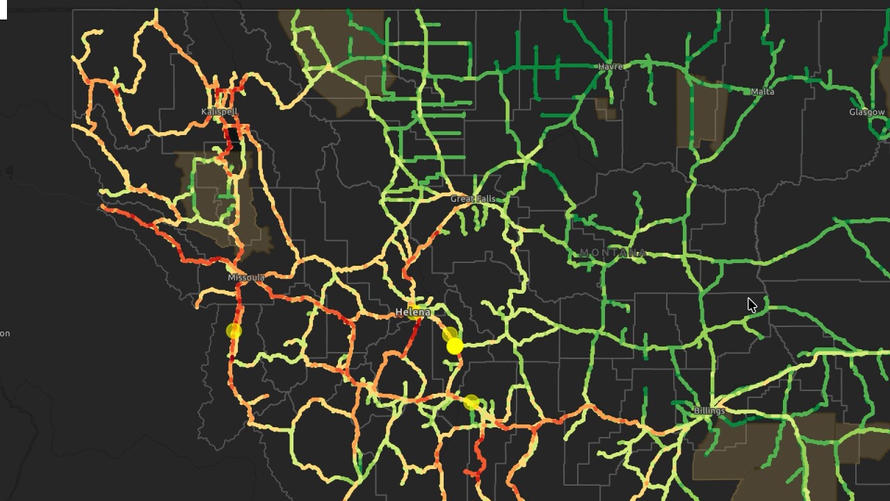
The Montana Wildlife and Transportation Partnership Tool pinpoints where improvements could have the biggest impact for both wildlife and the people traveling these roads.
“It is everybody’s issue, and everybody shares in this,” Tom Martin, the Montana Department of Transportation environmental services bureau chief, said.
According to MDT, Montana has one of the nation's highest wildlife-vehicle collisions per capita. Each year, maintenance crews collect more than 6,000 wildlife animal carcasses, and the Montana Highway Patrol responds to an average of 3,200 wildlife-vehicle collisions annually.
Collisions with wildlife on Montana’s roadways are an increasing concern both for the growing human populations and because of the increased need for connected wildlife habitat.
“You want to make sure you are spending money and placing it in a location that is going to remain effective for a very long time," Martin said.
That’s where the Montana Wildlife and Transportation Partnership comes in. The group, made up of Montana Fish, Wildlife, and Parks, Montana Department of Transportation, and Montanans for Safe Wildlife Passages, has worked for years to find ways to help mitigate the problems and find solutions.
Each roadway is evaluated on five criterion areas, such as risk to human safety and seasonal habitats for big game.
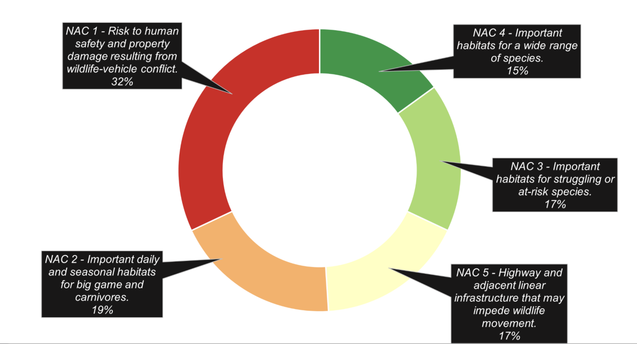
“It is a compilation of a number of different data sets that include carcasses, crashes that are wildlife related, and then a whole bunch of wildlife distribution layers, wildlife movement layers, connectivity modeling,” Deb Wambach, the Montana FWP wildlife coordination bureau chief, said.
Accommodations that could be considered are up to local communities and landowners. They can range from fencing projects to underpasses and overpasses. Montana currently has over 125 wildlife crossings, though they are very expensive.
“Focus limited resources and to work collaboratively to then drill down into these areas of greatest need and to start identifying projects," Wambach said.
Data depicts hotspots on the interstates of western Montana, and is already helping provide planning information for projects in the area.
“I am happy to report that it is already successful. It is already being used as a planning tool,” Martin shared.
To learn more about the tool and similar resources, you can visit this link.
