


A FLOOD WARNING has been issued for parts of Glacier Park, the Bob Marshall Wilderness, and the Flathead Lake area into Tuesday.
A WINTER WEATHER ADVISORY continues for the Beartooth and Absaroka Mountains into Tuesday.
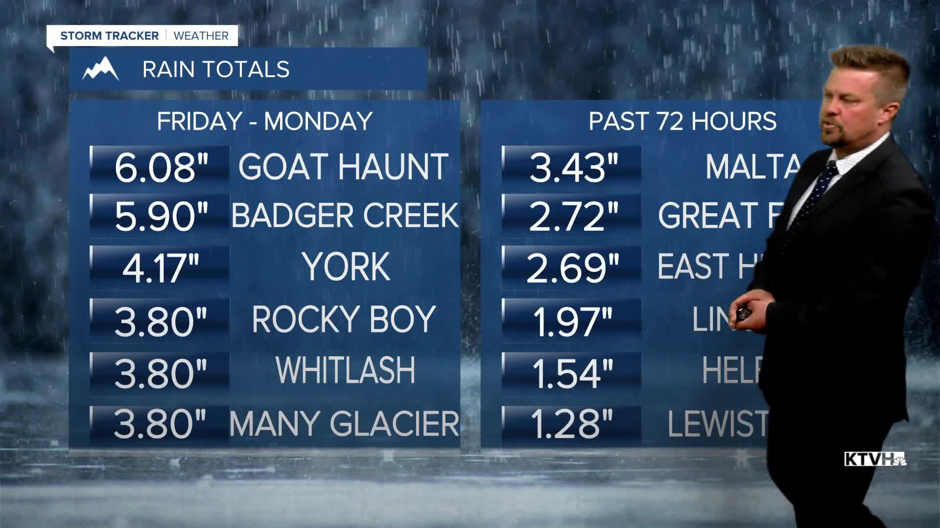
A record breaking storm has produced incredible rain and mountain snow here at the end of June, and the storm is not over yet. Rainfall totals will continue to increase through Monday night into Tuesday morning. With as much as 6" of rain in Glacier National Park, the Many Glacier Hotel and the Swiftcurrent Inn have been evacuated because of floodwaters. Many of the rivers and creeks in the state are running very high and will continue to be full as the rainwater drains out of the mountains over the next few days. With the storm slowly pulling away, Tuesday will have some sunshine with partly cloudy skies. There will be scattered showers and thunderstorms that will add to the rain totals and saturated ground. Highs will top out in the 60s and 70s. This week will gradually get drier but there will be some thunderstorms around parts of the state just about every day. Wednesday is July 1st, and the new month will start out partly cloudy with some scattered showers and thunderstorms. Highs will top out in the 70s to near 80. Thursday will be partly to mostly sunny with a few isolated thunderstorms, meaning most areas will be dry. Highs will warm to around 80. Friday will be partly cloudy with a few scattered showers and thunderstorms in the evening. Any storm should be brief as it passes. It's Independence Day Weekend and it's looking sunny, dry and warmer. It's exactly what we deserve. Highs will warm into the 70s and 80s. There might, might be an isolated storm on Sunday but most areas will have a dry holiday weekend.
Have a great day,
Curtis Grevenitz
Chief Meteorologist
