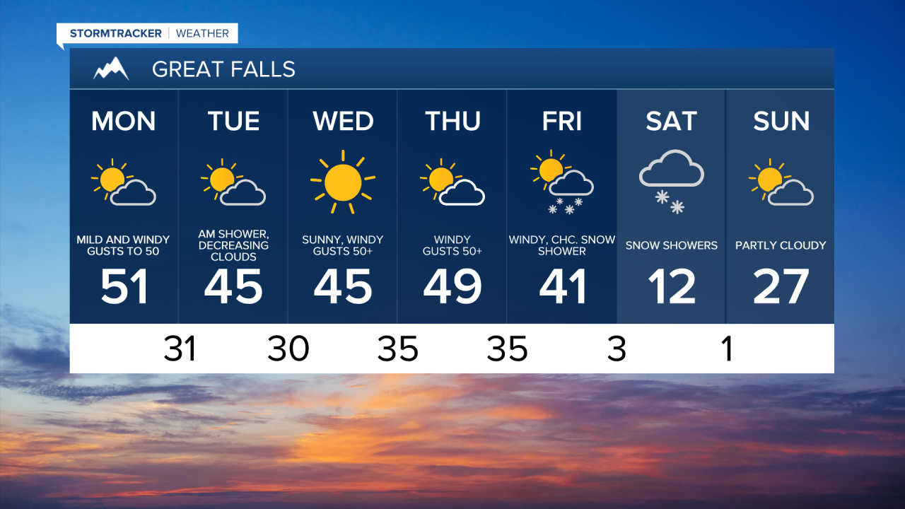
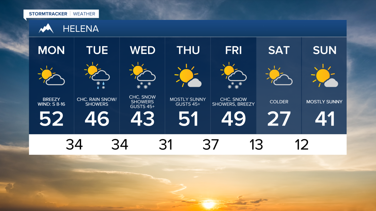
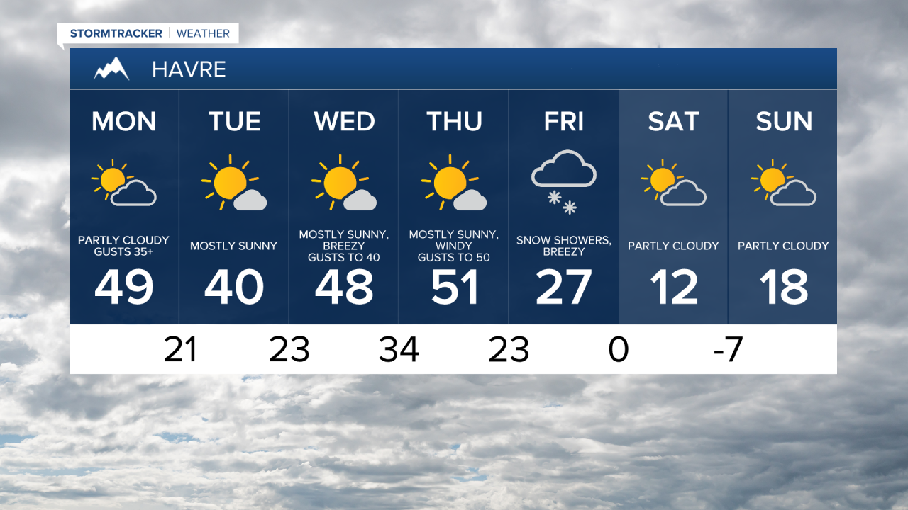
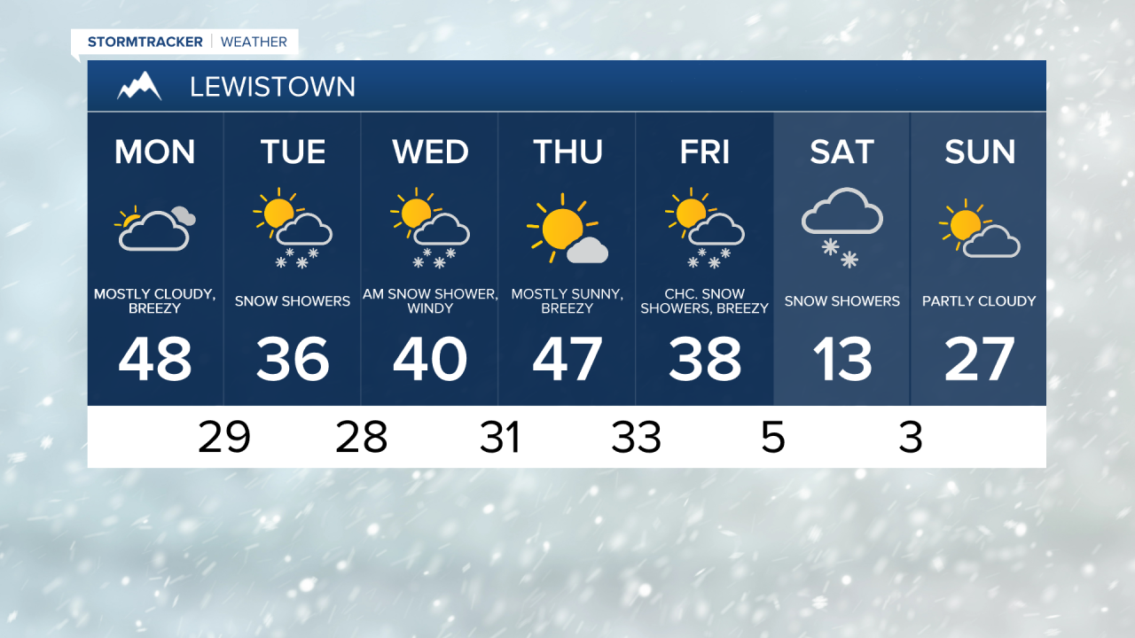
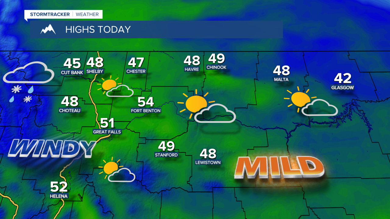
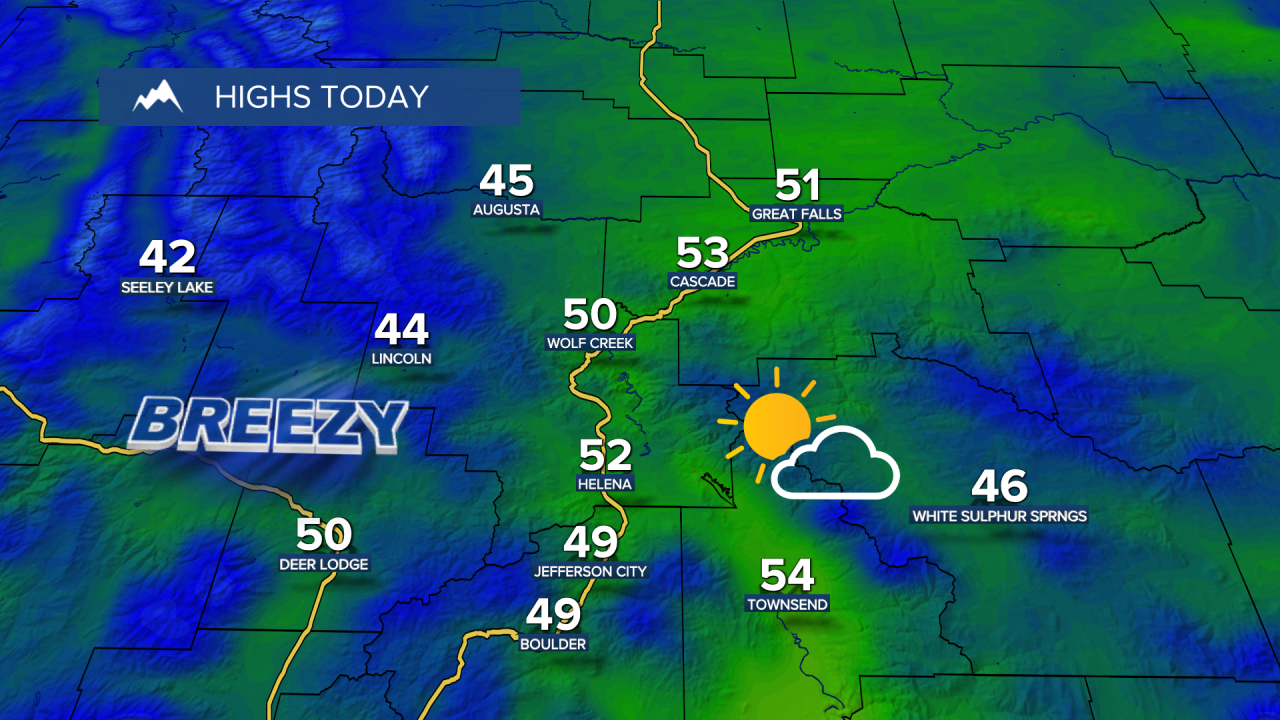
Our final full weekend of February was frigid, with high temperatures in the 10s and 20s in north central Montana. A return to milder temperatures is expected on Monday, with highs in the 40s and lower 50s. Winds will pick up on Monday and continue through the end of the workweek.
Today's Forecast:
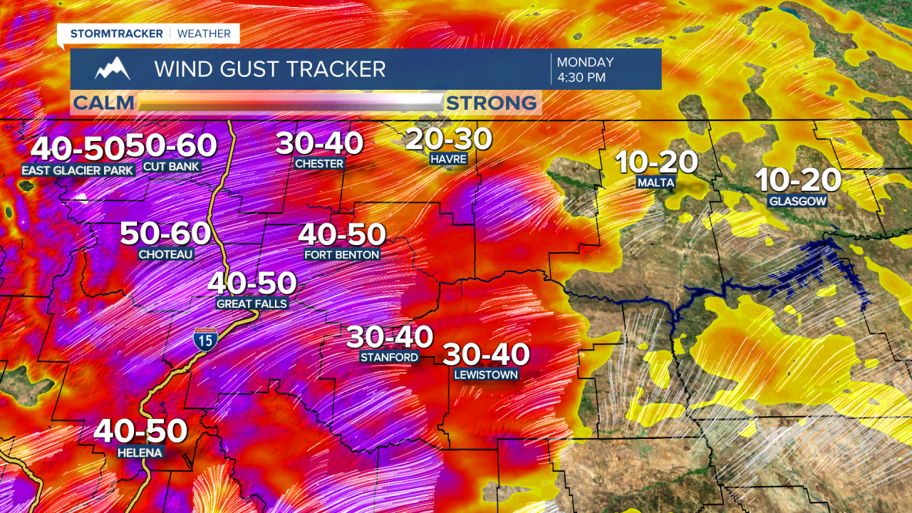
Those strong wind gusts could reach 35-50 mph across the plains during the day on Monday.
There will also be a round of mountain snow from Monday through Tuesday morning along and west of the Divide. Marias Pass is expected to receive around 5-10 inches of snow by Tuesday morning, with 1-3 inches over Rogers Pass and MacDonald Pass.
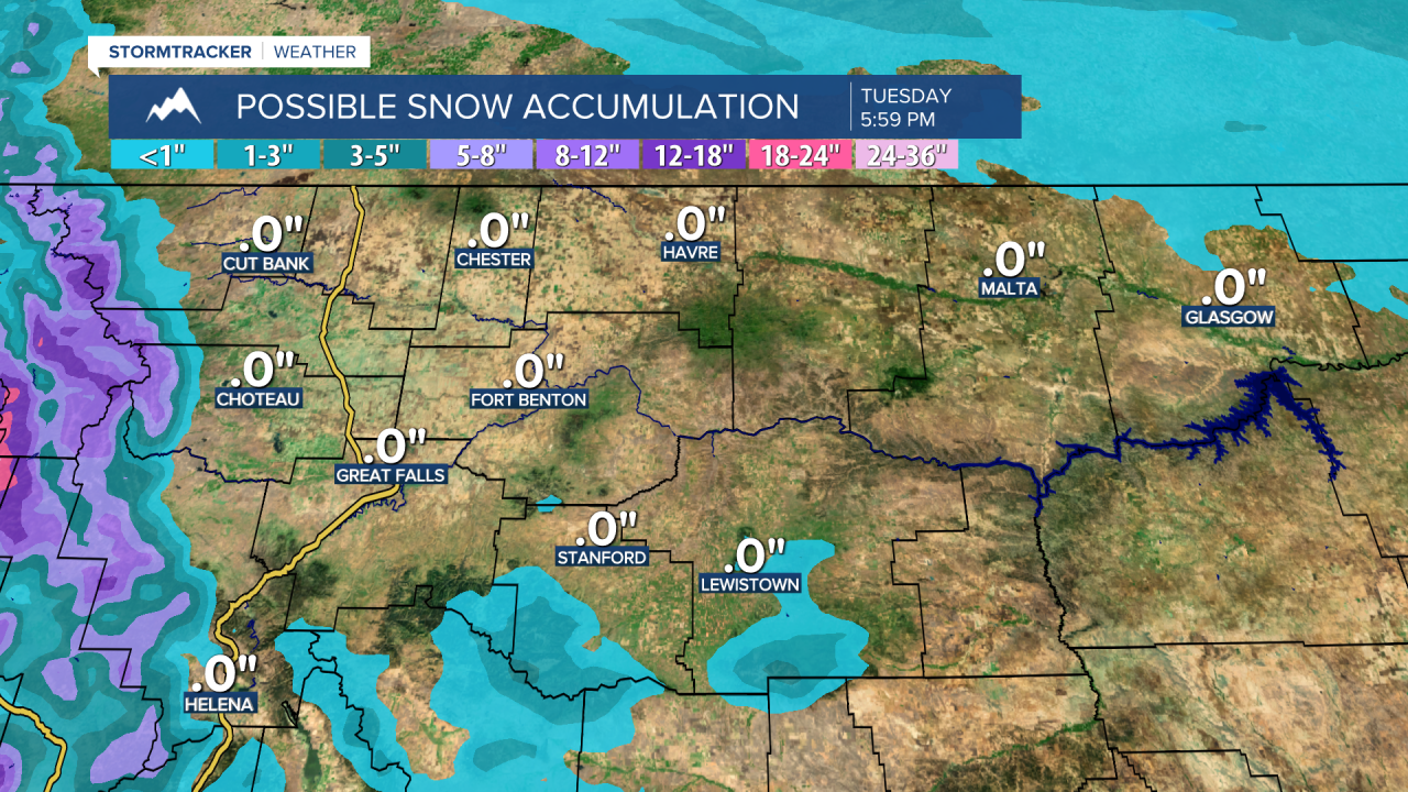
Tuesday will be mostly dry, with increasing clouds. Scattered rain and snow showers will develop in the lower elevations and the mountains Tuesday night into Wednesday morning. A cold front will bring high temperatures into the 30s and lower 40s.
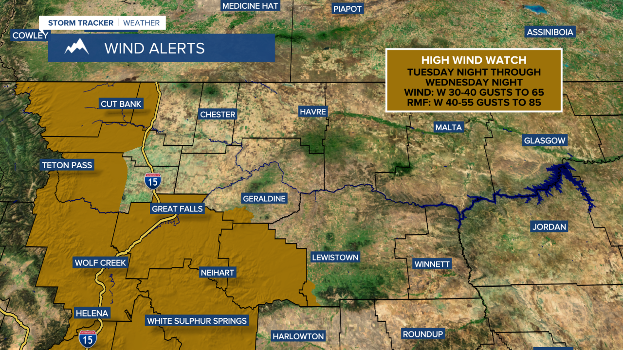
It will be breezy but less windy on Tuesday, although the wind will become very strong again Tuesday night into Wednesday. A High Wind Watch is in effect from Tuesday night through Wednesday, with gusts reaching up to 85 mph along the Rocky Mountain Front and up to 65 mph east of the Front. High temperatures on these days will be in the 40s.
The high winds will persist on Thursday. High temperatures will range from the 40s to lower 50s, but will drop into the 20s and 30s on Friday.
A strong cold front will move south across the area on Friday, bringing snow showers, gusty winds, and colder temperatures. Highs will fall into the 10s and 20s on Saturday.