

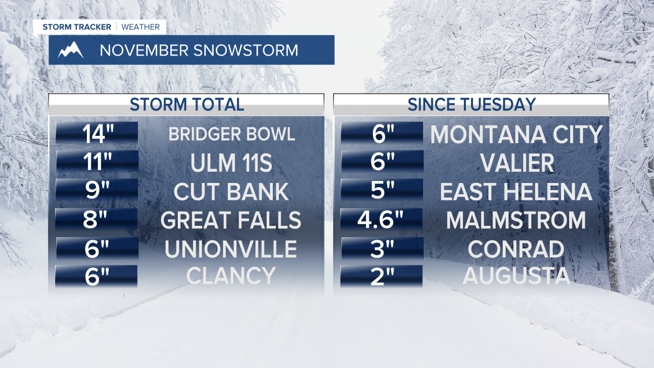


One storm that produced heavy, wet snow for many areas in Montana is moving out, but a new storm is moving in with a chance at more accumulation and cold temperatures into the weekend. Snow will generally be light over the next several days but the coldest air of the season will make sure what snow has and will fall, sticks around. Thursday will be mostly cloudy with a few areas of light snow through the day. Little to no accumulation is expected, but it'll be cold with a few flakes coming down. Highs will be in the 30s. Friday will be mostly cloudy with some flurries. Highs will stay in the 30s. This weekend will stay chilly with highs in the 20s and 30s, and lows in the 10s. Some of the normally colder spots in the mountain valleys may get down into the 0s. There will be areas of heavy snow showers through Friday night and Saturday. A few inches will accumulate in the mountains, and some of the lower elevations could experience heavy snow showers. The roads will have areas of snow and ice on them as the temperatures stay cold. High pressure will move in Saturday night with clear skies and very cold conditions. Sunday will have increasing clouds and a little light snow or some flurries. While next week gets a little warmer into the 30s and 40s, there could be some strong wind and more mountain snow heading into Thanksgiving.
Have a great day,
Curtis Grevenitz
