



A WINTER STORM WARNING is in effect for parts of central and western Montana into Monday morning.
A WINTER WEATHER ADVISORY is in effect for parts of northern and western Montana into Monday morning.
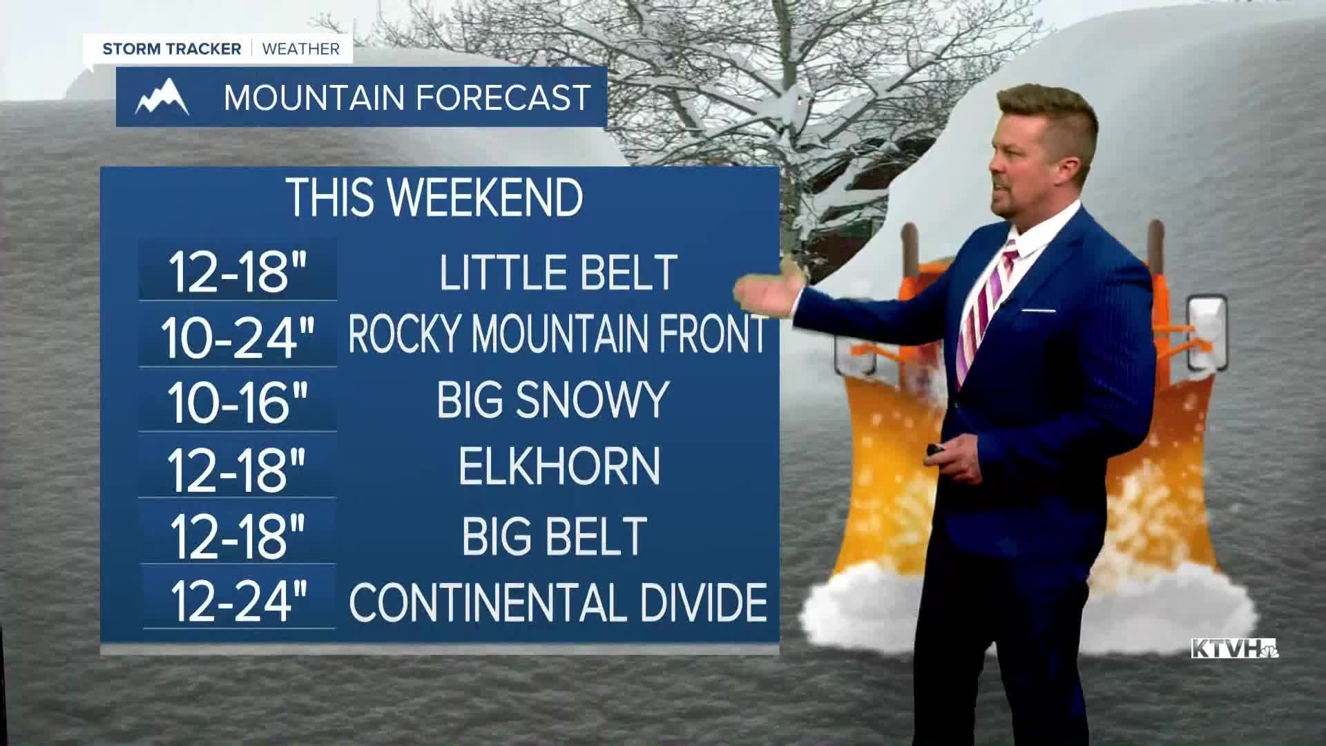
A major snowstorm will impact Montana this weekend with significant accumulating snow. As much as 12" will accumulate in the lower elevations with up to 24" in the mountains. Temperatures will tumble, and some light rain will mix with and turn to snow in through morning hours into the afternoon. Snow will really increase in coverage area through the afternoon and evening. Areas of snow will become widespread through Saturday night into Sunday. After snowing all night, many areas of central and southern Montana will wake up to a few inches of snow on the ground. Sunday looks cold and snowy for a good part of Montana. Some of the lower elevations may have a rain/snow mix, and some of the eastern plains could have just a cold rain. The snow will continue on Sunday for much of the state, and gradually come to an end from northwest to southeast through Sunday night into Monday. Right now, several inches up to a foot can be expected in some of the lower elevations, and the mountains could have one to two feet. Snow will accumulate on the roads in the mountains and some of the lower elevations will have a slushy accumulation on the road surfaces. It will be a little slick out there, especially on Saturday night through Sunday. The storm will pull away on Monday with most areas looking at mostly cloudy skies by afternoon. Temperatures will start to slowly warm up into the 40s and 50s for highs. Tuesday will be in the 50s and 60s. There will be some melting next week.
Have a great weekend,
Curtis Grevenitz
Chief Meteorologist
