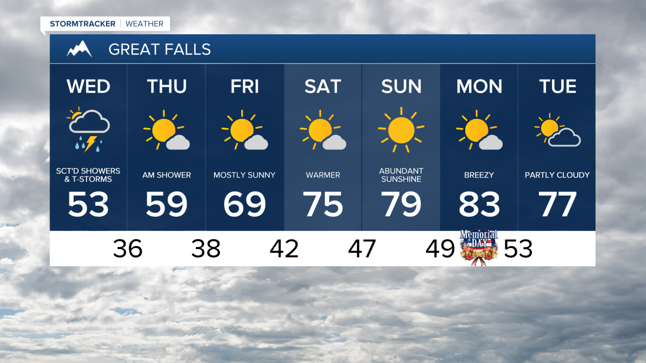
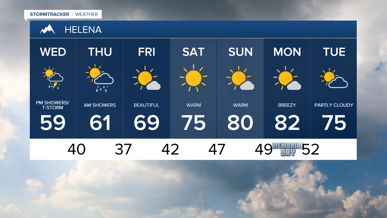
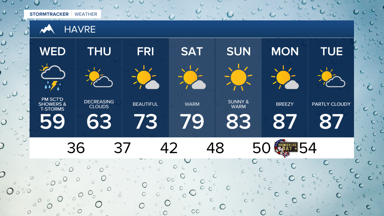
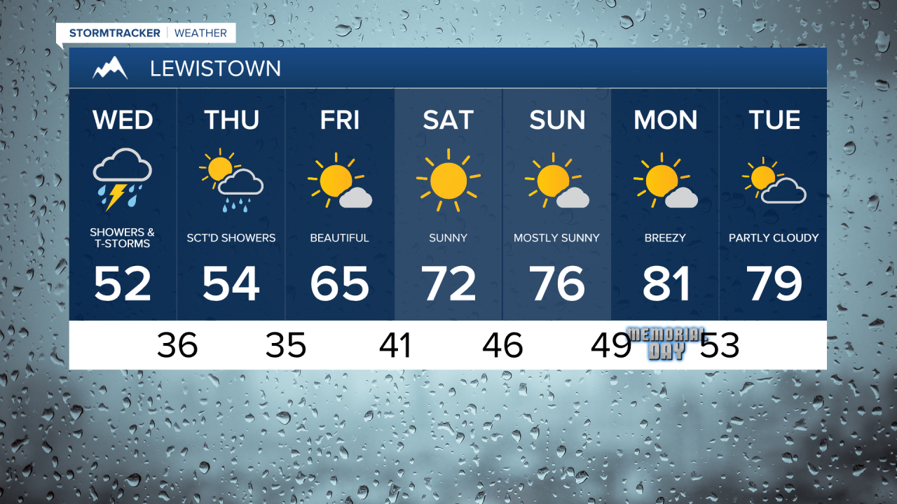
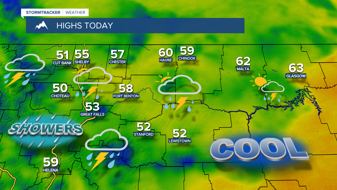
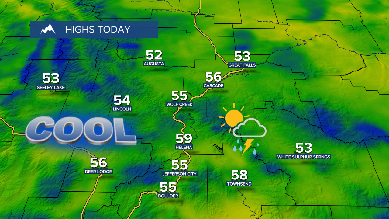
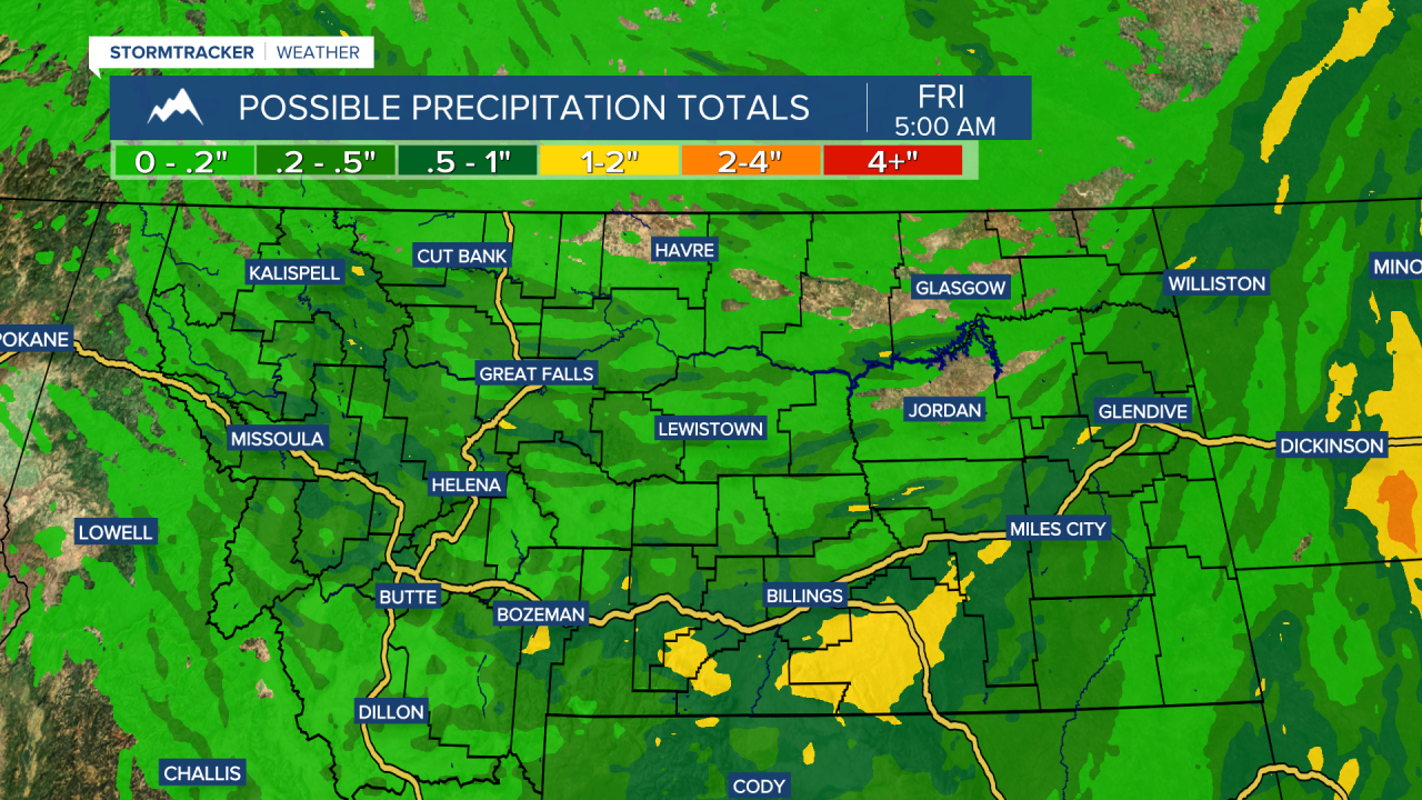
A cold front moves through Wednesday with more widespread showers and thunderstorms, along with cooler temperatures in the 40s and 50s. Some of the thunderstorms could contain brief downpours, small hail and gusty winds.
Wednesday Morning Forecast:
That storm pushes south on Thursday, bringing decreasing clouds and highs warming back into the 50s and 60s.
The week ends on a high note with highs climbing into the 60s and 70s. That will set the stage for spectacular weather Memorial Day weekend, with temperatures warming into the 70s and 80s.
However, gustier winds will develop through the weekend, with gusts reaching 40 mph, and even 50 mph on some lakes and reservoirs. Also keep in mind the water will still be very cold from snowmelt runoff.
Storm chances pick up again next Tuesday as another system moves into the state. High temperatures will be in the 70s.