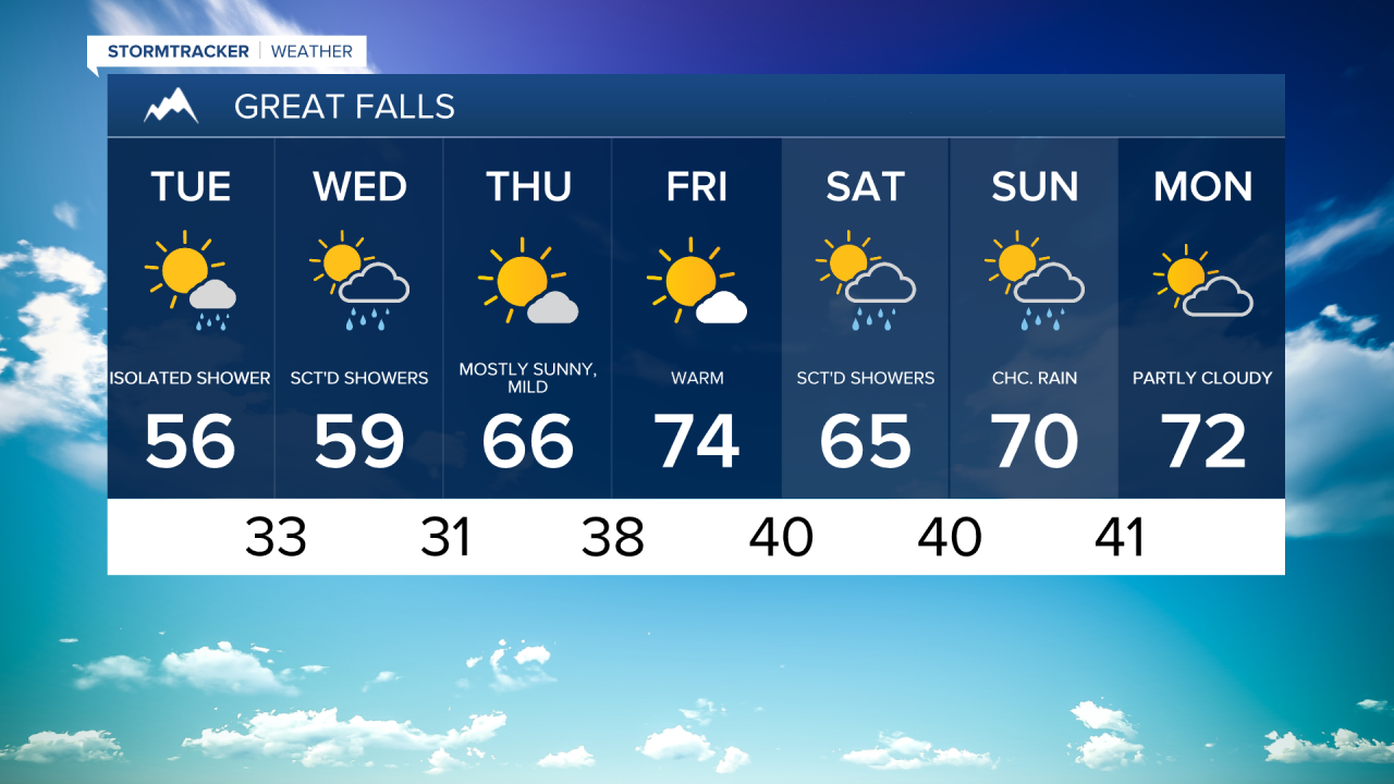
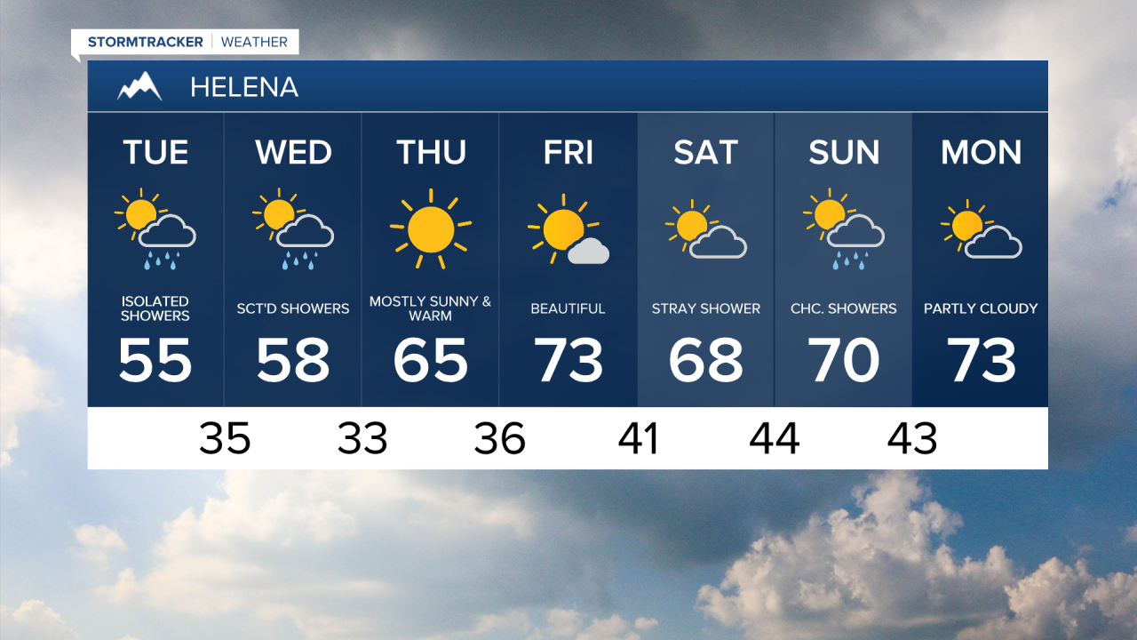
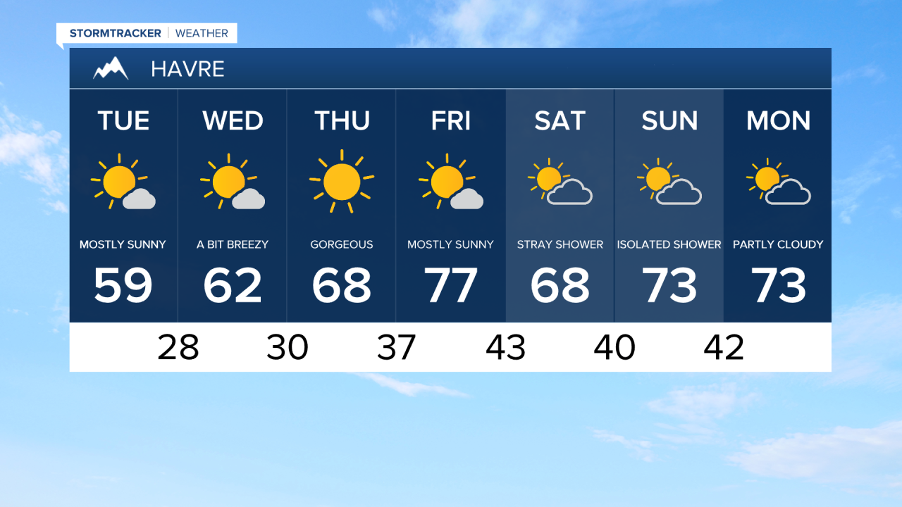
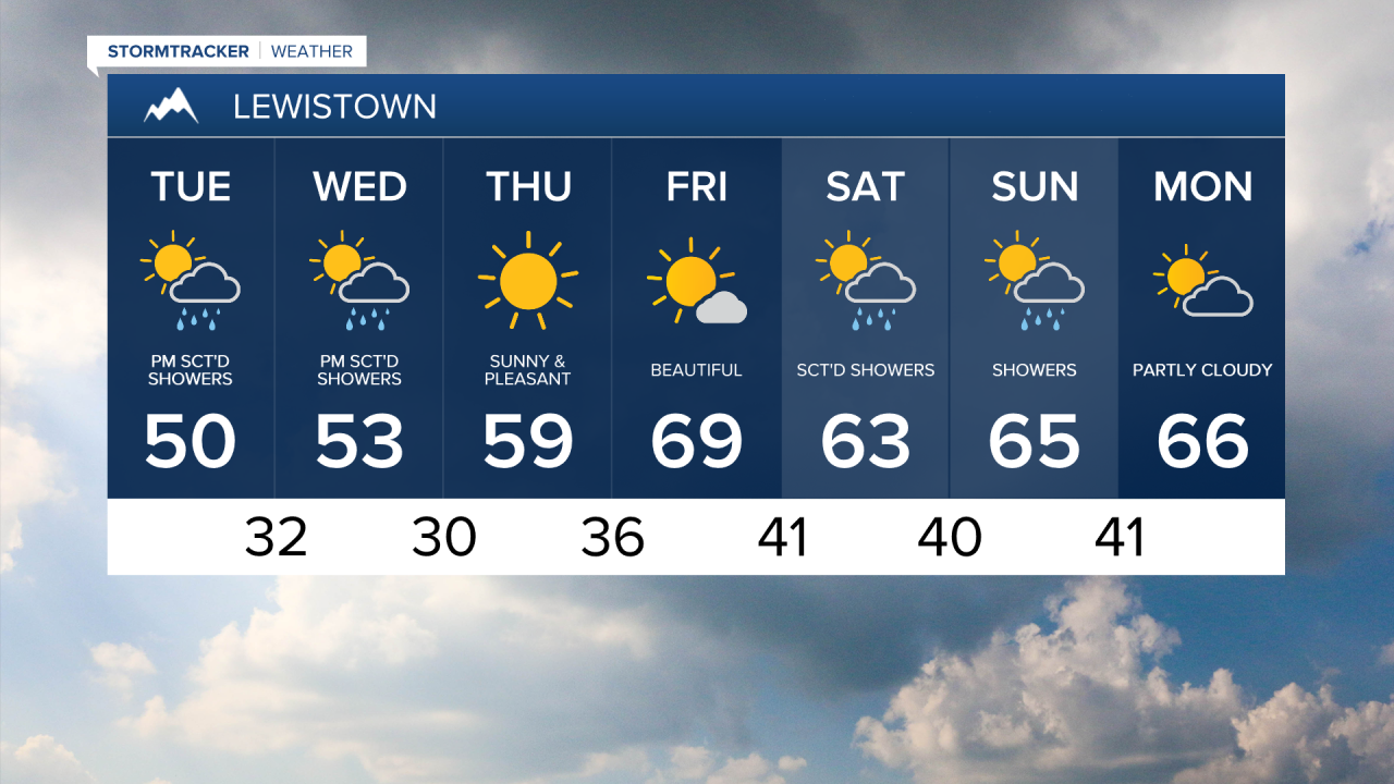
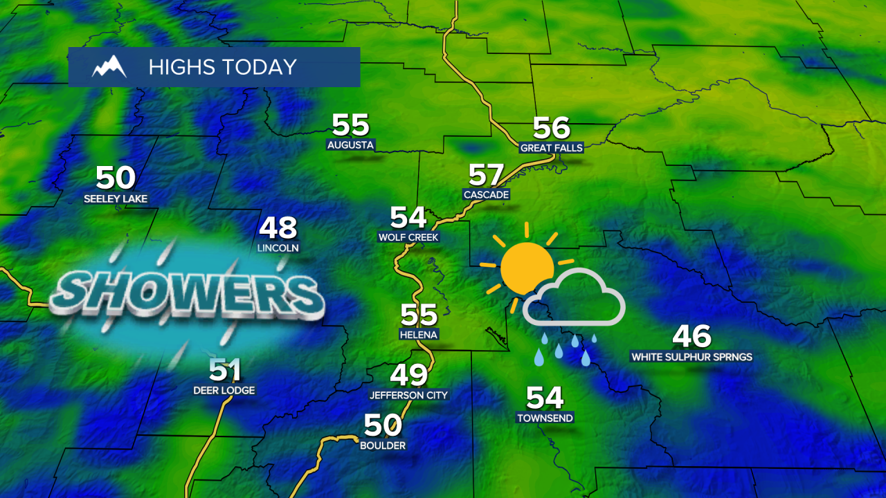
The week started with near record low temperatures, but the cold stretch is coming to an end as highs return to more seasonal levels for April, in the 50s to around 60°. There could be a few passing rain and snow showers, with even a few rumbles of thunder.

One more round of scattered showers will move through on Wednesday, with highs once again in the 50s to around 60°.
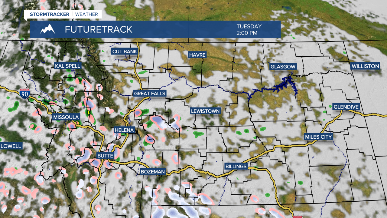
Tuesday Morning Forecast:
The system bringing the cool, unsettled weather to the region will finally move out by Thursday and Friday, replaced by a high pressure ridge. That will bring a quick return to beautiful spring weather, with sunshine and highs back into the 60s and 70s.
The first weekend of May looks a touch cooler, with highs in the 50s and 60s. A weak system will bring a few showers and isolated thunderstorms.