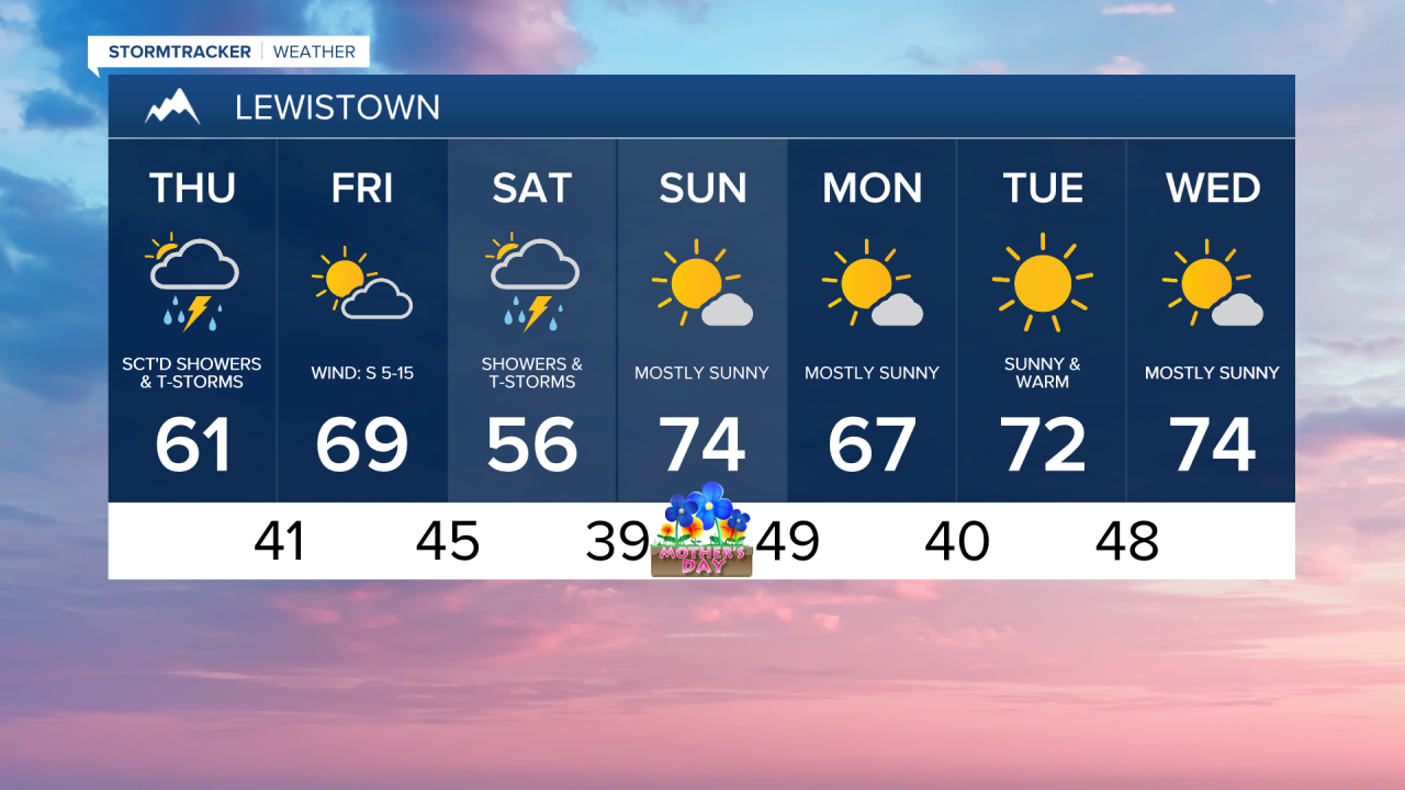
It was a spectacular day in the weather department on Wednesday. Even though a few towns tied or set record lows, temperatures rebounded quickly into the 60s and 70s during the afternoon under sunny skies.


Clouds rolled in during the evening along with a few overnight showers. We’ll continue to see scattered showers and isolated thunderstorms moving in from the northwest throughout Thursday. High temperatures will be a touch cooler than Wednesday, generally in the 60s and lower 70s.
Thursday Morning Forecast:
It dries out Friday with highs warming back into the 70s under partly cloudy skies. Then, another round of scattered showers and isolated thunderstorms moves through late Friday night into Saturday. The steadiest rain looks to fall east of I-15, especially across Fergus and Chouteau counties. Showers taper off Saturday evening as high pressure begins building in overnight into Sunday morning.

Mother’s Day is looking magnificent with mostly sunny skies and high temperatures warming into the 70s to near 80. A warm and dry weather pattern takes hold from Sunday into next week, with daytime highs continuing in the 70s and lower 80s.