

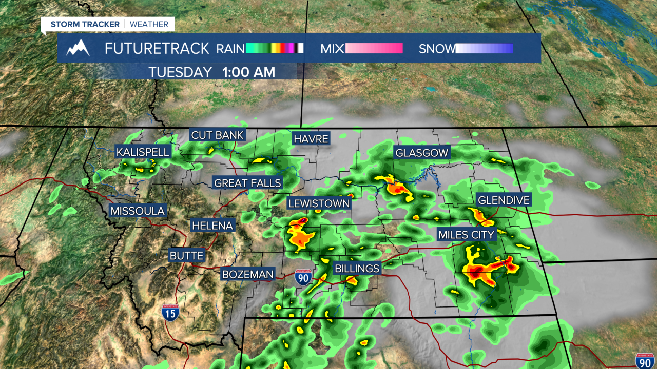


A FLOOD WATCH has been issued for parts of eastern Montana through tonight and most of Tuesday.
It's the Monday after the 4th of July weekend, and a new storm system is kicking off thunderstorms that could produce heavy rain and flooding in parts of Montana. Storms through Monday evening and Monday night will have heavy rain. These storms will move northeast through the night. The heaviest rain will set up on the Hi-Line for Tuesday with the Glasgow area right in the middle of all the action. Heavy rain in this part of the state could create flash flooding, so be careful. Elsewhere, only a few very isolated storms will form. Highs will be in the 60s for northeast Montana with the clouds and rain, but in the 70s and 80s elsewhere with sunshine. Wednesday will have scattered afternoon and evening thunderstorms. Highs will be in the 70s and 80s. The storms will dry up on Thursday, as it will be mostly sunny and windy, with highs in the 80s to near 90. The heat will start building for Friday and the weekend. The hottest temperatures so far this year will move in this weekend. Most of Montana will have highs in the 90s. Some of southern and eastern Montana will hit 100. Please prepare for this heat now, as to make sure you and kids and pets and livestock will be cool. When 2026 is all said and done, this weekend could be the hottest weekend of the entire year. Thunderstorms are likely to return Tuesday and Wednesday of next week, bringing some relief from the heat.
Have a great day,
Curtis Grevenitz
Chief Meteorologist
