
A strong high pressure ridge will continue to dictate our forecast for a few more days.
This current pressure system will allow for sunny skies and temperatures well into the 80s and 90s on Wednesday.
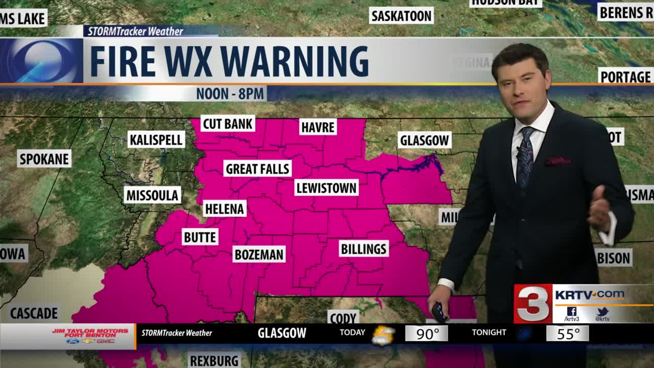
A passing cold front will kick up winds this afternoon only heightening the already high fire danger for Central Montana.
Gusts of 30 to 40 mph are likely along the leading edge of this system.
The hot and windy conditions will also be accompanied by very low relative humidity levels.
Because of this the National Weather Service has issued a Fire Weather Warning for Wednesday afternoon for all of Central Montana.
The gusty winds and dry conditions will allow for fires to spread quickly and rapidly.
Thursday will remain fairly warm with highs in the mid 80s for most.
A few spotty shower are likely throughout southwestern Montana.
Big changes are on track to move in on Friday.
Widespread rain is expected Friday afternoon with temperatures in the mid 70s.
We should see a break in the rain on Saturday.
The core of our next weather system will move in on Sunday.
This will allow for very widespread rain and much cooler temperatures next week.
