


Good Morning! Today is Wednesday, September 23, 2026.
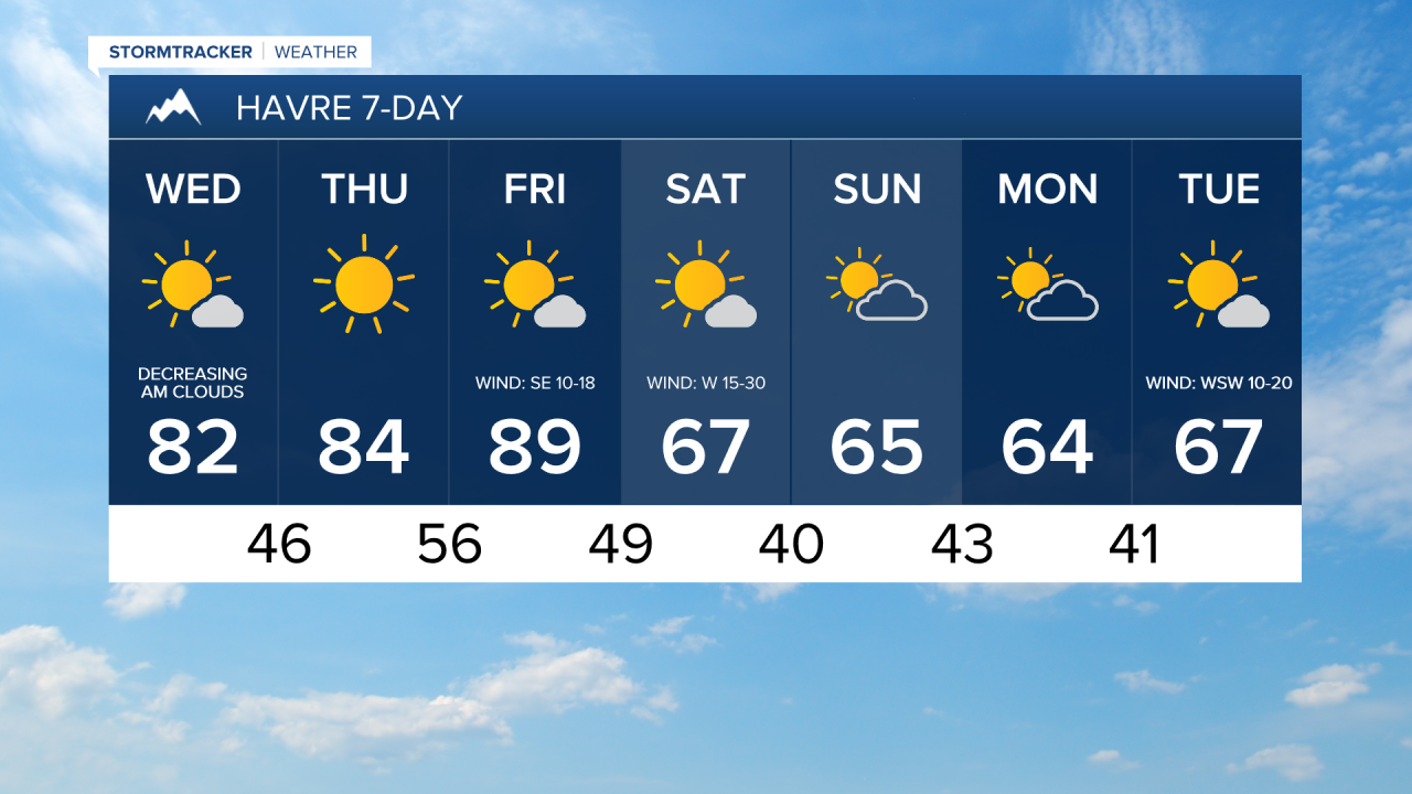
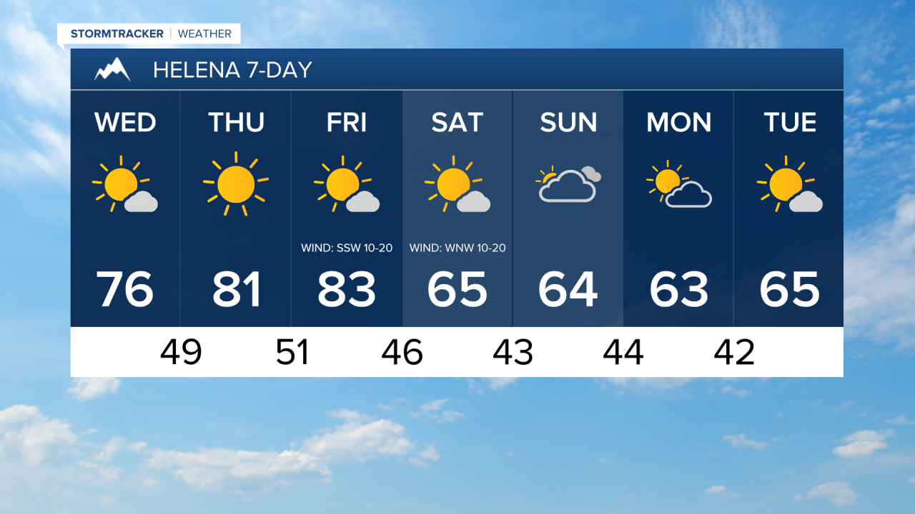
There will be a few showers around this morning in locations east of I-15 as a disturbance departs our area. Skies will start off partly to mostly cloudy, but the cloud cover will diminish as the morning goes on. This afternoon and evening, expect mostly sunny to sunny skies and mostly dry conditions. It will be warm again today as highs are going to be in the mid to upper 70s and low to mid 80s. Breezy conditions are also expected today along the Rocky Mountain Front as sustained wind speeds will be between 10 and 25 mph.
Tomorrow will be a beautiful, summer-like day with abundant sunshine, dry conditions, little wind, and very warm temperatures for late September. Highs tomorrow will be in the 80s and upper 70s in most locations.
Friday will be another very warm day as highs will be in the 80s in a lot of locations, and a few spots may reach 90°. It is also going to be mostly sunny on Friday and most locations will be dry, but a few showers are possible during the evening along the Divide and the Rocky Mountain Front as a cold front approaches our area.
Breezy conditions are expected on Friday, with the wind getting stronger as the day goes on. Sustained winds of 10-25 mph are expected, and gusts up to 40 mph are possible, especially during the late afternoon and evening.
Widespread gusty to strong winds are expected Friday night and Saturday as a cold front passes through our region. Sustained winds of 10 to 30 mph are expected, and gusts of 40-50+ mph are possible, with the strongest gusts along the Rocky Mountain Front.
There will be a few scattered showers and isolated thunderstorms around Friday night as the cold front passes through. It will also become cold enough that a little snow may fall in the Rockies. Glacier National Park will continue to see a little rain/snow on Saturday, while it will be mostly dry and mostly sunny elsewhere. Much cooler temperatures are expected on Saturday behind the front as highs will be back in the 60s and upper 50s.
On Sunday, it is going to be partly to mostly cloudy and mostly dry. It will remain cool with highs in the 60s and upper 50s. The wind will also be noticeably lighter on Sunday with sustained winds of 5 to 15 mph.
Another disturbance will pass through our area on Monday producing some isolated showers, primarily in central Montana. Skies will be partly to mostly sunny, and it will be cool with highs in the upper 50s and low to mid 60s.
On Tuesday, it is going to be partly to mostly sunny and dry. Highs will be in the 60s in most spots and it will be a little breezy with sustained winds of 5 to 20 mph.


Have a wonderful Wednesday!
Chief Meteorologist Ryan Dennis
