


Good Morning! Today is Tuesday, October 20, 2026. Here is today’s forecast:
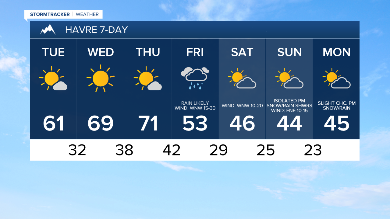
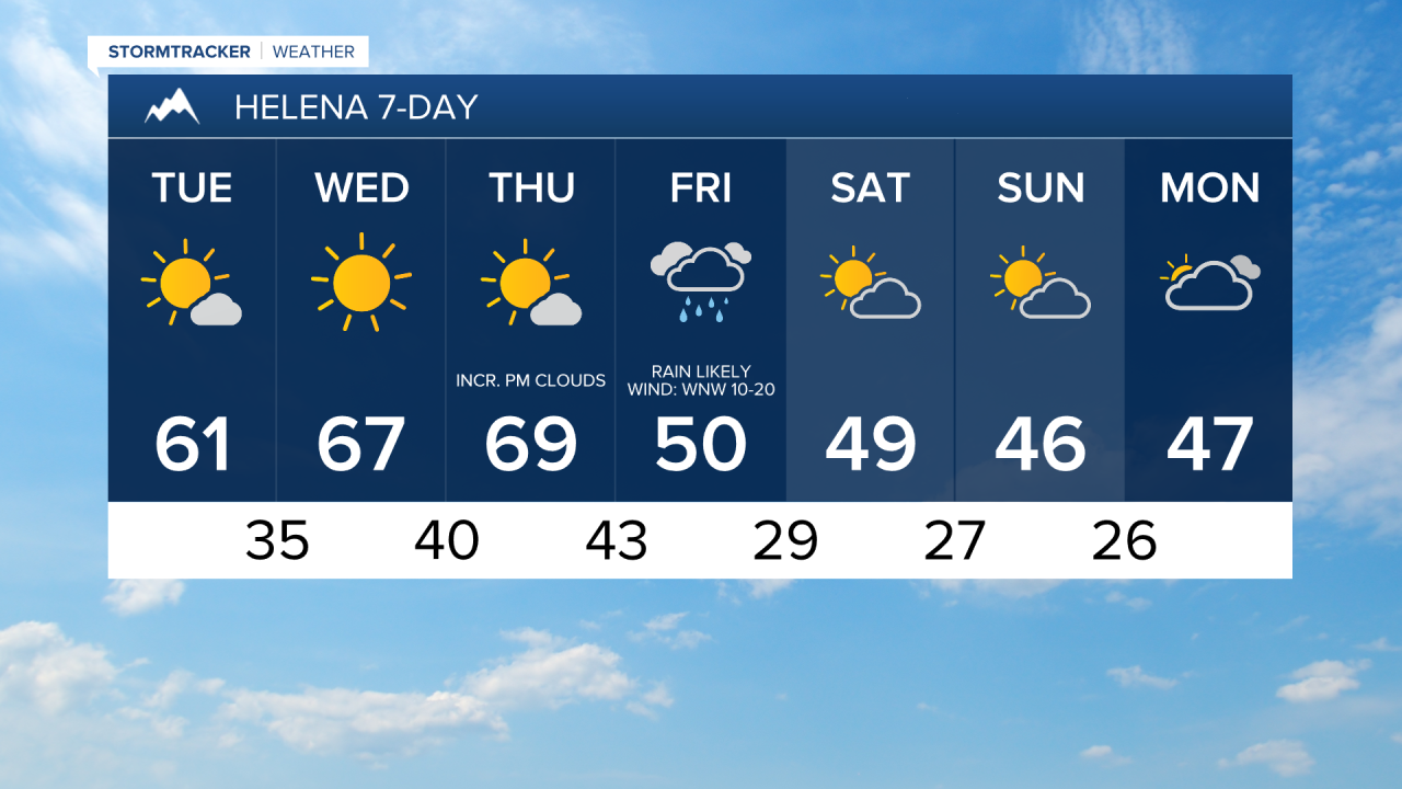
Beautiful fall weather is expected through Thursday as an upper-level ridge remains in control of the weather pattern. A strong cold front will then move through the state Thursday night into Friday, bringing much cooler temperatures, gusty to strong winds, and widespread rain and mountain snow to our area.
Pleasant fall weather is expected again today with partly to mostly sunny skies, dry conditions, and just a light breeze. It will be a bit cooler today than it was yesterday, but it is still going to feel nice outside as highs are going to be in the mid to upper 50s and low to mid 60s.
Lots of sunshine is expected tomorrow and it will continue to be dry. On Thursday, it is going to be mostly sunny and a few showers are possible west of I-15 during the evening as a cold front approaches our area.
Warmer and mild temperatures are expected tomorrow and Thursday as highs will be in the mid to upper 60s and low to mid 70s. The wind will remain on the lighter side in most areas tomorrow and Thursday, but it will be a little bit breezy tomorrow in and around the higher terrain as well as across eastern portions of north-central Montana, with sustained winds of 5 to 20 mph.
Much cooler temperatures are expected on Friday behind a cold front as highs will be in the mid to upper 40s and low to mid 50s in most spots (low to mid 60s in northeastern Montana), with falling temperatures throughout the day. Widespread gusty to strong winds are also expected on Friday, especially during the afternoon and evening, with sustained winds of 10 to 30 mph, and gusts up to 50 mph are possible. The strongest winds are expected east of I-15. There will also be widespread rain and mountain snow around on Friday. Snow levels will fall as the day goes on, and some lower elevations, especially those near the mountains, may see rain mix with and/or transition over to snow later in the day.
This weekend will be chilly, with highs in the 40s and low 50s. The wind will be lighter, although it will continue to be a little breezy, especially on Saturday, with sustained winds of 5 to 20 mph. Saturday will be partly to mostly sunny, while Sunday will be partly to mostly cloudy. Most locations will remain dry this weekend, but isolated rain and snow showers are possible.


Have a tremendous Tuesday!
Chief Meteorologist Ryan Dennis
