


Good Morning! Today is Wednesday, November 18, 2026. Here is today’s forecast:
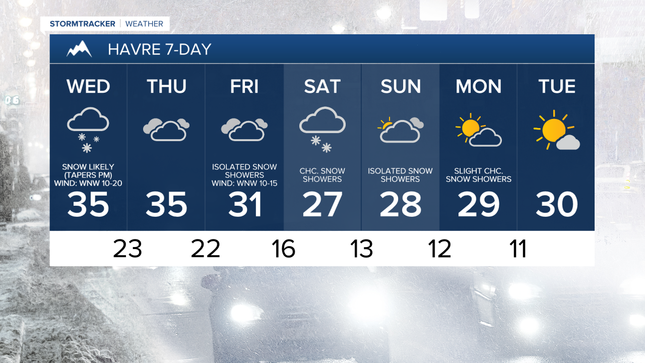
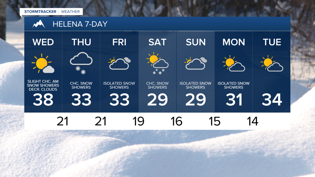
Roads are slick throughout a lot of central and north-central Montana this morning, and visibility is reduced where it is still snowing, so use extreme caution when driving and give yourself some extra time for the morning commute. In northeastern Montana, a mixture of rain and snow is likely today. Along the Hi-Line, snow is likely this morning, with the snow gradually tapering off during the afternoon and evening. South of the Hi-Line in north-central Montana, snow will taper off this morning, with some clearing this afternoon and evening. Around Helena, expect decreasing clouds today with a few areas of snow around this morning, generally to the north and east of Helena.
Along the Hi-Line, up to 2” or 3” of new snow accumulation is possible during the day today. In a few mountain ranges along the Hi-Line, up to 5” of new snow is possible. Elsewhere, <1” of new snow is expected during the day today. A WINTER WEATHER ADVISORY remains in effect for most of north-central Montana until 11am or 5pm today.


It will be windy today in Fergus County and Judith Basin County, with sustained winds of 15 to 30 mph, and gusts up to 50 mph are possible. Elsewhere, it will be breezy today, with sustained winds of 10 to 25 mph, and gusts of 30 to 40 mph are possible. The strongest wind will be east of I-15. It will also be cold today as highs will only be in the 30s, and when you factor in the wind, it will feel like it is in the teens and 20s for most of the day.
Tomorrow will be mostly cloudy to overcast with a few snow showers around, especially in the mountains. It will also be cold again tomorrow, with highs in the 30s, and it will be a little breezy in some areas.
On Friday, it will be mostly cloudy and there will be a few more snow showers around. There will then be some areas of light snow around Friday night and Saturday, especially during the morning, as a disturbance passes through our area. Skies will be partly to mostly cloudy on Saturday. It will remain cold on these two days with highs in the mid to upper 20s and 30s.
Sunday will feature mostly cloudy skies and a few snow showers as another disturbance passes through our region. It will also remain cold with highs in the mid to upper 20s and low to mid 30s.
The temperatures will begin to warm back up next week as highs will be back in the 30s and low 40s on Tuesday. Monday will be partly cloudy and there will be a few snow showers around. Partly to mostly sunny skies and dry conditions are then expected on Tuesday.


Have a wonderful Wednesday!
Chief Meteorologist Ryan Dennis
