


Good Morning! Today is Tuesday, November 17, 2026. Here is today’s forecast:
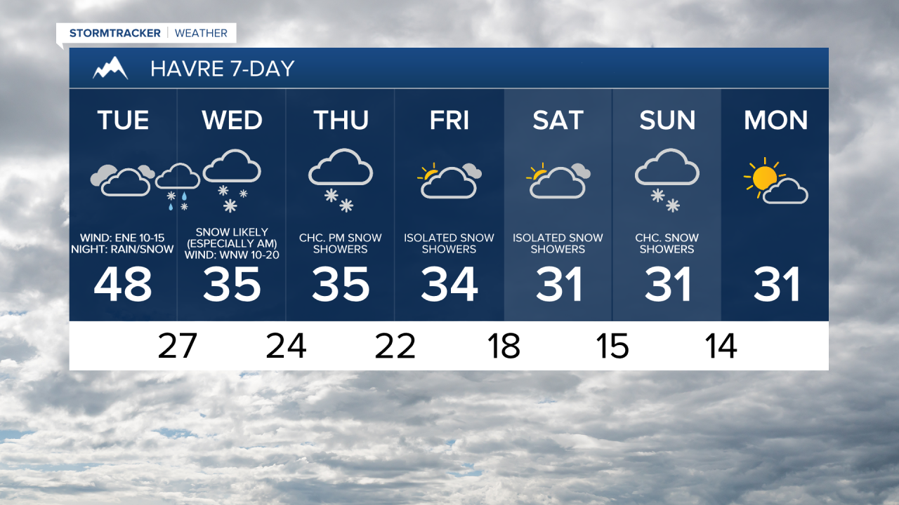
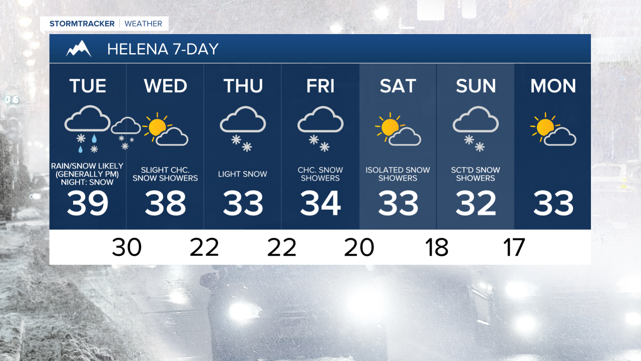
Around Helena and across western portions of north-central Montana, west of a line from Havre to Lewistown, rain and snow is likely today, especially during the afternoon and evening. Elsewhere, it will be partly to mostly cloudy and mainly dry today. In the lower elevations, precipitation will initially fall as rain before changing over to snow. Some of the snow that falls this evening may be heavy.
Widespread precipitation is expected tonight, with the precipitation gradually shifting eastward as the night goes on. In the lower elevations, rain will transition to snow from west to east as colder air moves in. Some of the snow that falls tonight may be heavy.
There will continue to be areas of snow and some rain around Wednesday morning in locations east of I-15, but this snow will taper off in a lot of areas as the morning goes on. During the afternoon and evening, there will be a mixture of rain and snow in northeastern Montana, light snow will persist along the eastern half of the Hi-Line, and it will be mostly dry elsewhere with peeks of sunshine.
In the lower elevations, up to 6” of snow is possible, with the highest snow amounts across western portions of north-central Montana and around the Helena area, and the lowest snow amounts across eastern portions of north-central Montana. There may also be a few isolated areas near the Canadian border in Glacier County and Toole County, that may receive up to 8” of snow. In the mountains, 3-10” of snow is expected.

The bulk of the accumulation will occur this evening through Wednesday morning, which is also when the greatest travel impacts are expected. Give yourself some extra time for the Tuesday evening commute if you are around or west of I-15 and give yourself some extra time for the Wednesday morning commute no matter where you are.
A WINTER WEATHER ADVISORY is in effect for a lot of central and north-central Montana beginning today and continuing through tomorrow.

Temperatures will begin to cool today, with highs ranging from the mid 30s near the Rockies to the mid 50s in northeastern Montana. It will then be cold tomorrow, with highs in the 30s. It will be a little breezy today, with sustained winds of 5 to 20 mph. Widespread breezy conditions are expected tonight, with sustained winds of 10 to 25 mph. It will then continue to be blustery tomorrow east of I-15, with sustained winds of 10 to 25 mph. Around and west of I-15, it will be a little breezy tomorrow.
On Thursday, there will be some light snow around the Helena area and there will be scattered snow showers in north-central Montana as another disturbance impacts the state. Skies will remain overcast and temperatures will stay cold, with highs only in the 30s.
There will be some more scattered snow showers around Friday and Saturday, especially in the mountains and along the Hi-Line, as we remain in an unsettled weather pattern. It will also remain cold on these two days, with highs in the upper 20s and 30s.
Another round of some light snow is then expected on Sunday as another storm system impacts the state. It will also be cold on Sunday as highs will be in the mid to upper 20s and low to mid 30s.


Have a terrific Tuesday!
Chief Meteorologist Ryan Dennis
