



Good Morning! Today is Tuesday, September 8, 2026. Here is today’s forecast:
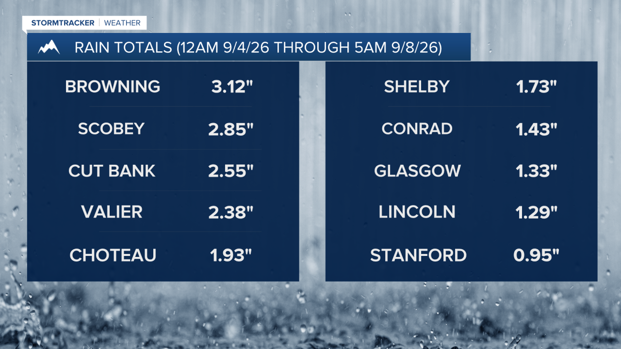
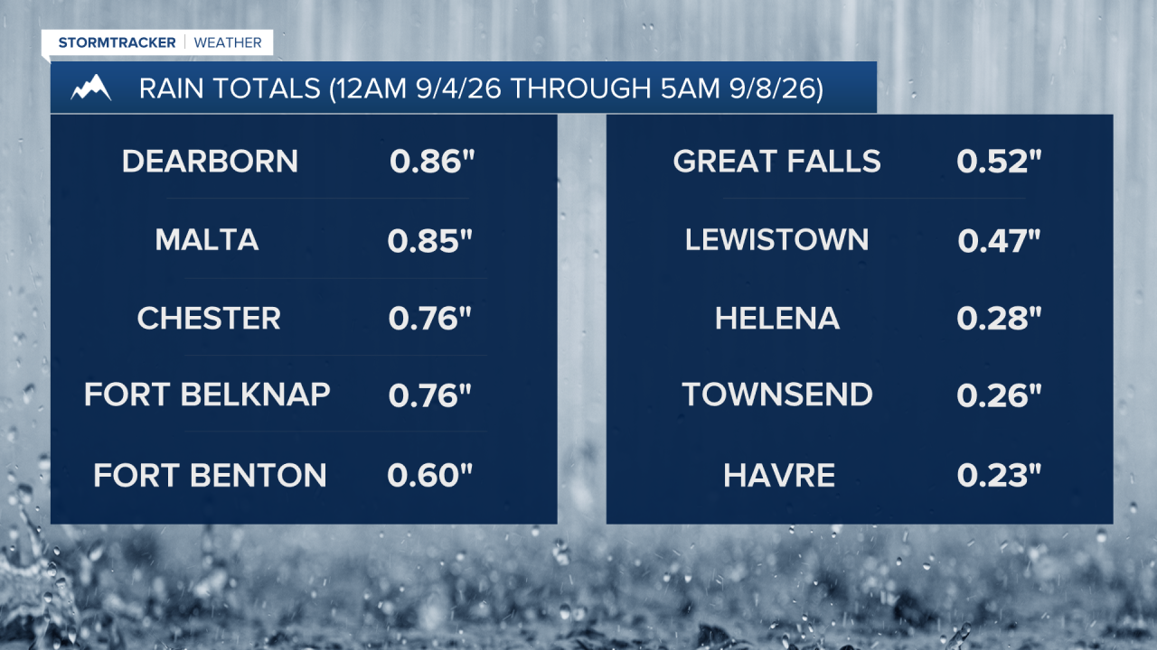
There have been scattered showers and thunderstorms around for the past several days in Montana as a storm system has very slowly been working its way through our region. Rainfall totals have varied significantly across the state, with some areas receiving little to no precipitation while others have picked up 2-3+ inches of rain. Across north-central Montana, most locations have received at least 0.10" of rainfall, with the heaviest amounts falling along the Rocky Mountain Front and across the Golden Triangle, where many communities have received over 1” of rain.
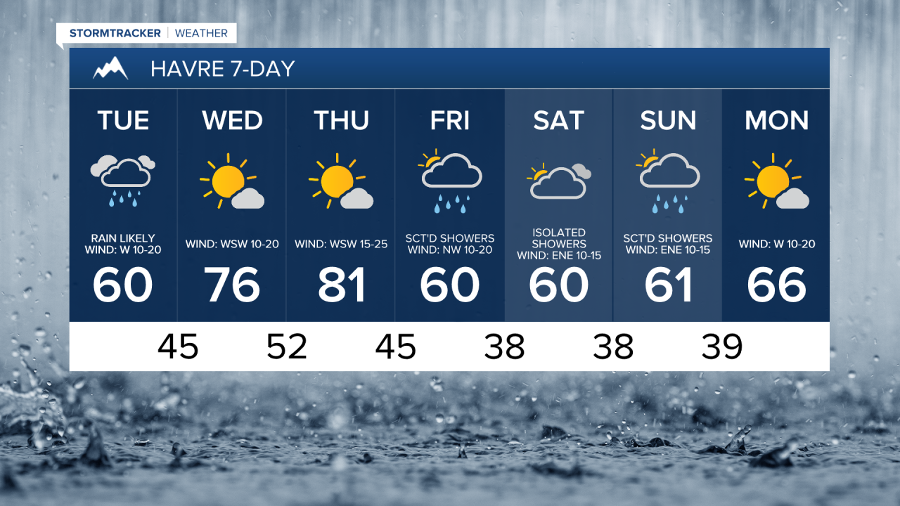
Additional precipitation is expected today as the storm system finally begins to exit the region. Rain is likely across the Golden Triangle, along the Rocky Mountain Front, and along the Hi-Line from the Continental Divide east to around Havre. This rain will gradually taper off from west to east during the afternoon and evening. Elsewhere in north-central Montana, there will be some scattered showers around today, generally during the afternoon and evening.
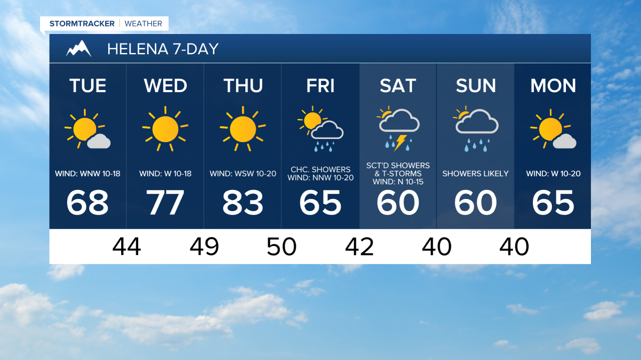
Most of the rain will be out of the area by sunset, although scattered showers will linger across northeastern Montana through about midnight. Skies will remain mostly cloudy today before gradually clearing this evening. Around Helena, it is going to be partly to mostly sunny and mostly dry today.
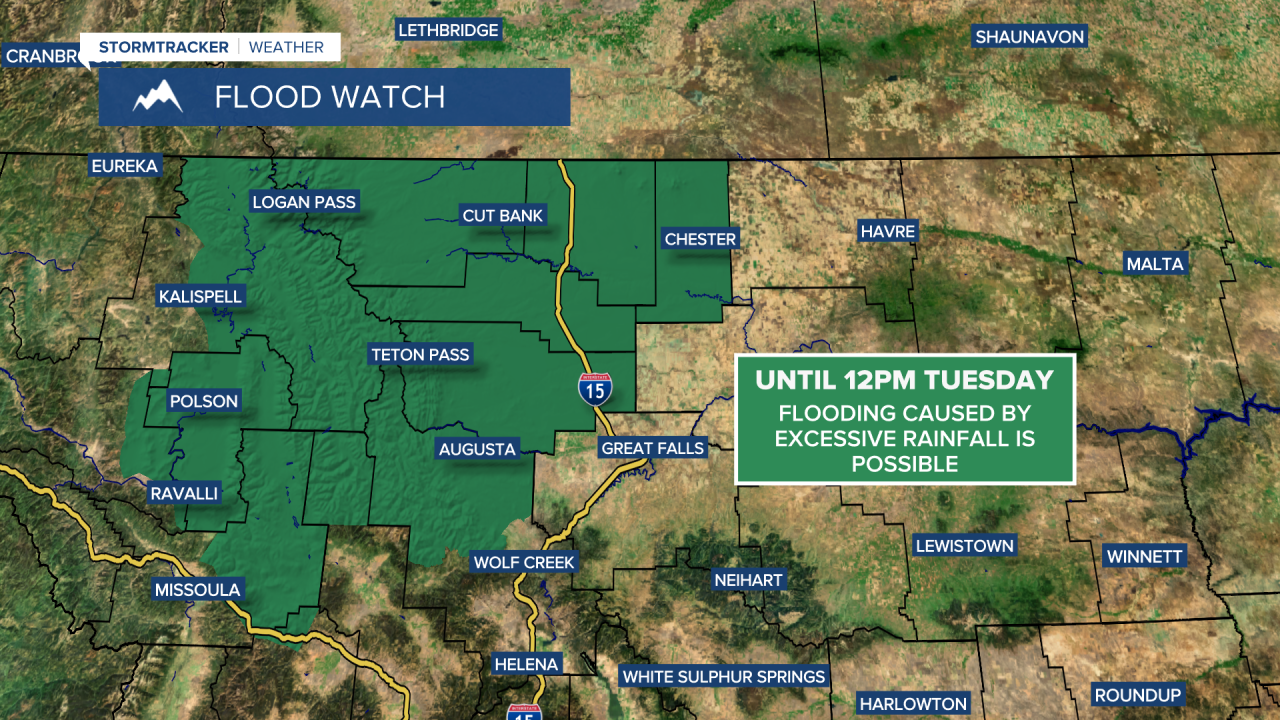
The greatest additional rainfall today is expected across the Golden Triangle, along the Rocky Mountain Front, and along portions of the Hi-Line. Many areas will receive at least a quarter inch of additional rainfall, with some areas receiving over a half inch of additional rainfall. Elsewhere, rainfall amounts today will generally remain below a tenth of an inch. A FLOOD WATCH remains in effect for portions of western and north-central Montana through noon today.

Breezy conditions will continue across the region today, with the strongest winds expected in eastern portions of north-central Montana. Sustained winds will range from 10 to 25 mph, and gusts of 30 to 40 mph are possible. It will also remain cool today, with afternoon highs topping out in the mid to upper 50s and 60s.
Beautiful weather returns tomorrow and sticks around through Thursday as high pressure takes control. Both days will feature mostly sunny to sunny skies, dry conditions, and a warming trend, with highs climbing into the 70s and low to mid 80s. Tomorrow will be breezy, with sustained winds of 10 to 20 mph. Thursday will be windy, with sustained winds of 15 to 30 mph and gusts up to 50 mph will be possible.
A cold front arrives Thursday night into Friday, bringing another round of showers and a few thunderstorms to our area. Precipitation will gradually taper off through the day Friday as skies remain partly to mostly cloudy. Cooler temperatures will also return, with highs falling back into the mid to upper 50s and low to mid 60s. It will also be a little breezy on Friday as sustained wind speeds are going to be between 5 and 20 mph.
Another storm system will impact the state this weekend. There will be scattered showers and a few storms around on Saturday, generally during the afternoon and evening and generally in central Montana and in western portions of north-central Montana. Showers are then likely Saturday night and Sunday. In the mountains, temperatures may become cold enough for accumulating snow, with snow levels potentially dropping to pass level, around 5,000 to 6,000 feet, Saturday night into Sunday morning. High temperatures this weekend will be in the 50s and low to mid 60s and it will be a bit breezy with sustained winds of 10 to 20 mph.


Have a lovely Tuesday!
Chief Meteorologist Ryan Dennis
