


Good Morning! Today is Friday, August 14, 2026. Here is today's forecast:
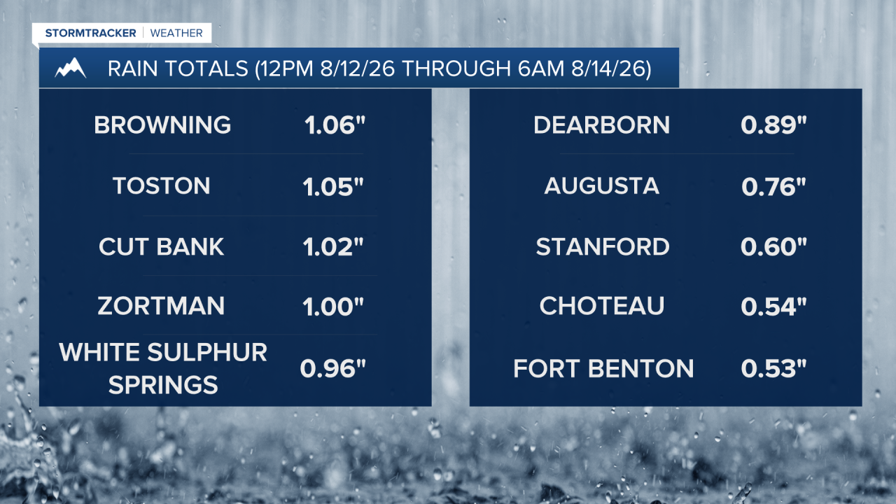
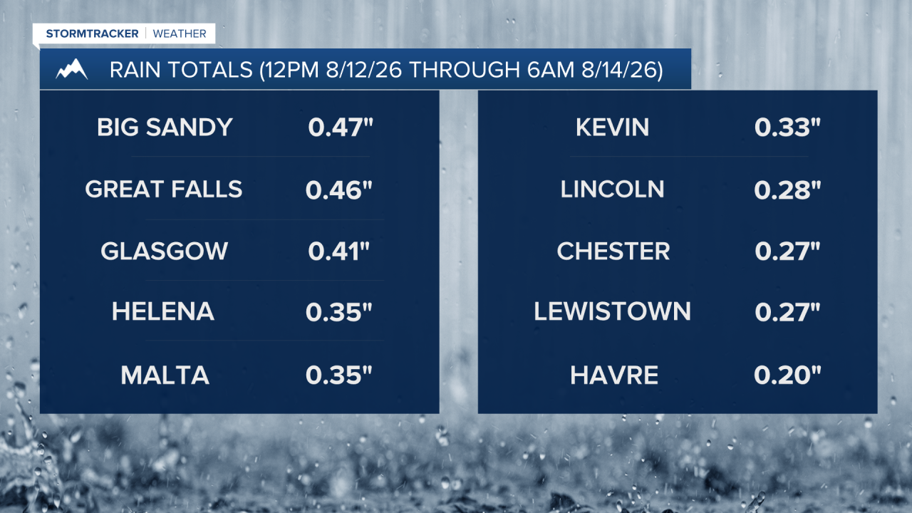
There were scattered showers and thunderstorms around yesterday and overnight. A majority of locations have received at least .2” of rain since Wednesday evening, with a few spots receiving around or over 1” of rain. The below graphic shows the rainfall totals for select locations as of 6am today (8/14/26).
There are going to be scattered showers and some thunderstorms around again today, so make sure you keep an eye to the sky and have a rain jacket handy if you are going to be outdoors at all. It is also going to be cool again today as highs are going to range from the mid 50s near Glacier National Park to the low 70s in northeastern Montana, and these temperatures are well below average for this time of year. Skies today will be mostly cloudy to overcast and there will just be a little haze around.
The temperatures will gradually warm back up this weekend as highs are going to be in the 70s tomorrow and the upper 70s and low to mid 80s on Sunday. There will be some scattered showers and thunderstorms around the Helena area tomorrow afternoon/evening and Sunday afternoon/evening, especially in the mountains. In north-central Montana, a lot of locations will remain dry this weekend, but a couple isolated showers and thunderstorms are possible tomorrow afternoon/evening and there will be some isolated showers and thunderstorms around on Sunday, generally during the afternoon and evening.
Tomorrow will be a partly cloudy day and there may be some areas of fog around during the morning. On Sunday, it is going to be partly to mostly sunny, with the cloud cover increasing during the afternoon and evening. There will be a little bit of haze around this weekend, but the air quality will remain in the “good” or “moderate” category and the visibility will remain good as well.
The active weather pattern continues next week as multiple disturbances pass through the state. On Monday, it is going to be partly to mostly cloudy and there will be a few scattered showers and thunderstorms around during the afternoon and evening, especially in the mountains. Tuesday is forecasted to be the wettest day next week as there will be scattered showers and thunderstorms around, generally during the afternoon and evening, as a stronger disturbance passes through the state. It is also going to be partly to mostly cloudy on Tuesday.
On Wednesday and Thursday, it is going to be partly cloudy and there are going to be some isolated showers and thunderstorms around, generally during the PM hours. It is also going to be warm, but comfortable next week as highs are going to be in the mid to upper 70s and low to mid 80s.


Have a fantastic Friday and weekend!
Chief Meteorologist Ryan Dennis
