


Good Morning! Today is Friday, August 28, 2026. Here is today’s forecast:
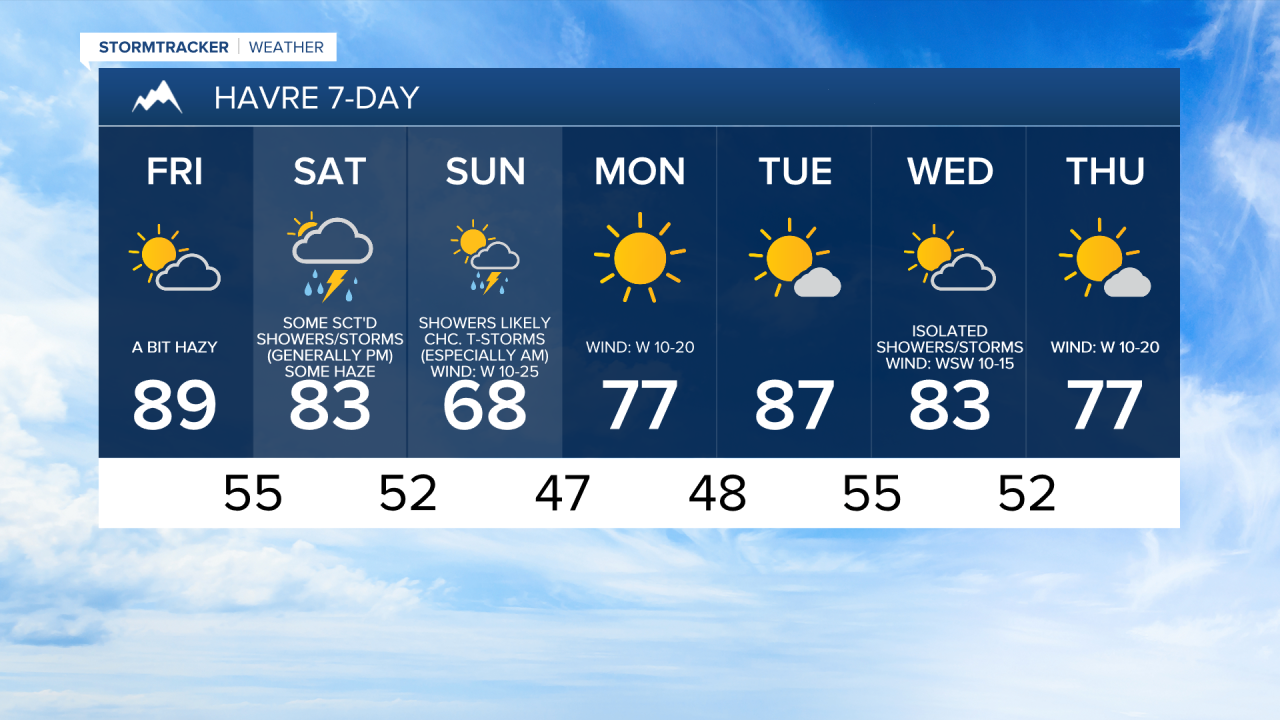
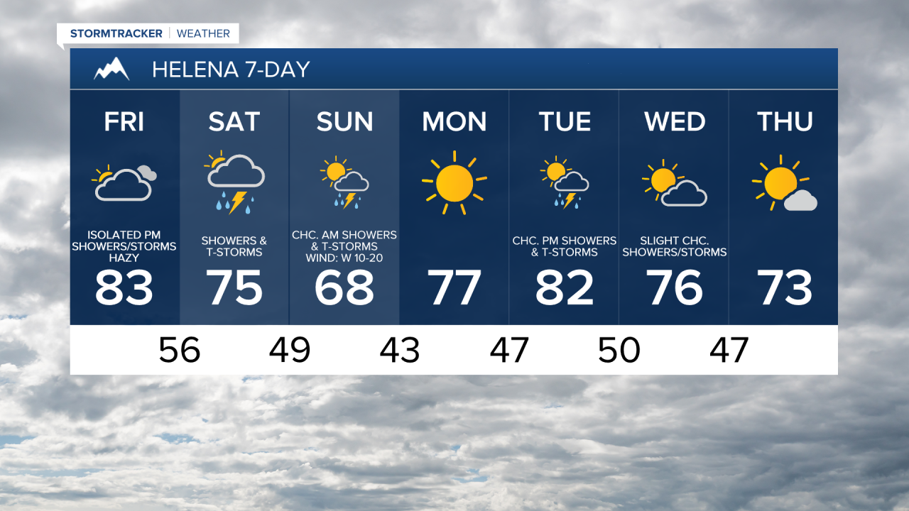
It is going to be partly to mostly cloudy today and there will be a few showers and thunderstorms around, mainly in central Montana. There will also be some haze around today and minor impacts to the air quality (moderate air quality) are possible.
It is going to be warm today, but it will be a little bit cooler than it was yesterday as highs are going to be in the 80s and upper 70s. There is also going to be a bit of a breeze around today along the Divide/Rocky Mountain Front and along the western half of the Hi-Line as sustained wind speeds are going to be between 10 and 20 mph.
This weekend will not be a washout, but you will want to have the rain jacket handy as there are going to be scattered showers and thunderstorms around throughout the weekend, with the shower activity tapering off from west to east on Sunday. The storms that develop this weekend are not expected to be severe, but will still be capable of producing gusty to strong winds, small to medium-sized hail, brief, heavy rainfall, and frequent lightning, so keep an eye to the sky when you are outdoors.
It will be partly to mostly cloudy this weekend, with the skies clearing out some as we go through Sunday. There will also continue to be some haze around tomorrow, but the haziness should diminish as the weekend goes on.
The temperatures will cool down a lot as we go through the weekend. Highs tomorrow are going to be in the 70s and low to mid 80s. It is then going to feel like fall on Sunday as highs are going to be in the 60s and low 70s.
There will be a bit of a breeze around tomorrow along the Divide and Rocky Mountain Front as sustained wind speeds are going to be between 10 and 20 mph. Widespread gusty winds are then expected on Sunday as sustained wind speeds are going to be between 10 and 25 mph, and gusts up to 40 mph are possible. Along the Rocky Mountain Front, sustained wind speeds on Sunday are going to be between 15 and 30 mph, and gusts up to 50 mph are possible.
Monday will be a beautiful day with lots of sunshine, dry conditions, just a little breeze, and pleasant temperatures as highs are going to be in the 70s and low 80s.
On Tuesday, it is going to be partly cloudy and there are going to be some scattered showers and thunderstorms around during the afternoon and evening, generally in central Montana, as a disturbance passes through our area. It is also going to be warm on Tuesday as highs are going to be in the 80s and upper 70s.
The temperatures will cool back down for the end of next week as highs on Wednesday are going to be in the mid to upper 70s and low to mid 80s and highs on Thursday are going to be in the 70s. On Wednesday, it is going to be partly cloudy and there will be a few showers and thunderstorms around. There is also going to be a bit of a breeze (10-20 mph) around on Wednesday. It is then going to be partly to mostly sunny and dry on Thursday.


Have a great Friday and an awesome weekend!
Chief Meteorologist Ryan Dennis
