


Good Morning! Today is Tuesday, October 27, 2026.
Roads are slick in some areas this morning, especially over the mountain passes, so use caution when driving. There are also some areas of fog around.
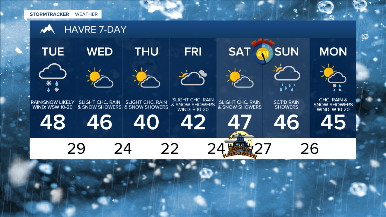
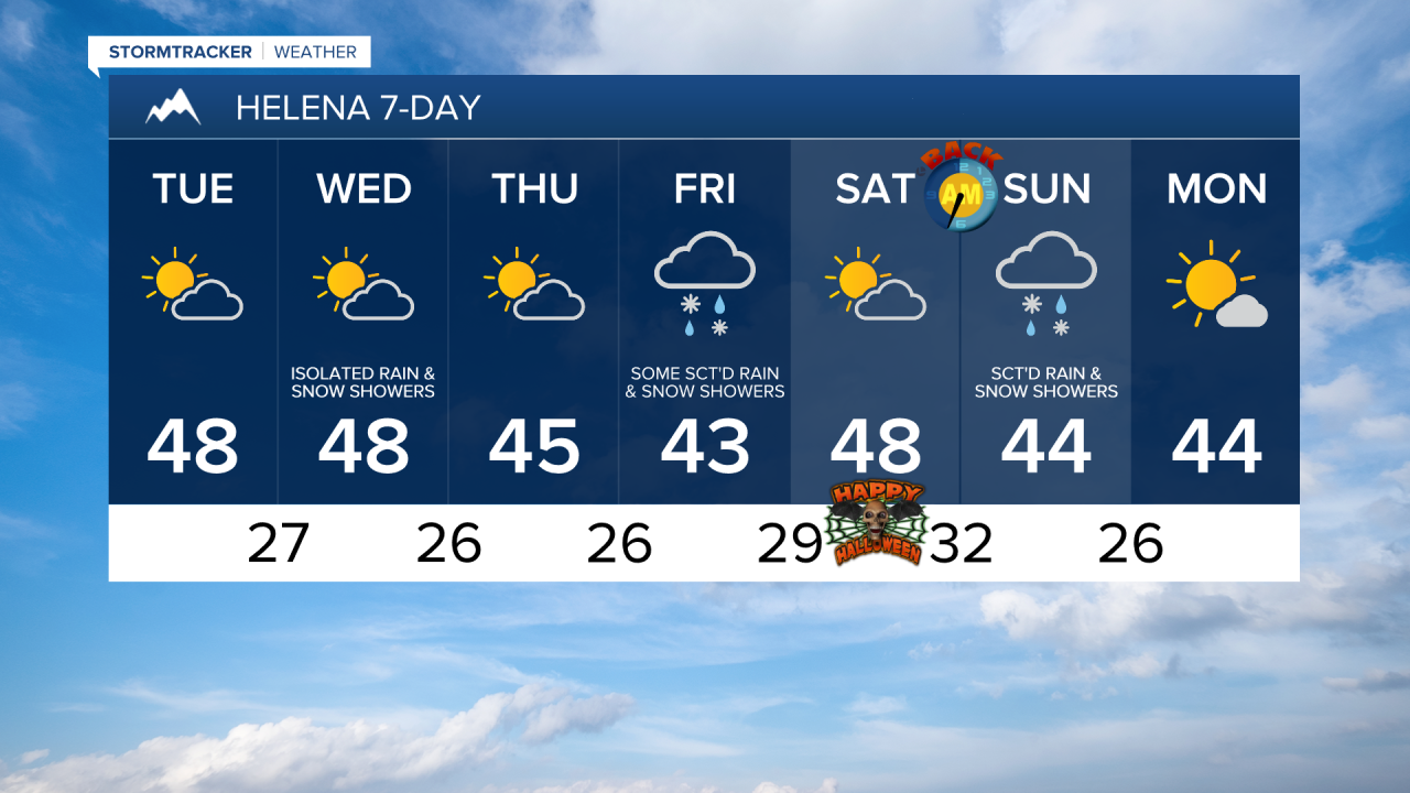
A disturbance has been working its way through Montana overnight and will continue to impact the state today. There will be scattered areas of rain and snow around in north-central Montana this morning. This afternoon and evening, there will continue to be some rain and snow along the Hi-Line and in the mountains. Elsewhere, it will be mostly dry. Around the Helena area, there will be isolated rain and snow showers around today, generally in the mountains. Skies will be partly to mostly cloudy today south of the Hi-Line and mostly cloudy to overcast along the Hi-Line.
Most areas will receive little to no snow accumulation today, but a coating to an inch or two is possible in the lower elevations and the mountains, with several inches possible in Glacier National Park.

Highs today will be in the 40s and low to mid 50s, so it will be another cool day. It will be windy along the Rocky Mountain Front today with sustained winds of 20 to 35 mph, and gusts up to 50 mph are possible. Elsewhere, breezy/gusty conditions are expected today, with sustained winds of 10 to 30 mph, and gusts up to 40 mph are possible.
Tomorrow and Thursday will be partly cloudy and mostly dry, just a few isolated rain and snow showers around. Highs tomorrow will be in the mid to upper 40s and low to mid 50s, while cooler temperatures will return for Thursday, with highs in the mid to upper 30s and low to mid 40s. There will also continue to be a breeze around tomorrow, with sustained winds of 10 to 20 mph.
Some scattered rain and snow showers are possible on Friday and it will be mostly cloudy to overcast as another disturbance impacts the state. It will also be chilly on Friday as highs will be in the mid to upper 30s and low to mid 40s.
Halloween is looking pretty nice right now with partly cloudy skies and mostly dry conditions. Highs will be in the 40s and there will be little to no wind.
Daylight Saving Time ends Saturday night, so remember to “Fall Back” one hour before you go to bed Saturday night. Also, make sure you change the batteries in your Smoke Detectors and Carbon Monoxide monitors.
Another disturbance will impact the state on Sunday. There will be scattered rain showers in the lower elevations, potentially mixing in with snow, and there will be scattered snow/rain showers in the mountains. Highs will be in the upper 30s and low to mid 40s and skies will be mostly cloudy.

Have a tremendous Tuesday!
Chief Meteorologist Ryan Dennis
