


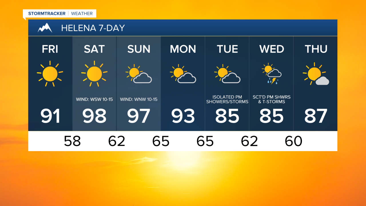
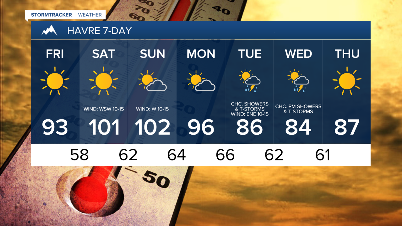
Good Morning and Happy Friday! The hottest temperatures of the year so far are expected today through Monday as an upper-level ridge is going to be in control of our weather. Highs today are going to be in the mid to upper 80s and low to mid 90s. It is then going to be very hot this weekend as highs are going to be in the 90s and 100s, and some locations may set new daily record high temperatures. The temperatures will then cool down a touch for Monday, but it will still be hot with highs in the 90s and upper 80s.
Here is the weekend forecast:
An EXTREME HEAT WARNING is in effect for northeastern Montana from 6am Saturday until 6am Monday and for southeastern Montana and portions of south-central Montana from 6am Saturday until 12am Tuesday.

A HEAT ADVISORY is in effect for most of north-central Montana and the Bozeman/Helena areas from 12pm Saturday until 9pm Monday.

If you will be outdoors at all over the next few days, make sure you stay hydrated, wear light and loose-fitting clothing, and wear sunscreen. Also, make sure you regularly check on those that are more susceptible to heat illnesses, including the elderly, young children, and pets.
Today and tomorrow will feature abundant sunshine, while Sunday and Monday will be partly to mostly sunny. A stray shower or thunderstorm can’t be ruled out, but for the most part, it will be dry today through Monday.
It will be breezy again today along the Divide and the Rocky Mountain Front as sustained wind speeds are going to be between 10 and 20 mph. Elsewhere, there will just be a little breeze around today. Tomorrow, it will be breezy in a lot of areas as sustained wind speeds are going to be between 10 and 25 mph, and this wind combined with the heat will elevate the fire danger. There will then just be a little breeze (5-20 mph) around on Sunday and Monday.
The temperatures will cool down some for the middle of next week as highs are going to be back in the 80s and upper 70s in a lot of locations. Precipitation chances also return for the middle of next week as a couple disturbances pass through the state. On Tuesday and Wednesday, there will be some scattered showers and thunderstorms around, generally during the PM hours, and it will be partly cloudy as well.

Have a great weekend and stay cool!
Chief Meteorologist Ryan Dennis
