


Good Morning! Today is Friday, October 16, 2026.
Pleasant fall weather is expected for most of the next week as an upper-level ridge will be in control of our weather. Most days will feature a good amount of sunshine, mainly dry conditions, and pleasant temperatures, with highs ranging from the mid 50s to the mid 70s.
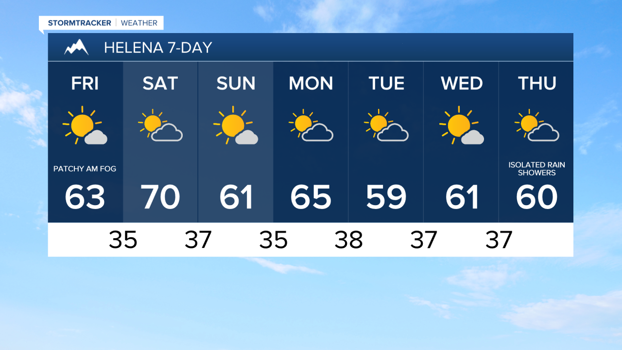
Much warmer temperatures are expected today as highs are going to be in the 60s and low 70s. There is also going to be a breeze around in some areas today, with sustained winds of 10 to 25 mph. The strongest wind today will be along the Rocky Mountain Front where gusts up to 50 mph are possible. Mostly sunny to sunny skies are also expected today, with patchy fog possible in the valleys this morning.
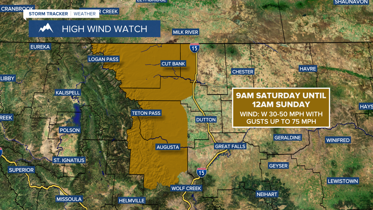
Widespread gusty to strong winds are expected across a lot of north-central Montana tomorrow. Along the Rocky Mountain Front and around the Cut Bank area, sustained winds of 25 to 45 mph are expected, with gusts up to 75 mph possible. A HIGH WIND WATCH is in effect from 9am Saturday until 12am Sunday for this area. Across the plains, sustained winds of 10 to 30 mph are forecast, with gusts over 40 mph possible. The wind will be weaker the further east you go.
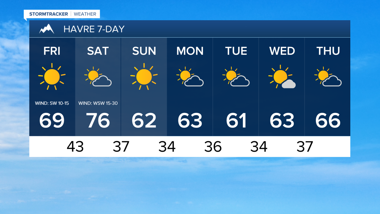
It will also be mild tomorrow as highs are going to be in the mid to upper 60s and low to mid 70s. Partly cloudy skies and dry conditions are also expected.
The temperatures will cool down some on Sunday as highs will be back in the upper 50s and low to mid 60s. The winds will also be lighter, and it will be mostly sunny.
Monday and Tuesday will be partly cloudy and mainly dry. Some isolated rain and mountain rain/snow showers are then possible Tuesday night through Thursday as a couple weak disturbances pass through the state. Wednesday will be mostly sunny, while Thursday will be partly cloudy. Seasonable temperatures are expected next week as highs will generally be in the 60s and mid to upper 50s. There will also only be a little breeze around next week.


Have a fabulous Friday and a great weekend!
Chief Meteorologist Ryan Dennis
