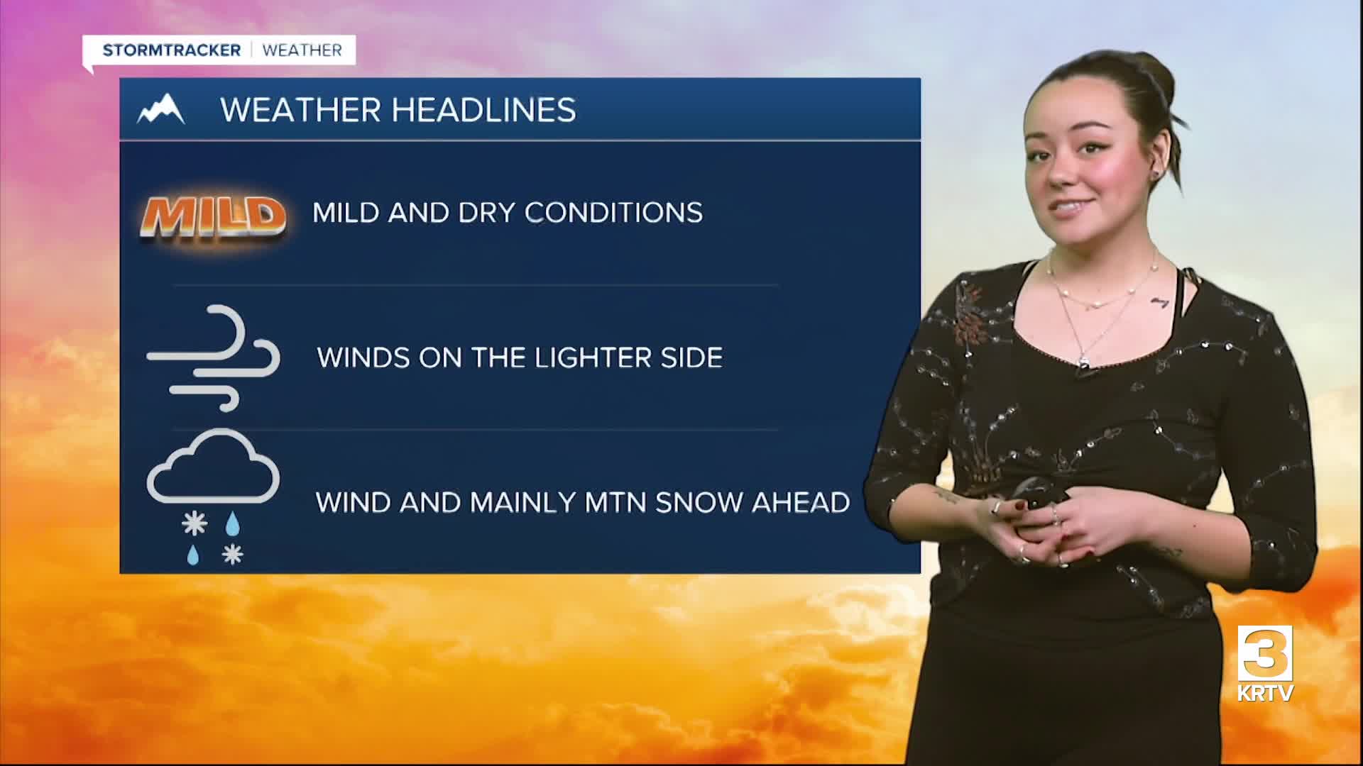


WEATHER DISCUSSION: The weekend began on a mild note with temperatures reaching into the 50s and 60s with a light breeze and mainly dry conditions. Tonight, expect mostly clear skies with low temperatures in the 20s and 30s and winds around 5 to 10 mph. In areas that clear and have light winds across North Central Montana, fog has the potential to form.

An upper-level ridge takes control of the region, bringing the mostly dry conditions and mild, slightly above-average temperatures. Although, a weak upper-level shortwave associated with a surface cold front will bring isolated light rain showers to portions of the Hi-Line this evening.
On Sunday the upper-level ridge remains over the region but due to the surface cold front, it will be a few degrees cooler than today with the coldest temperatures along the Hi-Line where below seasonal average temperatures are expected. Isolated light rain showers will also continue across the Hi-Line Sunday. Otherwise, expect increasing clouds with high temperatures in the 50s and 60s (mainly southern portions) with light winds around 5 to 10 mph.

On Monday, the ridge remains over the region bringing more warm temperatures and dry conditions.
On Tuesday, an upper-level low associated with a surface cold front will briefly bring a strong surface pressure gradient, leading to windy conditions across North Central, Central, and Southwestern Montana on Tuesday.
A High Wind Warning will be in place for locations around the Rocky Mountain Front during this period. The cold front/upper-level low will also bring primarily mountain precipitation Tuesday afternoon and evening.
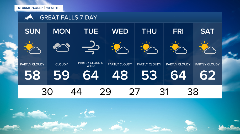
On Wednesday and Thursday, an upper-level moves back into the region along with a cold front, meaning colder temperatures and light mountain snow is expected. Friday, temperatures warm up slightly with mostly dry weather towards next weekend.


