


Good Morning! Today is Monday, September 21, 2026. Here is today’s forecast:
The weekend started off cloudy, cool, and wet in some areas, but it ended on a much brighter note. Many locations enjoyed plenty of sunshine and pleasant temperatures on Sunday. For the upcoming work week, an upper-level ridge will be in control of our weather, so a good amount of sunshine, mostly dry conditions, and above average temperatures are expected. An upper-level trough will bring cooler and cloudier conditions to the area later Friday into the weekend.
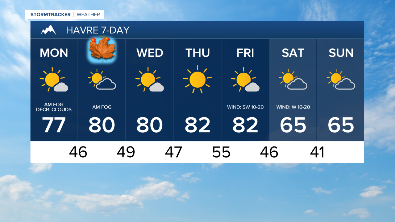
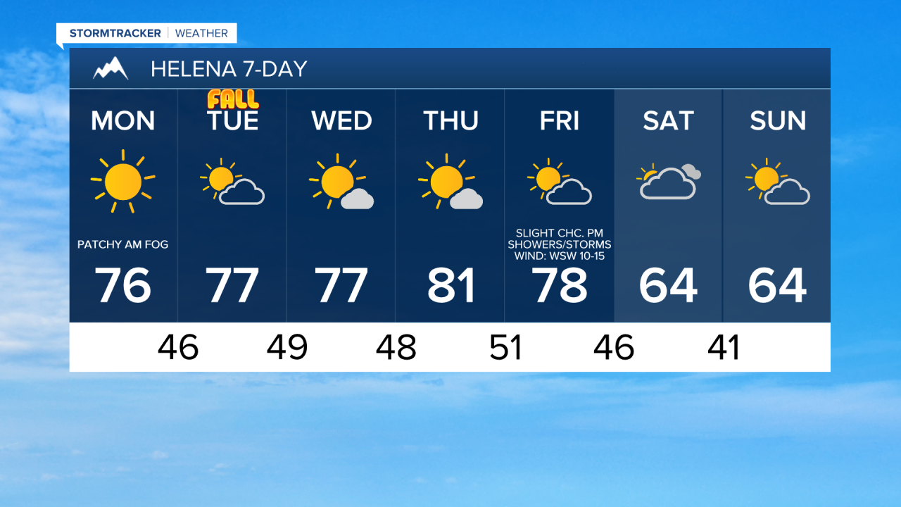
There are areas of fog around this morning, especially in locations east of I-15 in north-central Montana, and some of this fog is locally dense, so give yourself some extra time for the morning commute. The fog will gradually burn off through the morning, giving way to plenty of sunshine for most locations. In northeastern Montana, however, fog and low clouds may linger through the afternoon, resulting in partly to mostly cloudy skies. Afternoon highs will climb into the 70s and low 80s, making for a mild day. Along the eastern half of the Hi-Line and the northern part of the Rocky Mountain Front, there will be a little breeze around today with sustained winds of 5 to 20 mph.
There are going to be some areas of fog around again tomorrow morning, particularly across eastern portions of north-central Montana. Outside of the fog, skies will be partly to mostly sunny, with the cloud cover increasing as the day goes on. Most locations will remain dry tomorrow, but a few isolated showers and thunderstorms are possible during the evening in central Montana. Highs tomorrow will be in the mid to upper 70s and low 80s, so it will be a warm day. Winds will remain light in most areas.
Tomorrow is also the First Day of Fall. Fall officially begins at 6:05pm MDT.
Wednesday will feature mostly sunny skies and predominantly dry conditions, though a few isolated showers and thunderstorms will be possible in the mountains and east of I-15. Thursday looks sunny and dry area-wide. Both days will be warm, with highs in the mid to upper 70s and low to mid 80s. A little breeze of 5 to 20 mph is also expected.
Friday will be partly to mostly sunny, with a few showers and thunderstorms developing later in the day as a cold front approaches. Breezy conditions will develop during the afternoon and evening with sustained winds of 10 to 25 mph and gusts up to 40 mph are possible. Friday will be the final warm day of the month with highs in the mid to upper 70s and low to mid 80s.
Much cooler temperatures return for the weekend, with highs dropping back into the upper 50s and 60s. Skies will be partly to mostly cloudy, and while most locations will remain dry, a few isolated showers are possible. Saturday will also be a little breezy, with sustained winds of 5 to 20 mph.


Have a magnificent Monday and a wonderful week!
Chief Meteorologist Ryan Dennis
