


Good Morning! Today is Tuesday, September 15, 2026. Here is today’s forecast:
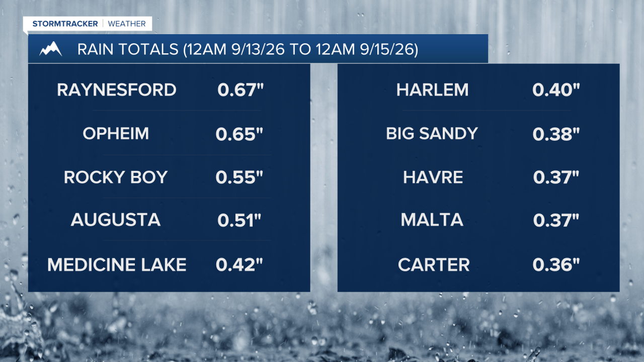
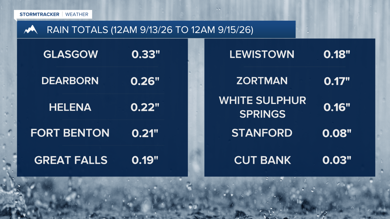
There were scattered showers around Sunday evening through Monday and some thunderstorms around Sunday evening/night as an upper-level low passed through our area. Rainfall amounts ranged from nothing at all to over a half inch, with northeastern Montana generally receiving the highest rainfall amounts. It was also cold enough for snow in the mountains on Monday. Logan Pass in Glacier National Park received several inches of snow, and Going-to-the-Sun road had to be closed from Avalanche Creek to Jackson Glacier Overlook due to winter weather conditions. The entirety of Going-to-the-Sun road should reopen later today or tomorrow at the latest.
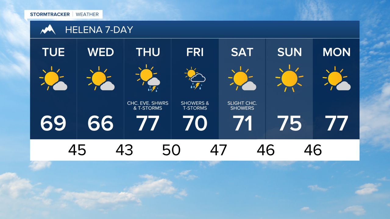
Around Helena, it is going to be partly to mostly sunny and dry today. In north-central Montana, it is going to be partly to mostly cloudy today and a few showers are possible along the western half of the Hi-Line and the northern half of the Rocky Mountain Front this afternoon and evening. The wind will be lighter today compared to yesterday, but it will still be a little breezy, especially in central portions of north-central Montana, as sustained wind speeds will range from 5 to 20 mph. Highs today will be in the 50s and 60s in most locations.
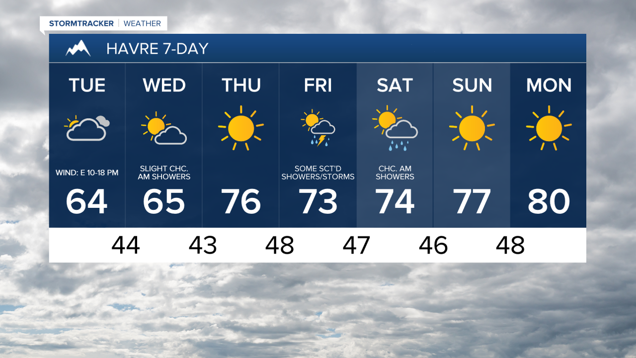
There will be a few showers around tonight along the Hi-Line and the Canadian border as a disturbance passes by our area to the north. Skies tonight will be partly to mostly cloudy. Tomorrow will be partly to mostly sunny, with the skies clearing out as the day goes on. A couple isolated showers are possible along the Canadian border tomorrow morning, but most locations will be dry. Highs tomorrow will be in the mid to upper 50s and to low to mid 60s. There will also be a little breeze around tomorrow in some areas.
Warmer temperatures return on Thursday as highs are going to be in the 70s. In north-central Montana, it will be mainly sunny and dry. Around Helena, it is going to be mostly sunny on Thursday and there will be a few showers and thunderstorms around during the evening. There will also be a bit of a breeze around on Thursday in the eastern half of north-central Montana with sustained winds of 10-20 mph.
There will be scattered showers and thunderstorms around on Friday, especially in central Montana, as a disturbance begins to pass through our area. Skies will be partly to mostly cloudy. On Saturday, it is going to be partly to mostly sunny and there will be some scattered showers around, especially during the morning and generally in the mountains and in locations east of I-15, as this disturbance departs our area.
Temperatures will remain comfortable Friday and Saturday, with highs in the mid to upper 60s and low to mid 70s. There will also just be a little breeze around on these two days.
Beautiful weather is expected Sunday and Monday as an upper-level ridge will be in control of our weather. On these two days, it will be mainly sunny, dry, and mild as highs are going to be in the 70s and low 80s in most locations.


Have a tremendous Tuesday!
Chief Meteorologist Ryan Dennis
