


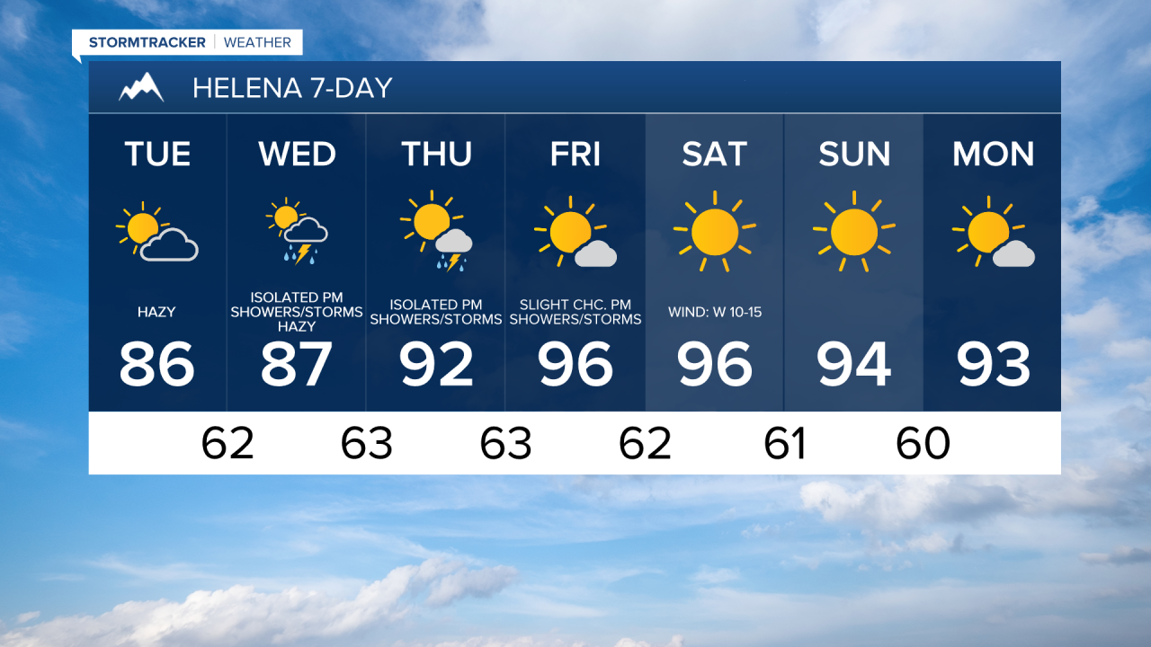
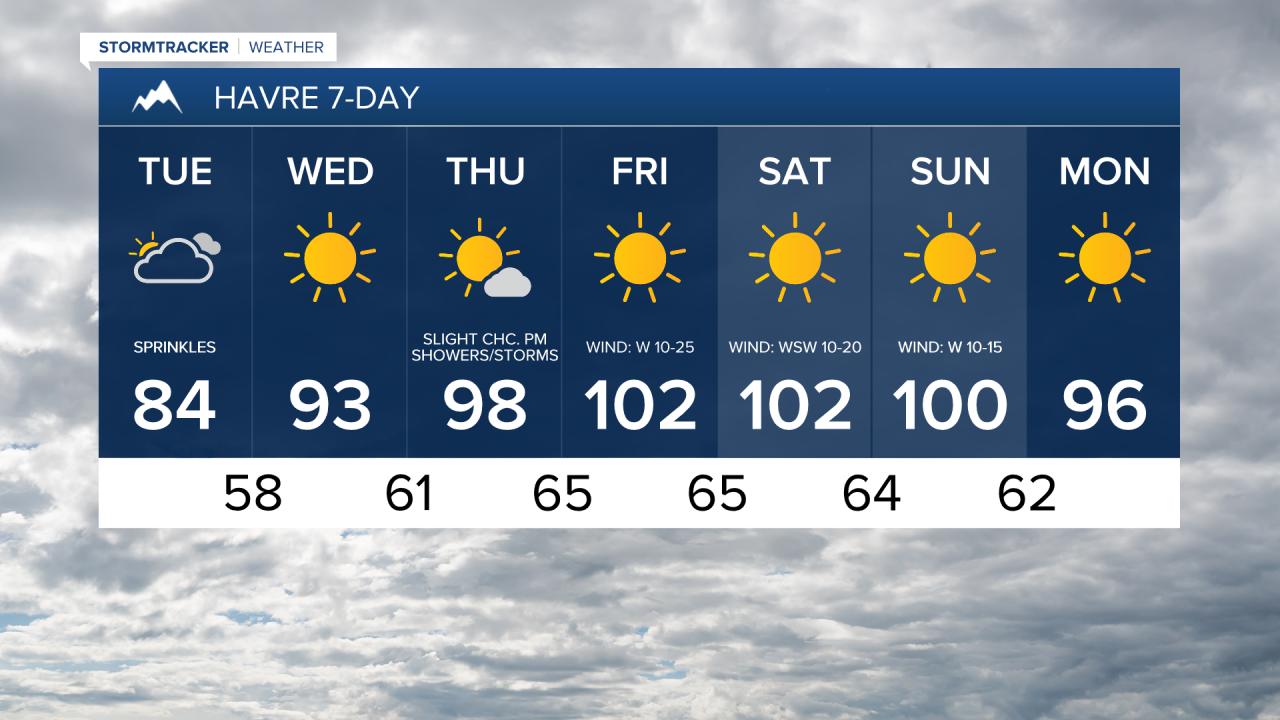
Good Morning and Happy Tuesday! In north-central Montana, it is going to be mostly to partly cloudy today, with the cloud cover decreasing some during the afternoon and evening. A few light showers/sprinkles are possible, but most locations will be dry. Around Helena, it is going to be partly to mostly cloudy and mainly dry today. It is also going to continue to be hazy today, but the haze won’t be as bad as it was yesterday and the air quality will be in the “good” or “moderate” category throughout the day.
Here is today's forecast:
There will be a little breeze around today as sustained wind speeds are going to be between 5 and 20 mph, with the strongest wind expected in Chouteau County, Fergus County, and Judith Basin County. It is also going to be warm today as highs are going to be in the upper 70s and low to mid 80s in most spots.
Tomorrow will be mostly sunny and mostly dry in north-central Montana. Around Helena, it is going to be partly to mostly sunny tomorrow (via increasing clouds) and there will be some scattered showers and thunderstorms around during the afternoon and evening, especially to the south and east of Helena. It will also be warmer tomorrow than it will be today as highs are going to be in the mid to upper 80s and low to mid 90s. There will also continue to be some haze around tomorrow.
On Thursday and Friday, it is going to be mostly sunny with the cloud cover increasing during the afternoon and evening. A lot of locations will be dry on these two days, but there will be some isolated showers and thunderstorms around during the PM hours, especially in central Montana. It is also going to be very hot on these two days as highs are going to be in the 90s and upper 80s on Thursday and the 90s and low 100s on Friday. Gusty winds are also expected in some areas on Friday as sustained wind speeds are going to be between 10 and 25 mph, and gusts over 40 mph are possible. This wind will elevate the fire danger.
This weekend will be sunny, dry, and hot as highs are going to be in the 90s and 100s. There is also going to be a good breeze around in some areas this weekend as sustained wind speeds are going to be between 10 and 25 mph, and gusts over 40 mph are possible. Due to this wind, the fire danger will remain elevated this weekend, so please do your part to not start any new fires.

Have a tremendous Tuesday!
Chief Meteorologist Ryan Dennis
