


Good Morning! Today is Tuesday, September 22, 2026.
Happy First Day of Fall everyone! Fall officially begins at 6:05pm MDT. Even though fall officially begins today, the weather for the rest of the work week will feel more like summer as an upper-level ridge will be in control of our weather. Skies will be partly to mostly sunny, it will be mostly dry, and temperatures will be above average for this time of year. An upper-level trough will bring cloudier, breezier, and cooler conditions to our area for the weekend.
Fog will not be as widespread today as it was yesterday, but there will be some areas of fog around again this morning, primarily across eastern portions of north-central Montana. Outside of the fog, you can expect partly to mostly sunny skies today, with the cloud cover increasing during the afternoon and evening. A few isolated showers and thunderstorms are possible around the Helena area this evening, primarily in the mountains, but most locations will remain dry today.
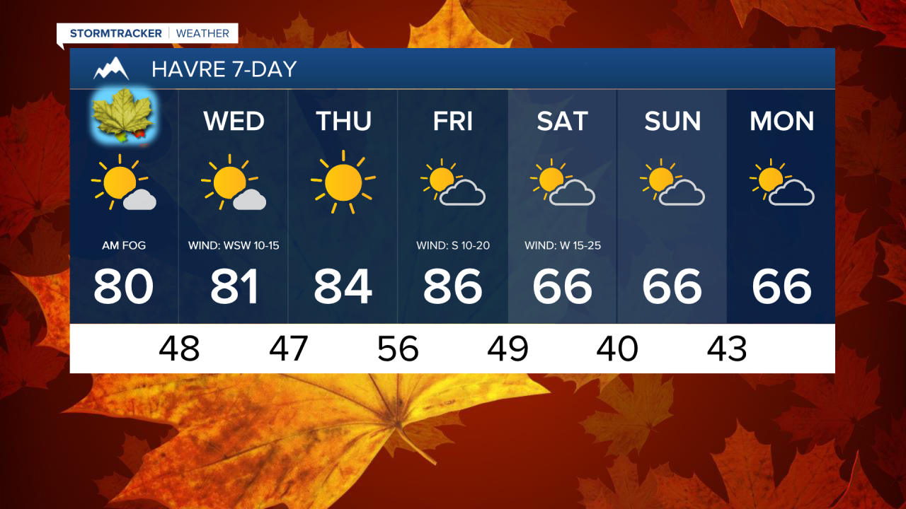
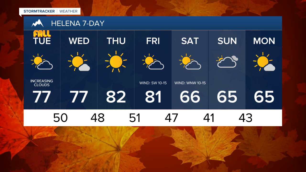
It will be a warm day today as highs are going to be in the mid to upper 70s and low to mid 80s in most locations. There will be a little breeze along the Rocky Mountain Front and in northeastern Montana today as sustained winds of 5-20 mph are expected.
Tonight, it is going to be partly to mostly cloudy and there will be a few isolated showers and thunderstorms around in central Montana as a weak disturbance passes through our area. Tomorrow, it is going to be mostly sunny and mostly dry, just a few isolated showers around in central Montana as the disturbance leaves our area.
It will be warm again tomorrow as highs are going to be in the mid to upper 70s and low to mid 80s. Breezy conditions are expected along the Rocky Mountain Front tomorrow as sustained winds will be between 10 and 25 mph. Elsewhere, there will just be a little breeze around tomorrow.
Thursday looks mainly sunny and dry area-wide. On Friday, it is going to be partly to mostly sunny and a few isolated showers and thunderstorms are possible later in the day as a cold front begins to approach our area.
It will be very warm on these two days as highs are going to be in the 80s and mid to upper 70s, and these two days will probably be the warmest days until next spring. Not much wind is expected on Thursday. Breezy conditions will develop on Friday ahead of the cold front with sustained winds of 10 to 20 mph.
Much cooler temperatures return for the weekend, with highs dropping back into the upper 50s and 60s. Saturday will be a gusty day with sustained winds of 10 to 30 mph, and gusts over 40 mph are possible. The wind will be much lighter on Sunday. Skies will be partly to mostly sunny on Saturday and partly to mostly cloudy on Sunday. Most locations will remain dry this weekend, but a few isolated showers are possible, especially in the mountains.


Have a terrific Tuesday!
Chief Meteorologist Ryan Dennis
