

It was a beautiful day today as we had some sunshine and warmer, but comfortable temperatures for the middle of July as highs were in the 60s and 70s. For tonight, we are going to have mostly clear skies with some patchy fog around after midnight. It is also going to be cool tonight as lows are going to be in the mid to upper 40s and low 50s, and it is going to be a little breezy tonight in some areas as sustained wind speeds are going to be between 5 and 20 mph.
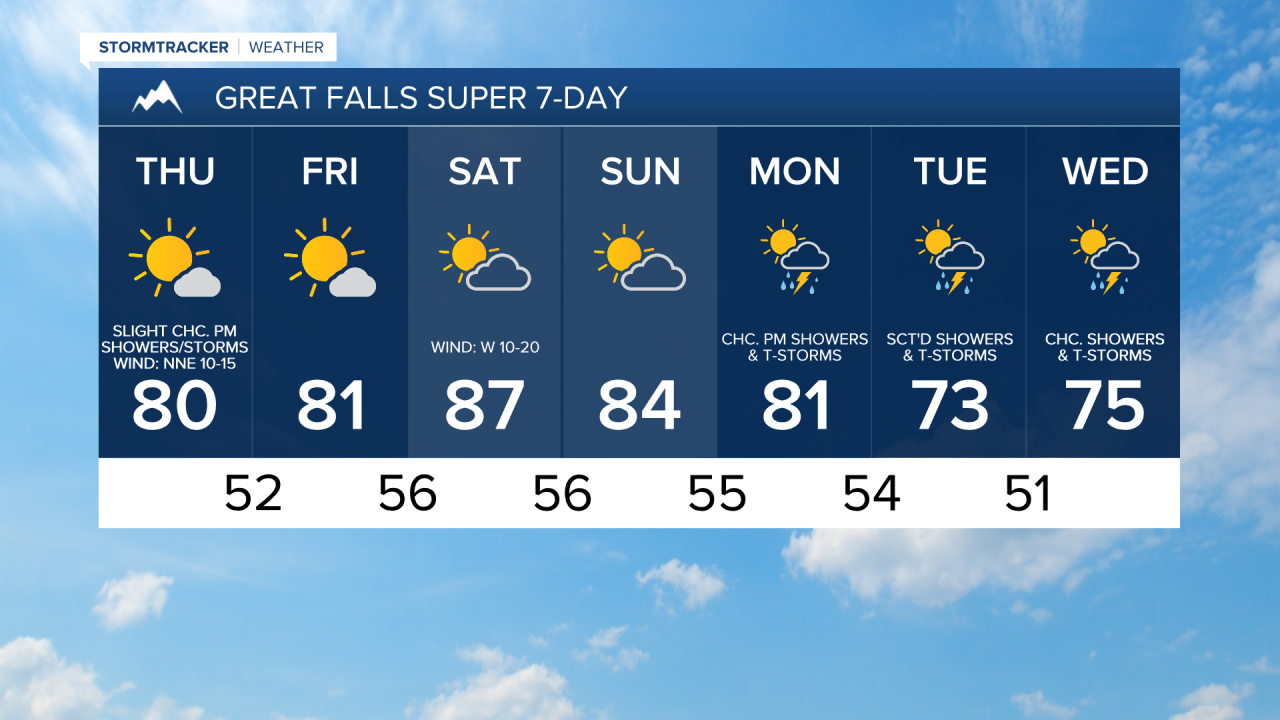
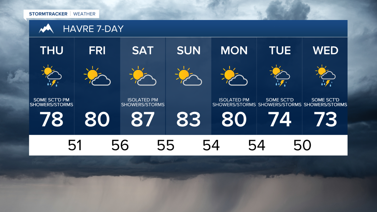
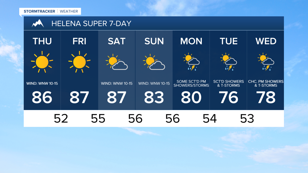
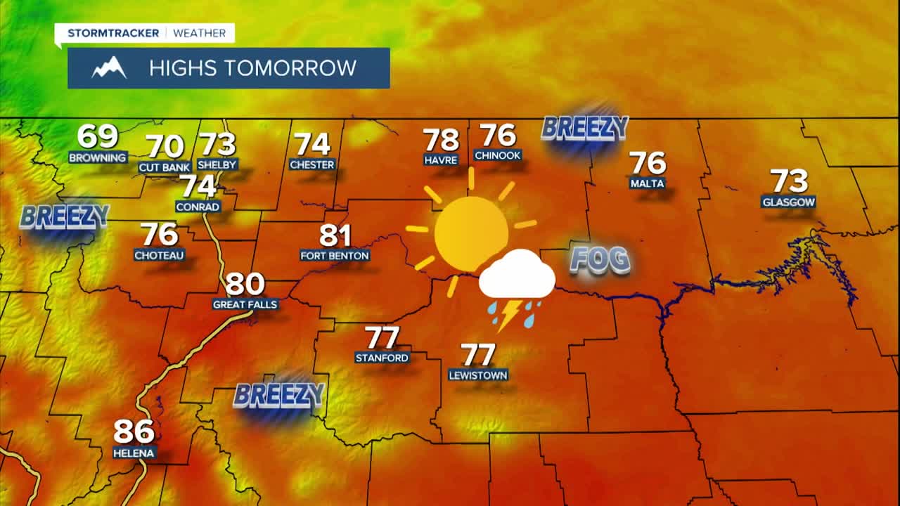
Tomorrow will feature more sunshine and pleasant temperatures in north-central Montana as we are going to have partly to mostly sunny skies (cloudiest along the Hi-Line) and highs are going to be in the 70s and low 80s. Around Helena, it is going to be mainly sunny and warm tomorrow as highs are going to be in the 80s.
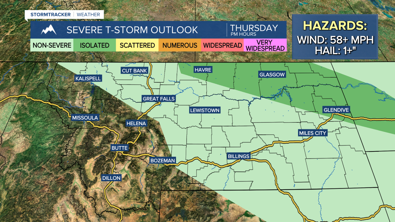
There are also going to be some scattered showers and thunderstorms around tomorrow afternoon and evening, generally along the Hi-Line, as a disturbance clips our area. A couple of these thunderstorms may be severe with damaging winds (58+ mph) and/or large hail (1+”), especially from Hill County eastward into northeastern Montana. There is also going to be a bit of a breeze around tomorrow along the Rocky Mountain Front and the eastern half of the Hi-Line as sustained wind speeds are going to be between 10 and 20 mph. Elsewhere, there is just going to be a little breeze around tomorrow afternoon/evening.
Friday will be a beautiful day as we are going to have partly to mostly sunny skies and mainly dry conditions as high pressure is going to be in control of our weather. It is also going to be mild/warm on Friday as highs are going to be in the mid to upper 70s and low to mid 80s, and the warmest temperatures are going to be in the Helena area.
This weekend will be a nice one as we are going to have partly cloudy skies with just some isolated showers and thunderstorms around, generally along the eastern half of the Hi-Line and in the mountains. It is also going to be warm this weekend as highs are going to be in the 80s and mid to upper 70s in most locations. There is also going to be a bit of a breeze around on Saturday as sustained wind speeds are going to be between 10 and 20 mph, and it is going to be a little breezy on Sunday as sustained wind speeds are going to be between 5 and 20 mph.
Unsettled weather returns for next week as we are going to have daily chances of scattered showers and thunderstorms. Right now, Tuesday features the best chance of precipitation. The temperatures are also going to cool back down next week as highs are going to be in the mid to upper 70s and low to mid 80s on Monday, and the mid to upper 60s and low to mid 70s on Tuesday and Wednesday. There is also going to be a little breeze around Monday through Wednesday as sustained wind speeds are going to be between 5 and 20 mph.