



Good Morning! Today is Friday, November 13, 2026.
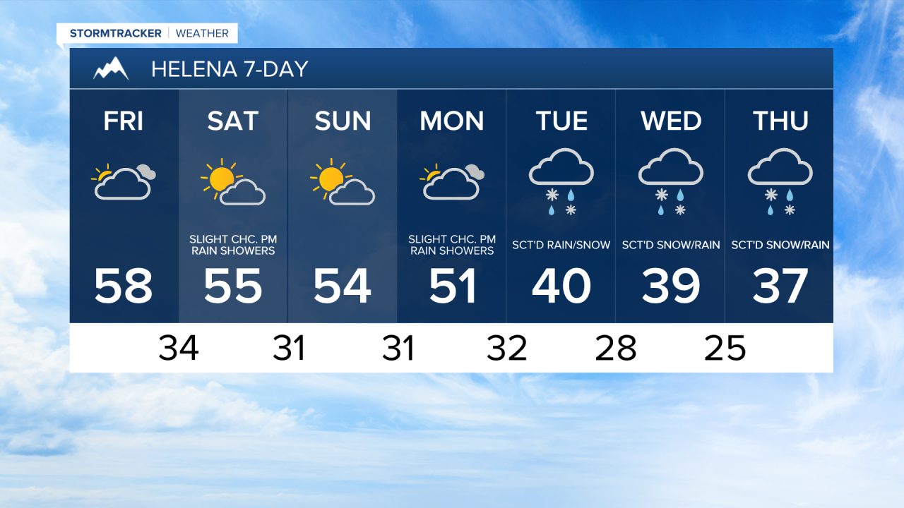
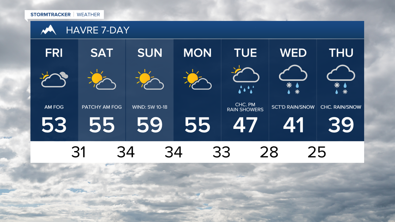
Pleasant fall weather continues through the weekend as an upper-level ridge will continue to primarily be in control of our weather. Today, it is going to be partly to mostly cloudy and dry. There will also be some areas of fog around this morning, mainly across eastern portions of the Hi-Line. Highs today will be in the 50s and 60s and it will be a little breezy in some areas, with sustained winds of 5 to 20 mph.
Tomorrow will be partly to mostly sunny with a few areas of fog around during the morning, mainly across the eastern part of the Hi-Line. Most locations will remain dry tomorrow, but there will be isolated rain and mountain rain/snow showers around the Helena area, generally during the afternoon and evening. Gusty conditions return to the Rocky Mountain Front tomorrow, with gusts up to or over 40 mph possible. It will also be breezy across portions of the plains, especially in and around Cascade County, with sustained winds of 10 to 20 mph. Highs tomorrow will be in the 50s and low to mid 60s.
More wind is in the forecast for Sunday. It will remain gusty along the Rocky Mountain Front, with gusts up to 50 mph possible. East of the Rocky Mountain Front, it will be breezy in some areas, with sustained winds of 10 to 25 mph, and gusts up to 40 mph possible. Outside of the wind, Sunday will be a beautiful day, with partly to mostly sunny skies, dry conditions, and pleasant temperatures as highs will be in the 50s and low 60s.
Monday will be mostly cloudy and mostly dry, just a few isolated rain and mountain snow/rain showers around during the afternoon and evening in central Montana. Highs will be in the 50s in most spots and there will be little to no wind.
Colder and wetter weather is expected Tuesday through Thursday as an upper-level trough moves in. Highs will fall back into the 30s and 40s, with the coldest temperatures expected on Wednesday and Thursday. Precipitation will move in on Tuesday, with precipitation becoming more widespread as the day goes on. In the lower elevations, precipitation will start out as rain, but will gradually mix in with snow in some areas. In the mountains, precipitation will be in the form of snow. There are then going to be areas of lower elevation rain/snow and mountain snow around Wednesday and Thursday.
It is still too far out to talk about snow amounts, but there will likely be accumulating snow in the lower elevations, and several inches of accumulation is expected in the mountains. Travel may be difficult at times, especially at and above mountain pass level. We will continue to keep you updated on this storm and its potential impacts in the coming days.


Have a fabulous Friday the 13th and a great weekend!
Chief Meteorologist Ryan Dennis
