


Good Morning! Today is Thursday, September 3, 2026. Here is today’s forecast:
A line of severe thunderstorms with strong, damaging winds swept through central and north-central Montana yesterday afternoon and evening, leaving widespread damage in its wake. Reports included numerous downed trees and power lines, power outages, roof damage, blowing dust, rolling stock tanks, flying trampolines, and several new fire starts. The largest fire reported was the Cora Creek Fire near Armington Junction, southeast of Belt, which burned an estimated 280 acres.


Peak wind gusts exceeded 60 mph in many locations. Great Falls recorded the strongest wind gust in the state at 83 mph. Cut Bank, Havre, and Helena also experienced wind gusts greater than 70 mph.


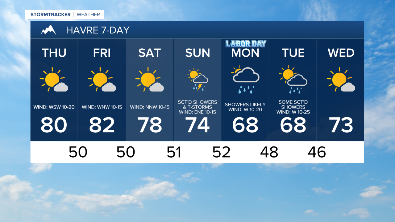
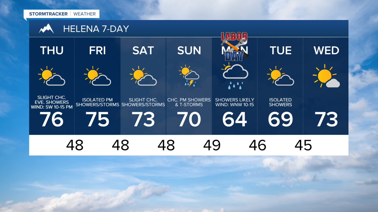
Thankfully, much quieter and more pleasant weather is expected today. Skies will be partly to mostly sunny, and most areas will remain dry, just a few isolated showers and storms around.
Along the Rocky Mountain Front, it will be gusty today as sustained wind speeds are going to be between 15 and 30 mph, and gusts of 40-50 mph are possible. East of the Rocky Mountain Front and around the Helena area, it will be breezy today with sustained wind speeds between 10 and 25 mph, and gusts of 30-40 mph are possible. The wind will weaken the further east you go.
Temperatures will vary considerably across the state today, with afternoon highs ranging from the low to mid 60s near the Rockies to the mid 80s in northeastern Montana.
It is going to be partly to mostly sunny tomorrow and Saturday, with more clouds around and west of I-15 and more sunshine east of I-15. A lot of locations will remain dry on these two days, but there will be a few showers and isolated thunderstorms around, generally around the Helena area and in locations around and west of I-15 in north-central Montana.
Highs on these two days will range from the mid 60s near the Rockies to the low to mid 90s in northeastern Montana. There is also going to be a little bit of a breeze around on these two days as sustained wind speeds are going to be between 5 and 20 mph.
The next storm system will begin approaching the region on Sunday, bringing scattered showers and thunderstorms. Showers become likely on Monday, with a few thunderstorms also possible as the system moves through the state. On Tuesday, there will continue to be some scattered showers around, generally during the morning and generally in locations east of I-15, as the storm moves out. Skies will be mostly cloudy on Monday and partly cloudy on Tuesday.
Cooler temperatures are expected from Sunday through Tuesday, with highs mainly in the 60s and low to mid 70s (low to mid 80s in northeastern Montana on Sunday). Monday looks to be the coolest day of the period. There is also going to be a little breeze around Sunday and Monday as sustained wind speeds are going to be between 5 and 20 mph. It is then going to be breezy on Tuesday as sustained wind speeds are going to be between 10 and 25 mph.


Have a tremendous Thursday!
Chief Meteorologist Ryan Dennis
