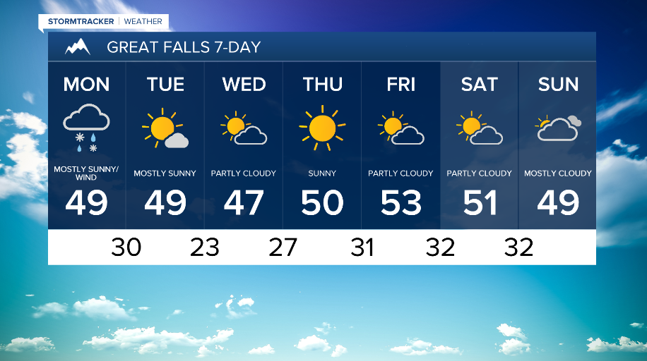


WEATHER DISCUSSION: Tonight, expect chilly temperatures in the 20s and 30s with mostly cloudy skies and precipitation chances. Winds will decrease through the overnight hours, on the light side around 5 to 10 mph.

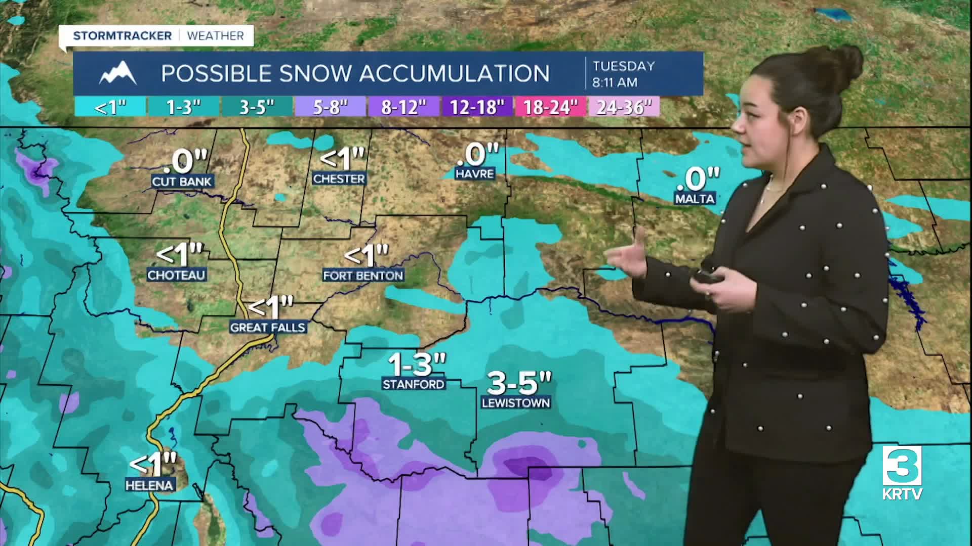
Precipitation increases tonight as a mid-level front moves in, bringing widespread rain over the lower elevations across North Central MT. What initially will start out as rain will transition to wet snow/a rain and snow mix during the overnight hours through Monday morning. Marginal morning lows hovering just above or below freezing will make snow struggle to accumulate, but light accumulations are expected if snow accumulates.

Coverage in precipitation decreases mid to late Monday morning. The main uncertainty in the forecast for snow Monday morning is how much light snow accumulates at lower elevations. At this time, it doesn’t seem that there will be much accumulating snow in lower elevations, though up to 8 inches is possible in some Central MT locations. The main impact will be winter driving conditions for the Monday morning commute.
Otherwise, expect cloudy/mostly cloudy skies with high temperatures in the upper-30s/40s. It will be breezy along the Rocky Mountain Front with gusts up to 40 mph. The trough still passing through Monday will allow for isolated snow showers to persist for the rest of the day Monday.

Behind this system, cooler air moves in for the week though temperatures will remain above average in the 30s, 40s, and 50s. Expect low chances of precipitation and periods of breezy conditions throughout the week.