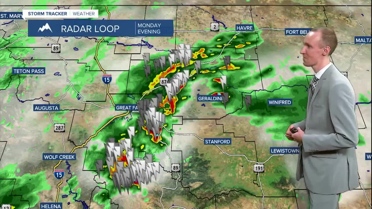


There are going to be scattered showers and thunderstorms around this evening and tonight, and a few of these thunderstorms may be severe with damaging winds (58+ mph) and/or large hail (1+” in diameter), so please be weather aware if you are going to be outdoors at all. We are also going to have overcast to mostly cloudy skies tonight.
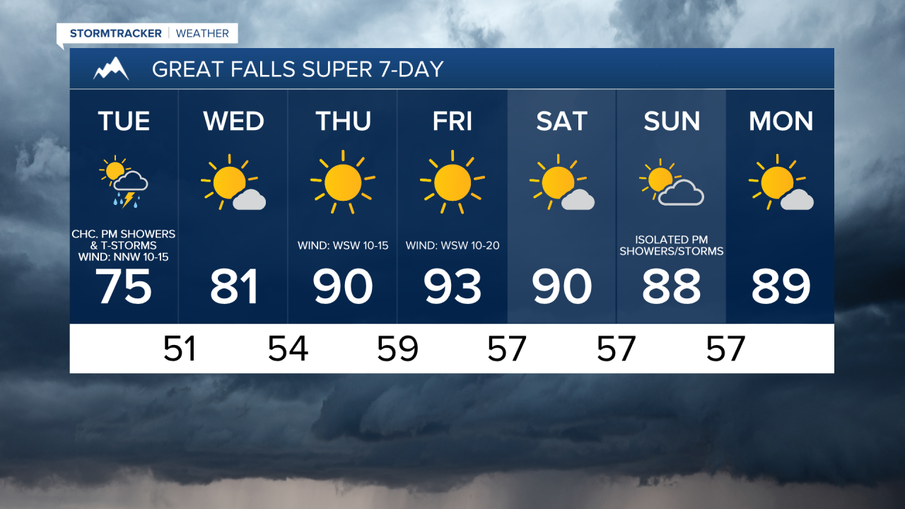
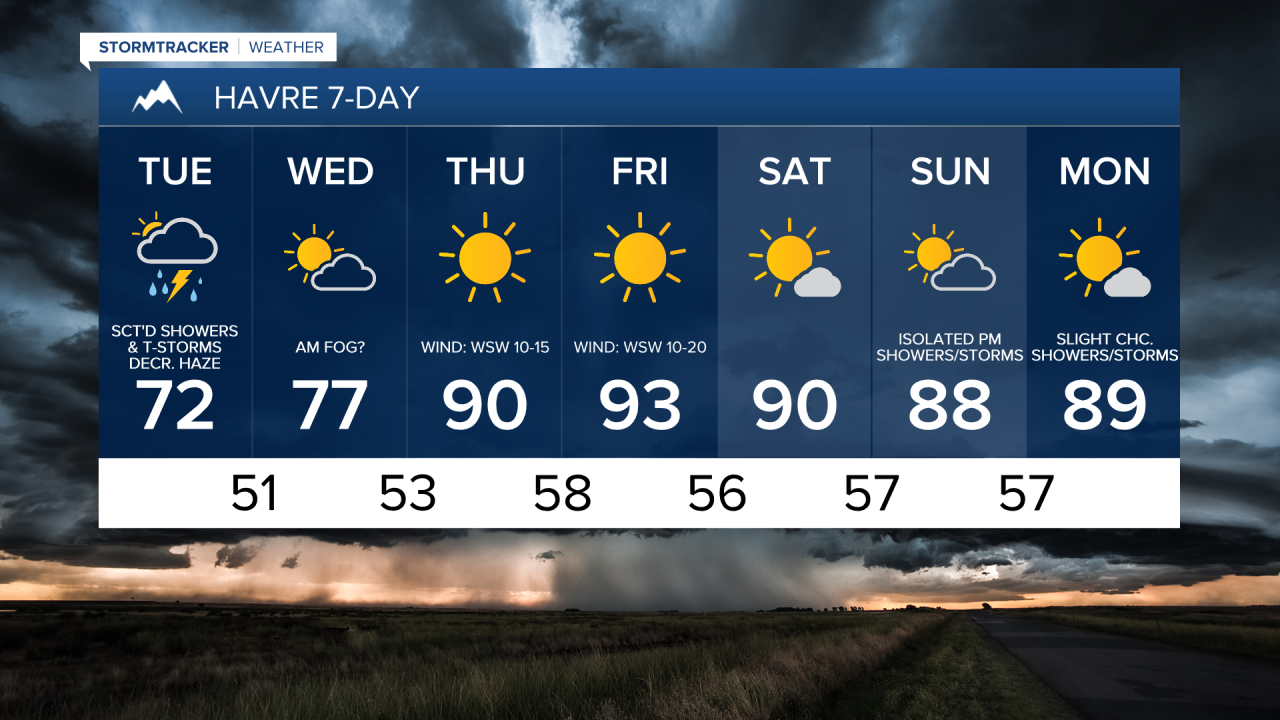
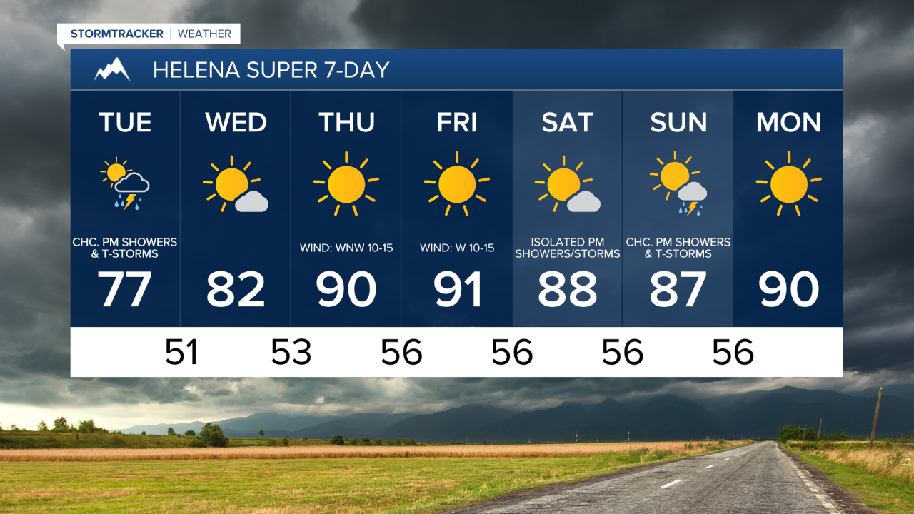
For tomorrow, we are going to have mostly to partly cloudy skies with some scattered showers and thunderstorms around, generally during the afternoon and evening, as a storm system continues to impact our area. It is also going to be breezy tomorrow in western portions of north-central Montana as sustained wind speeds are going to be between 10 and 20 mph, and gusts over 30 mph are possible.
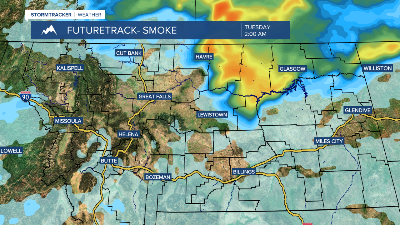
Canadian wildfire smoke will return to northeastern Montana and eastern portions of north-central Montana (east of a line from Chester to Lewistown) tonight, and this smoke may cause the air quality to become unhealthy for sensitive groups or unhealthy for everyone. As we go through tomorrow, the haze/smoke will decrease and the air quality will improve.
Lows tonight are going to be in the 50s in most spots. It is then going to be seasonably cool tomorrow as highs are going to be in the 70s and mid to upper 60s in most locations (mid to upper 50s and low 60s along the northern half of the Rocky Mountain Front and in Glacier County).
On Wednesday, we are going to have partly to mostly sunny skies with some areas of fog around during the morning. There are also going to be a few lingering showers and thunderstorms around east of I-15 on Wednesday as a storm system departs our area. It is also going to be mild on Wednesday as highs are going to be in the 70s and low 80s in most locations.
Typical July weather will return for Thursday and Friday as we are going to have lots of sunshine, mainly dry conditions, and hot temperatures as highs are going to be in the mid to upper 80s and low to mid 90s. It is also going to be a bit breezy on these two days as sustained wind speeds are going to be between 10 and 20 mph, and gusts over 30 mph are possible.
This weekend, we are going to have partly to mostly sunny skies and very warm temperatures as highs are going to be in the 80s and low 90s. Most locations will be dry on Saturday, but there will be a few isolated showers and thunderstorms around during the afternoon and evening. There are then going to be some scattered showers and thunderstorms around Sunday afternoon/evening as a disturbance begins to impact our area. It is also going to be a little breezy this weekend as sustained wind speeds are going to be between 5 and 20 mph.