


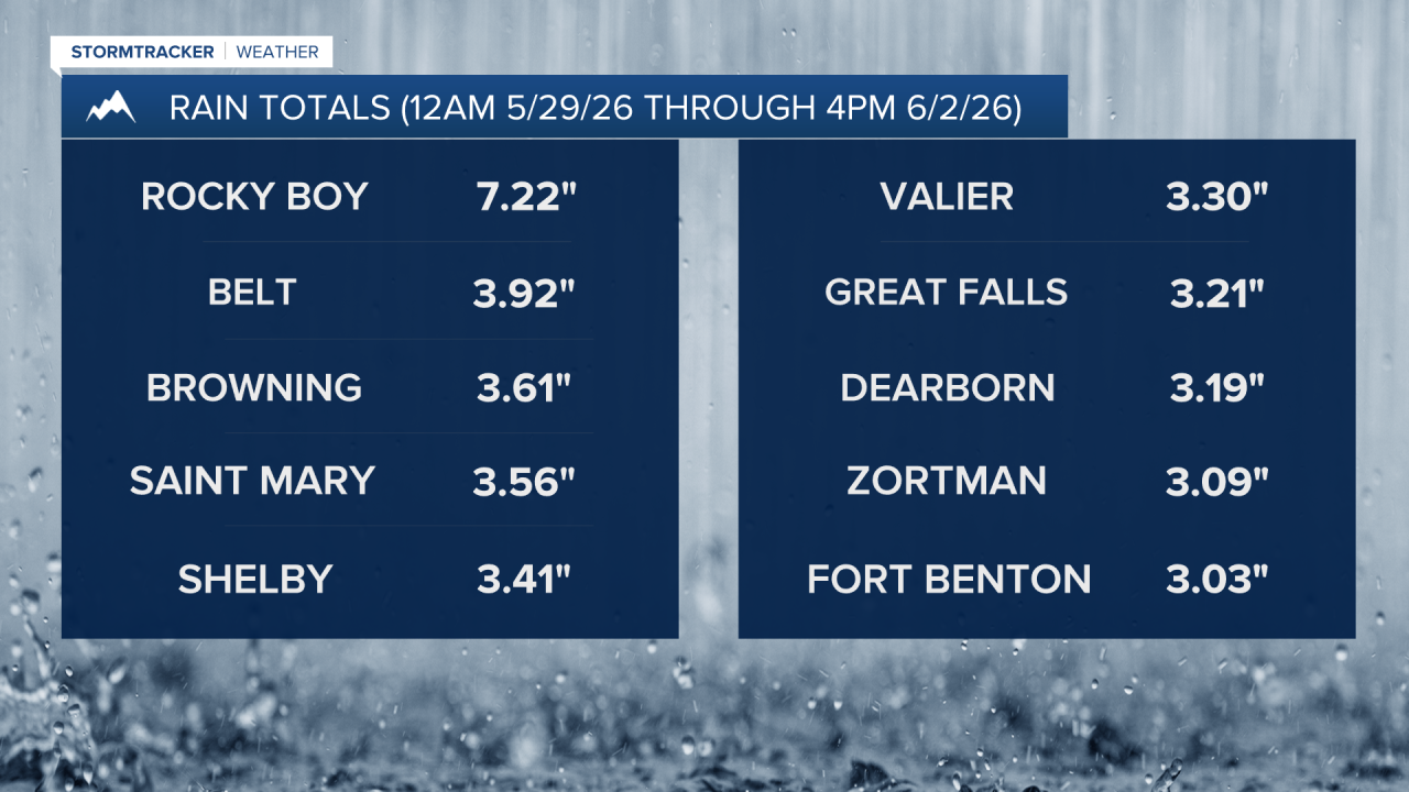
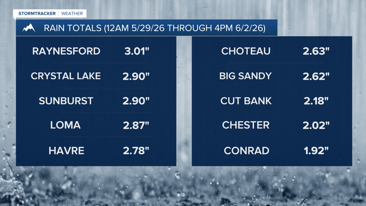
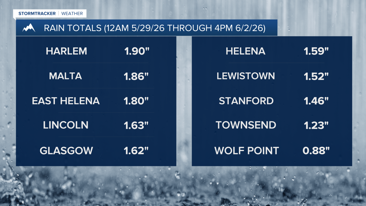
A storm system has brought beneficial moisture to a lot of the state the past several days with most locations in north-central Montana and around the Helena area receiving 1-4” of rain! Rocky Boy was the big winner with this storm, picking up over 7” of rain!
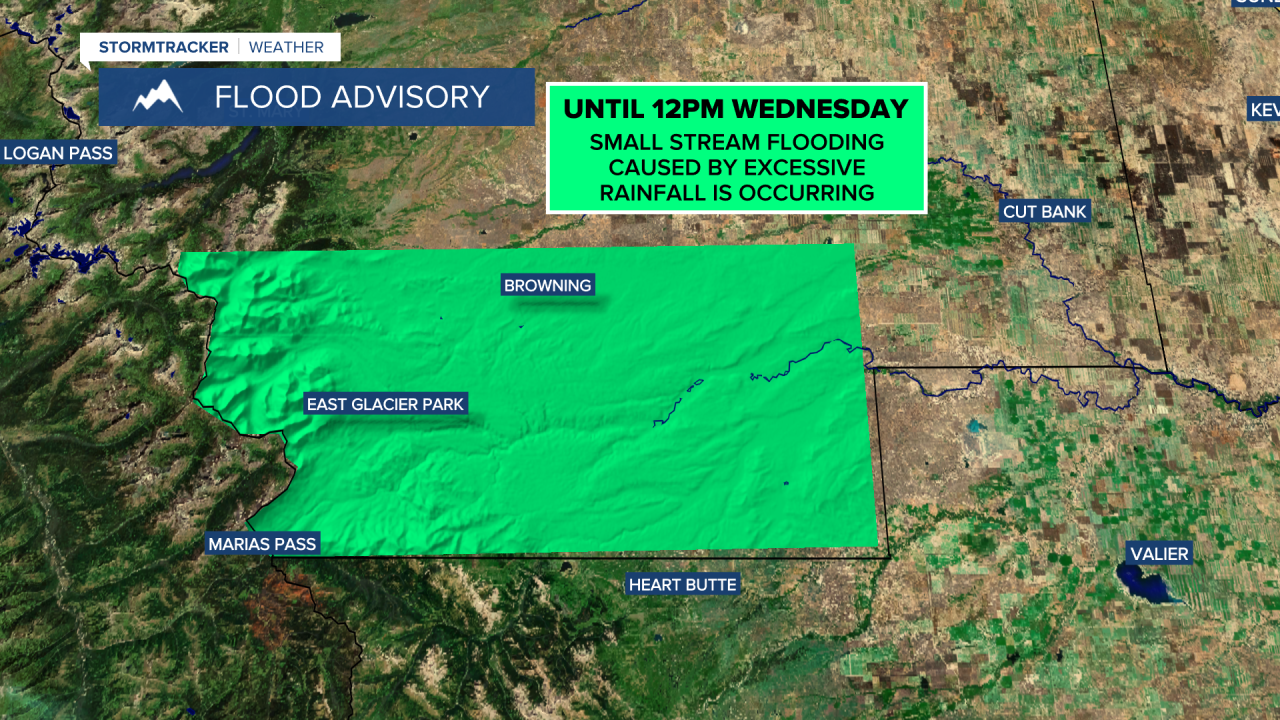
This rain has led to minor flooding in some areas and a FLOOD ADVISORY is in effect for southwestern Glacier County, including East Glacier and Browning, until 12pm Wednesday. Small-stream flooding is occurring in this area, specifically along Badger Creek and the Two Medicine River.
It was drier today than it has been over the past few days, but there were still showers around throughout the day. For the rest of this evening and tonight, there will be a few light rain showers around, but a lot of locations will be dry. It is also going to be mostly cloudy tonight in north-central Montana and partly cloudy around the Helena area. Due to all the recent moisture, there will be some areas of fog around tonight, especially after midnight. It is also going to be cool tonight as lows are going to be in the upper 30s and low to mid 40s.
Here is the detailed forecast:
Sunnier and drier weather is in the forecast for tomorrow as the storm system that has been impacting the state for the past several days finally departs our area. Tomorrow will be mostly sunny around Helena, while in north-central Montana, it will be partly cloudy, with the skies clearing out as the day goes on. There will also be some areas of fog around during the morning. A couple stray showers/storms are possible tomorrow, but most locations will be dry.
The temperatures will be warmer tomorrow than they have been over the past several days as highs are going to be in the mid to upper 60s and low to mid 70s. It is also going to be breezy in eastern portions of north-central Montana tomorrow as sustained wind speeds are going to be between 10 and 20 mph. Elsewhere, there is only going to be a little breeze around tomorrow.
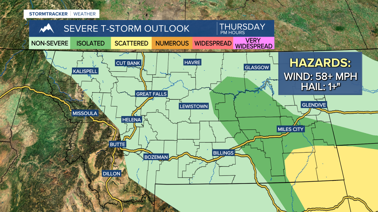
There will be some scattered showers and thunderstorms around late tomorrow night and on Thursday as a disturbance passes through the state. A few of the thunderstorms that develop on Thursday in eastern Montana may be severe with damaging winds and/or large hail. It will also be partly to mostly cloudy and mild on Thursday as highs are going to be in the mid to upper 60s and low to mid 70s. Gusty winds are expected on Thursday along the Rocky Mountain Front as gusts up to 50 mph are possible. East of the Rocky Mountain Front, it will be a bit breezy on Thursday as gusts over 30 mph are possible.
We will end the work week with beautiful weather! On Friday, it is going to be mainly sunny, mainly dry, and warm as highs are going to be in the 70s and low 80s. Perfect weather for the last day of school for Great Falls Public Schools students and staff.
This upcoming weekend will not be as wet or as cool as this past weekend was! On Saturday, the cloud cover will increase as the day goes on and there will be some scattered showers and thunderstorms around during the afternoon and evening, and a few of the thunderstorms may be strong to severe. There are then going to be a few more scattered showers and thunderstorms around on Sunday. It is also going to be partly to mostly cloudy on Sunday.
The temperatures will cool down some between Saturday and Sunday as highs are going to be in the 70s and low 80s on Saturday and the 60s and upper 50s on Sunday. There is also going to be a little breeze around this weekend as sustained wind speeds are going to be between 5 and 20 mph.
Monday will feature partly to mostly sunny skies and mostly dry conditions. There are then going to be some scattered showers and thunderstorms around on Tuesday as another disturbance impacts the state. It is also going to be mild on these two days as highs are going to be in the 70s and upper 60s.


