We're tracking a cold front moving through North Central Montana Tuesday afternoon.
Behind the front temperatures have fallen as low as the teens.
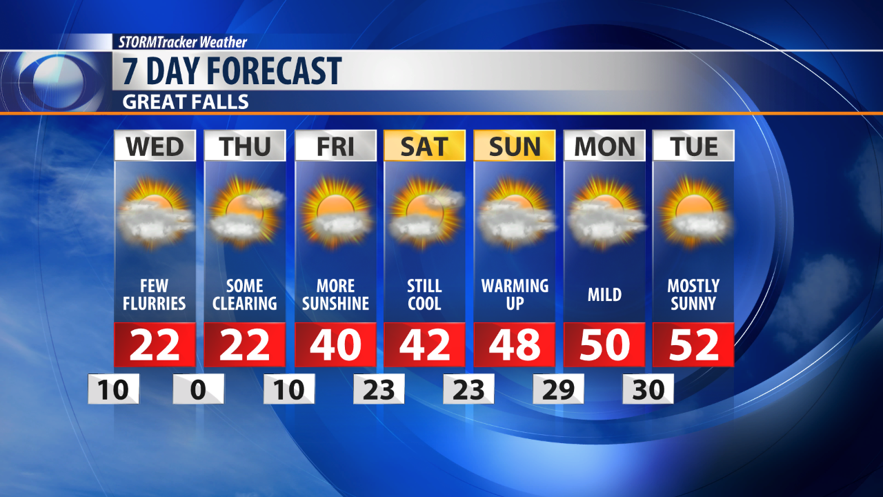
As the front continues to push south, temperatures will fall into the teens and even single digits by Wednesday morning.
Highs Wednesday afternoon will be in the teens and 20s, with a few warmer spots like Helena climbing as high as 30 degrees.
The cold is just half of the story, though.
We're also tracking snow across the Treasure state.
Snow showers have already formed Tuesday afternoon, and will continue through the night and into early Wednesday.
Confidence on snowfall totals is still on the lower side, but it looks like widespread light snow between 1 and 3 inches is expected.
We will likely see some areas of heavier snow, too, as a more intense band sets up overnight.
Places like Jordan and Havre may see as much as 5 inches, with even higher amounts possible in Lewistown.
Roads will likely be slippery Tuesday night and Wednesday morning thanks to accumulating snow as well as wet roadways freezing over.