


Good Morning! Today is Monday, October 5, 2026.
Nice, summer-like weather is expected this week as an upper-level ridge will be in complete control of our weather. This weekend, a pattern change to cooler and wetter weather is expected as an upper-level trough digs down into the Pacific Northwest.
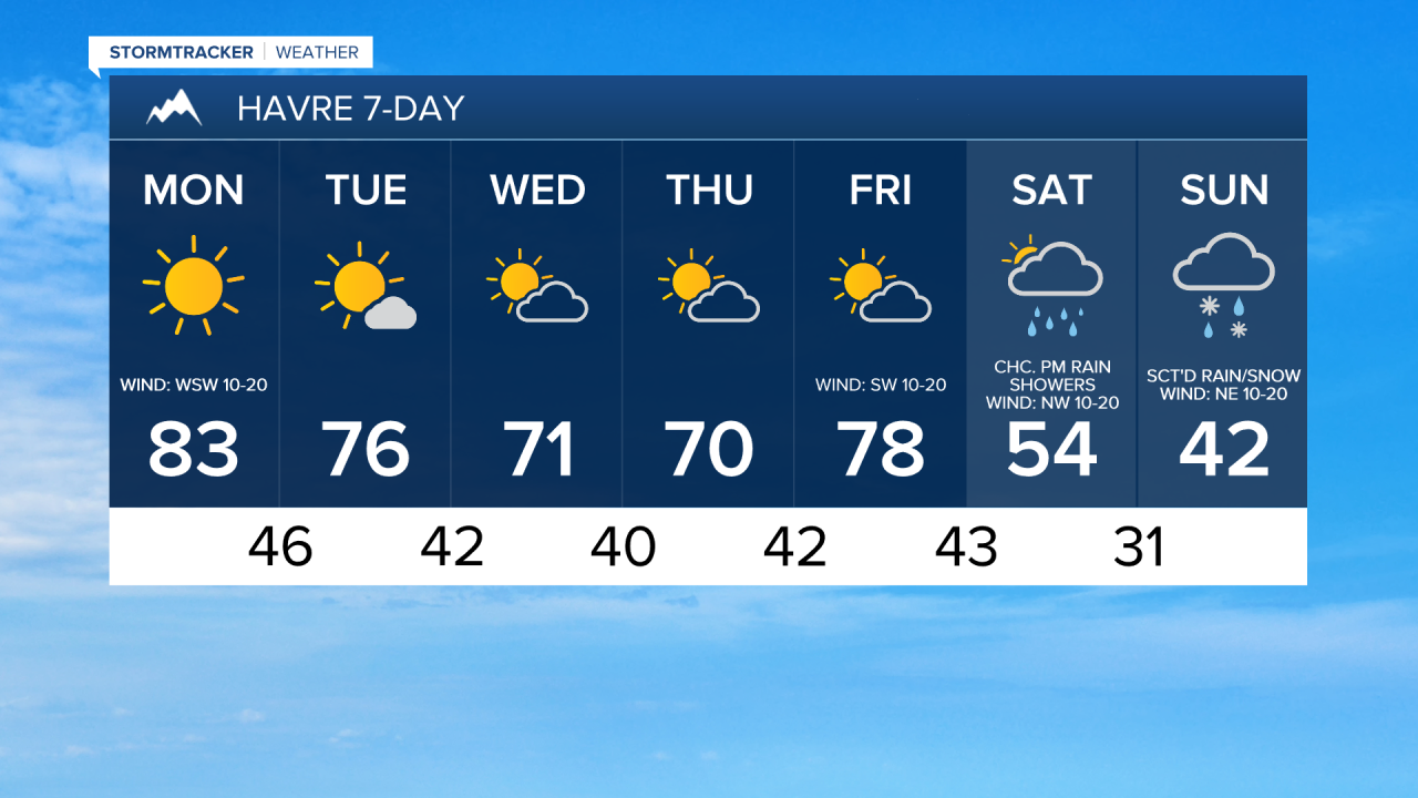
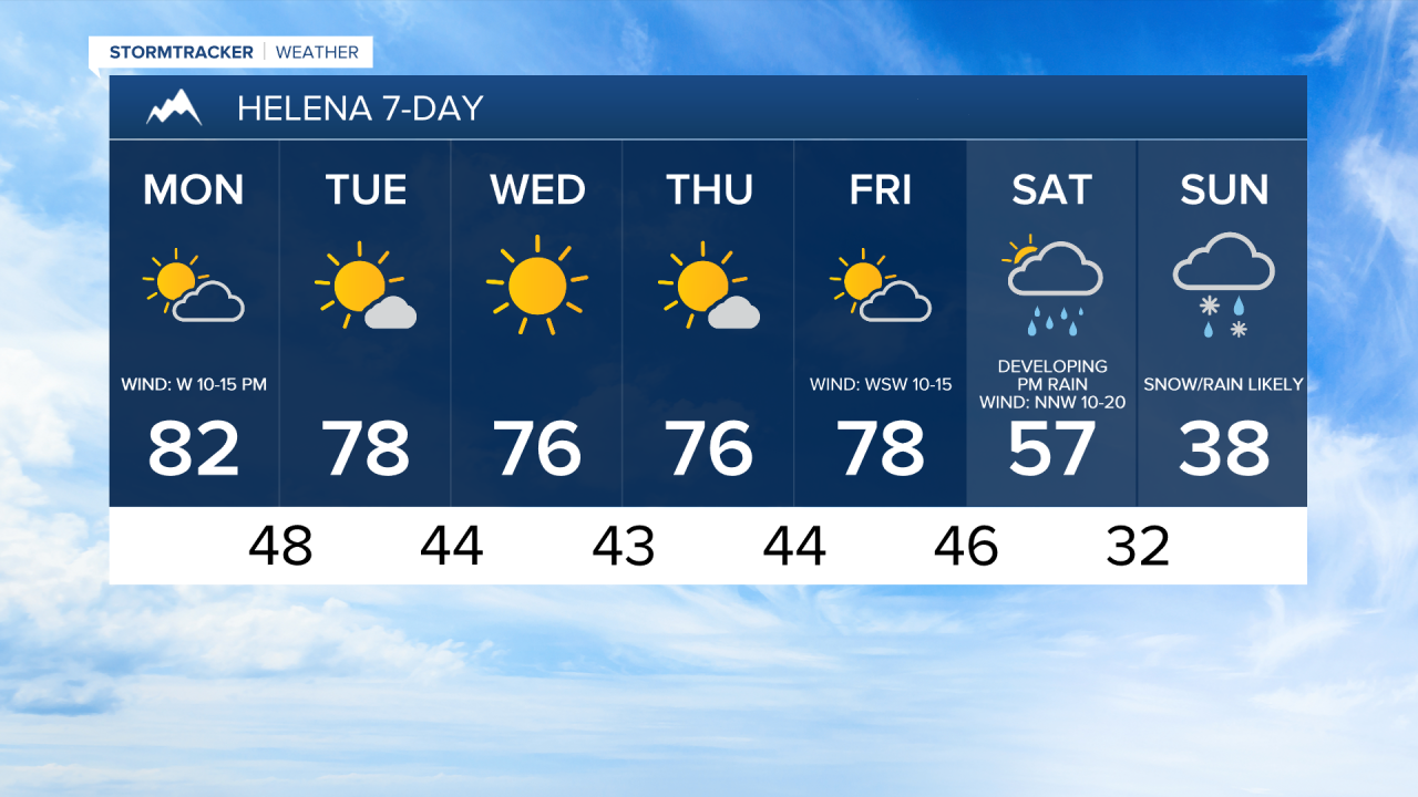
Today will likely be the warmest day until next spring for most locations. Highs are going to be in the upper 70s and low to mid 80s, and a few locations may set a new record high temperature, including Great Falls. It is also going to be breezy today with sustained winds of 10 to 20 mph. Along the Rocky Mountain Front, gusty winds are expected today with sustained winds of 10 to 25 mph. Lots of sunshine is expected in north-central Montana, while it will be partly to mostly sunny today around Helena.


Tomorrow will be mostly sunny, dry, and warm as highs are going to be in the mid to upper 70s and low 80s. Breezy conditions will persist along the Rocky Mountain Front with sustained winds of 10 to 20 mph, while elsewhere, it will be a little breezy tomorrow with sustained winds of 5 to 20 mph.
Wednesday will be mostly sunny and dry, while Thursday and Friday will be partly cloudy and dry. It will remain mild on these three days with highs in the upper 60s and low to mid 70s on Wednesday, and the 70s and low 80s on Thursday and Friday. Little to no wind is expected on Wednesday and Thursday, while gusty winds are expected on Friday with sustained winds of 10 to 25 mph.
The temperatures will cool down a lot this weekend, with Sunday likely being the coldest day that we have had since last spring. Highs on Saturday will be in the 50s and low 60s, while highs on Sunday will be in the mid to upper 30s and low to mid 40s. Precipitation will develop and become more widespread throughout the day on Saturday ahead of an approaching cold front. There are then going to be areas of precipitation around Saturday night and Sunday.
Precipitation will initially be in the form of rain in the lower elevations, but snow levels will drop down to the plains and valley floors Saturday night into Sunday, allowing for a rain/snow mix, or a transition to all snow in the lower elevations. This would be the first snowfall of the season.
A lot can and will change with this storm system in the coming days. There are still a lot of variables in play, including how much moisture is available, how cold temperatures get, and how quickly the cool-down occurs. All of these factors will determine how much precipitation falls as snow.
For now, just know that accumulating snow is possible in the lower elevations next weekend.


Have a marvelous Monday and a great week!
Chief Meteorologist Ryan Dennis
