

WEATHER DISCUSSION: Temperatures remained on the mild-side through Sunday, topping in the 40s and 50s for most locations across the state. Northeastern areas were a bit colder, seeing temperatures in the 30s.

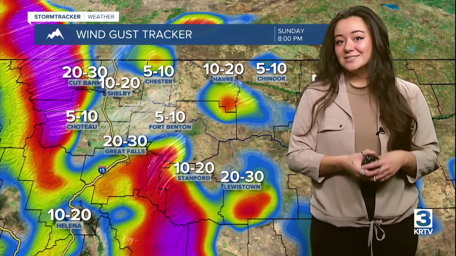
An upper-level trough continues to push into the region with a shortwave moving in this evening, bringing another round of light snow to the mountains of North Central, Central, and Southwestern Montana. Expect a mix of cloud cover tonight, partly cloudy to mostly cloudy skies with low temperatures in the 20s and 30s. Gusty winds are still hanging on overnight tonight, mainly along the Rocky Mountain Front and adjacent plains. Through early Monday morning, there is the possibility for rain to occur and then freeze in the Helena Valley.
On Monday, expect warm temperatures with windy conditions and light mountain snow. High temperatures are expected in the 30s, 40s, and 50s with a mix of cloud cover, mostly sunny to mostly cloudy skies. Gusty winds are expected from the Rocky Mountain Front through Lewistown line, increasing towards the evening and overnight hours.

Monday night into Tuesday morning, another shortwave will move over North Central Montana. This will bring strong winds to the Rocky Mountain Front and plains west of I- 15. Tuesday and Wednesday look similar, expect cooler temperatures and mountain snow, along with windy and gusty conditions, gusts up to 75 mph at this time.
On Thursday, temperatures begin to cool down with more chances of mountain snow. Windy conditions are likely along the Rocky Mountain Front and plains west of I-15 on Thursday. Warmer temperatures up with mostly dry weather are expected Friday through Saturday next weekend.


