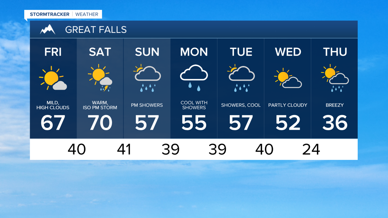
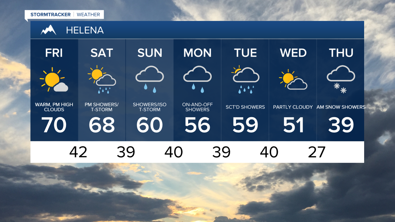
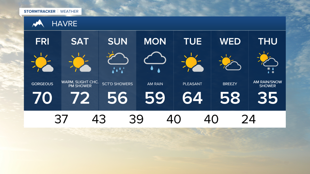
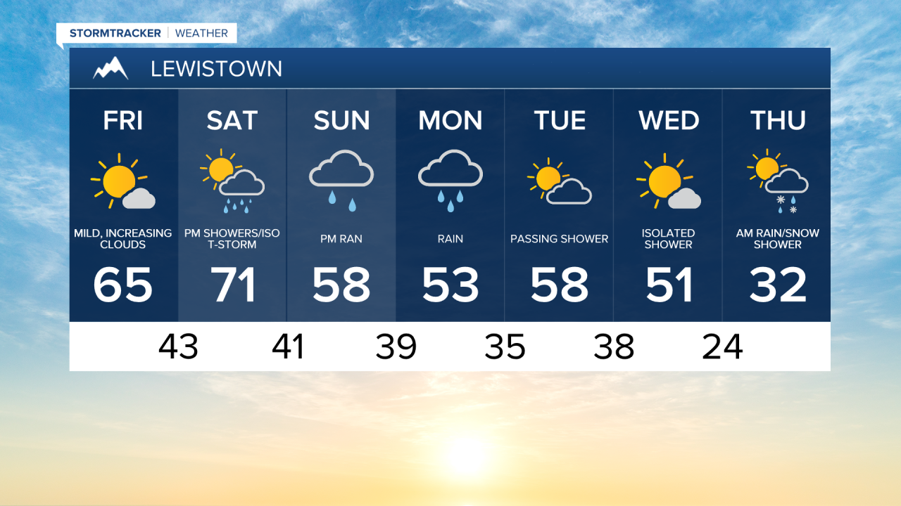
Friday will be gorgeous with mostly sunny skies and warm temperatures. Highs in the 60s and low 70s. A moist southwest flow ahead of an incoming trough of low pressure will bring a few more clouds this evening and a few isolated thunderstorms in southwest Montana.
Friday Morning Forecast:
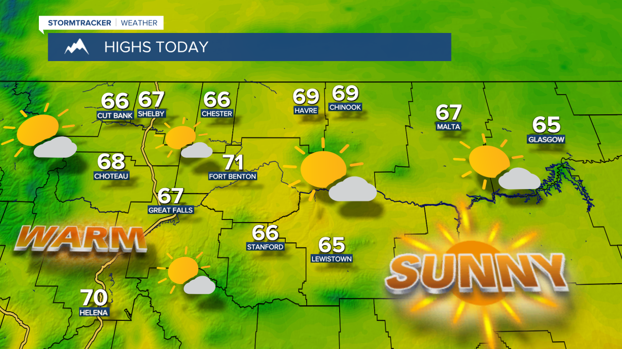
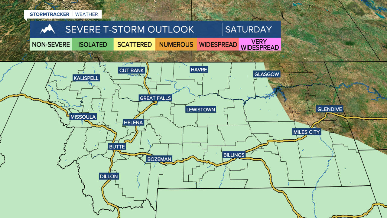
The weekend starts out beautiful as temperatures climb to the 60s and 70s under mostly sunny skies on Saturday. By the afternoon, widely scattered showers and thunderstorms will move across central Montana from southwest to northeast. The severe risk is low, but some downpours and gusty winds are possible.
The trough of low pressure moves over the state by Sunday, with scattered showers, isolated thunderstorms and some mountain snow. Highs will cool to the 40s and 50s.
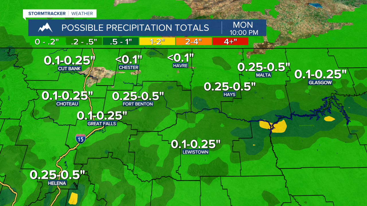
Scattered showers continue into Monday as snow levels will lower Sunday night into Monday to 5,000-6,000 feet, with limited impacts to mountain passes expected at this point.
Cooler, unsettled weather looks to continue next week as several systems track across the state.