

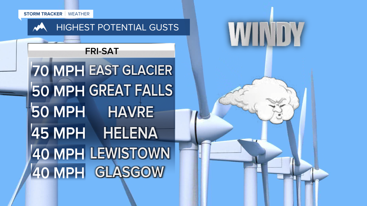


A HIGH WIND WATCH has been issued for the East Glacier area and along the Rocky Mountain Front for Friday evening through Saturday morning.
The workweek will end on a windy and warm note, and the weekend will still be windy but much cooler air will move back into Montana. Thursday was a gorgeous day with light wind and warm temperatures in the 70s and 80s. Friday will be even warmer with some places in the plains approaching 90. Many areas will have highs in the 80s. The wind will increase in the afternoon ahead of an approaching cold front. Gusts will top 40-50mph in some areas, possibly up to 70mph around the East Glacier area. A few isolated thunderstorms are possible in western Montana late in the day. A cold front will move through the state Friday night into Saturday. There will be some showers and high mountain snow across northwest Montana into Saturday morning. Saturday will be cooler and blustery with strong west wind. Highs will drop into the 50s and 60s. Saturday night will be chilly with lows down in the 30s. Sunday will be partly to mostly cloudy with highs in the 60s to around 70, and much lighter wind. A few isolated showers and thunderstorms are possible late Sunday into Monday, but no major early fall storms are likely.
Have a great day,
Curtis Grevenitz
Chief Meteorologist
