


The wind is picking up causing temperatures to spike into the 20s and 30s. A Winter Weather Advisory is in effect through noon for the Rocky Mountain Front for blowing and drifting snow. As temperatures warm into the 40s, the blowing snow threat will end. Partly to mostly cloudy skies with a stray rain or snow shower.
Blackfeet Law Enforcement has reported several vehicles in the ditch this morning on Highway 2 between Browning and East Glacier. Wind gusts of 50-60+ mph is blowing and drifting snow across the highway and causing near zero visibility. Use extreme caution! Roads should improve quickly as temperatures warm above freezing.
Here's US-2 at Two Medicine Bridge:

Today's Forecast:

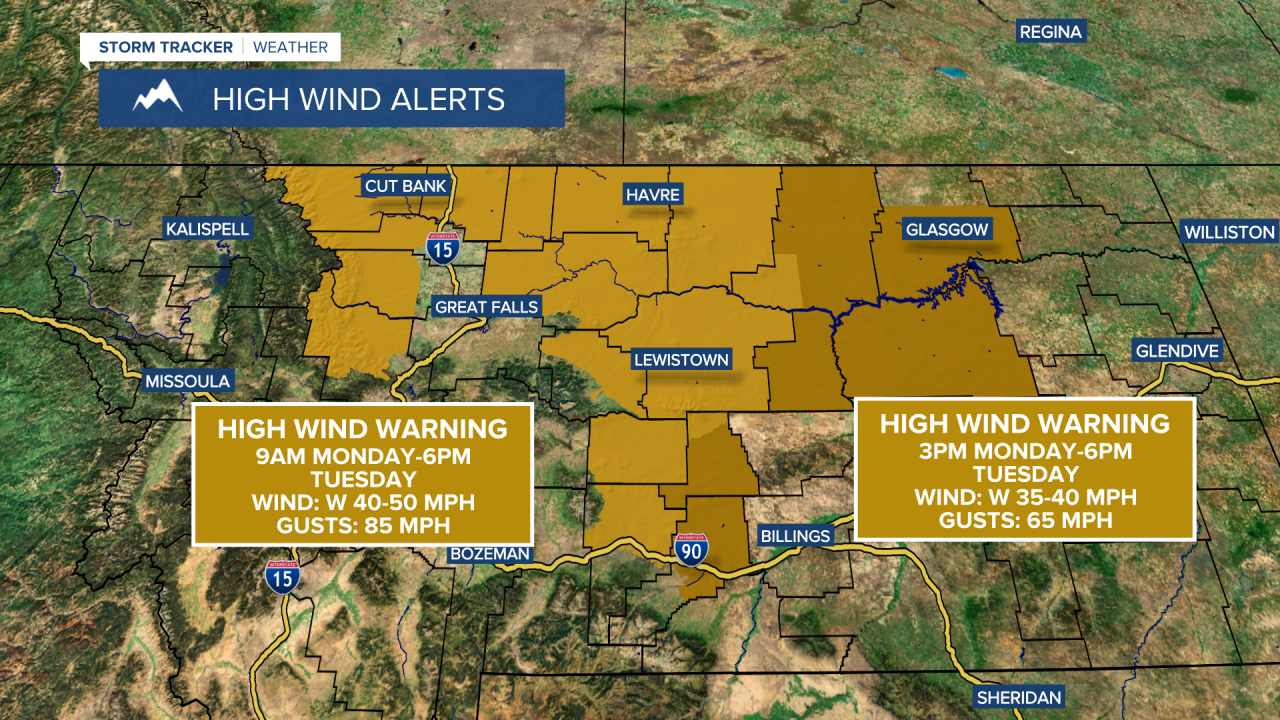
A High Wind Warning starts at 9 a.m. for the Rocky Mountain Front and 3 p.m. across the plains through 6 p.m. Tuesday, with gusts up to 65 mph across the plains and up to 85 mph along the Rocky Mountain Front.
Starting tomorrow, we are looking at a pattern change as temperatures warm up quickly. While flooding is not a major concern, the feet of snow in parts of central Montana is going to turn into a slushy, muddy mess. High temperatures will reach the 50s and 60s on Tuesday for St. Patrick's Day.
Temperatures warm into the 60s and 70s from Wednesday through Friday challenging record high temperatures. Other than some light precipitation near the Continental Divide, it will stay mostly dry until this weekend. A cold front drops south across the region on Saturday, with some rain and mountain snow and cooler temperatures.


