


GREAT FALLS — A Type II Incident Management Team arrived at the Poverty Flats Fire (Inciweb) in Big Horn County on Thursday morning to coordinate firefighting efforts.
The fire has burned an estimated 75,000 acres as of Wednesday afternoon. There have been no evacuation orders at this point, and no reported injuries or damaged structures. The cause of the fire has not yet been determined.
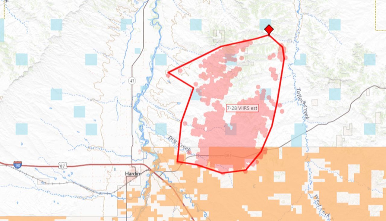
The fire started east of the Bighorn River on Tuesday, July 27, at about 1:30 p.m., about ten miles north of Hardin. Big Horn County Fire responded. Access was via ten miles of dirt road from Highway 384 east of Hardin. A cold front Tuesday evening brought brisk winds from the north. The fire then ran south, crossing Highway 384 about 1:30 am Wednesday morning and entering the Crow Indian Reservation about then, and reaching the Little Big Horn River 6 miles southeast of Hardin by Wednesday afternoon, about 16 miles from its origin. It spotted across the river Wednesday night but forces caught those small fires.
On Thursday morning the fire had quieted down in the area around Dunmore, according to the Bureau of Indian Affairs, but they said the fire is expected to gain intensity on Thursday.
"Please avoid the River Road and Dunmore! Looky-loos (spectators) were obstacles to firefighters Wednesday - The river road is too narrow to be craning necks looking around! Even people on the freeway were bad drivers. Stay away so firefighters can do their work," BIA fire officials said in a Facebook post on Thursday morning.
-
Wildfire Watch: Share Your Photos and Videos
Did you take pictures or videos you want to share? Click here to find out how. -
Wildfire Watch
Latest information on wildfires in Montana -
Wildfire Terminology 101
This glossary is intended to help people better understand the terminology used by fire crews and in news reports.
