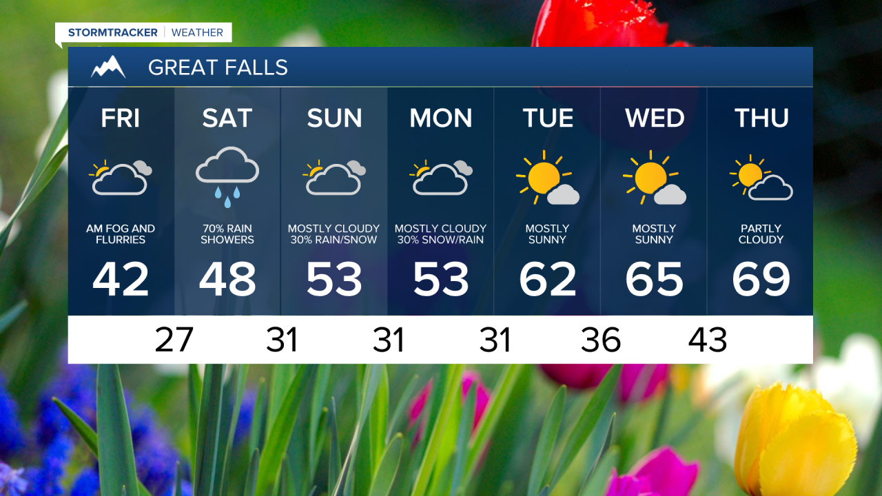
As the snow tapers off this morning across the region, temperatures will remain well below seasonal averages today and into Saturday. The area will see a brief break today, but by Saturday morning another system will be making its way through the state. Right now, it appears that most of the precipitation that does fall for the lower elevations will be in the form of rain, but with our low temperatures falling below freezing, a rain/snow mix (or just snow) can't be ruled out. Overall, the area could pick up quite a bit of beneficial moisture through Monday. This pattern will stick around through Monday before warmer, drier air enters the region on Tuesday.
Meanwhile, we're closely watching the drought monitor for any changes, especially in Northeastern and Eastern Montana (although the drought is persisting in several other parts of the state as well). This week there has been an expansion of the moderate drought and a slight expansion of the severe drought. These systems moving through the area over the weekend look to be the best chance for precipitation for areas under severe and extreme drought, but it will take a lot of measurable water to make a dent in the drought.

Monday looks to be the transition day between our two systems, with highs back to average and more sunshine. The remainder of the extended forecast looks dry with temperatures back to the mid 60s for our highs. Some parts of the state may see highs in the low 70s but forecasting that far out isn't always the most accurate, so we'll continue to monitor the numbers over the next several days.