We're going from 70s yesterday to snow across the area today as a cold front from Canada passes through our area. Snow is falling along the Rocky Mountain Front and precipitation will become more widespread as we go through the afternoon. It'll reach the Great Falls area by lunchtime and the Lewistown and Helena areas by late afternoon.

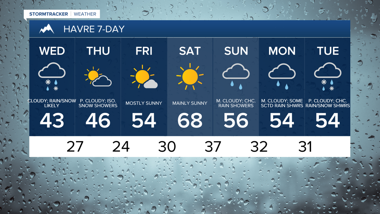
Most areas will switch over to snow this afternoon and evening as colder air works its way into our area. There will be areas of snow around tomorrow night, with rain mixed in in some area, but the storm starts to pull away by Thursday morning. Thursday is going to be brisk with daytime highs in the 30s and low 40s with a chilly breeze out of the north.

In the Rockies, 8-20” of snow is expected through Thursday night, and in the mountains in central Montana, 4-12” of snow is expected through Thursday night. In the lower elevations, snow amounts will vary greatly based on your location. East of I-15 in north-central Montana, < 1.5” of snow is expected through Thursday night, with many locations receiving little to no snow accumulation. In the lower plains around and west of I-15 in north-central Montana as well as in southern portions of north-central Montana and in central Montana, including around Helena, Lewistown, and Stanford, a coating-4” of snow is expected through Thursday night. For the Rocky Mountain Front and the high plains next to the Rocky Mountain Front, 3-10” of snow is expected through Thursday night, and this includes locations like Browning and Heart Butte.

Prepare for slippery travel, especially over mountain passes. 6-12" of snow is likely for both Marias and Rogers Pass through tonight. The wind could cause there to be areas of low visibility when combined with falling snow.

The weather will improve for Friday and Saturday. We will have sunshine and dry conditions on both days. Temperatures warm from the 40s and 50s on Friday to the 60s on Saturday.
On Easter Sunday, we will have increasing clouds as the next system works into our area. Some rain and snow showers are also possible in the evening, especially for areas along the Rocky Mountain Front and Continental Divide. Temperature-wise it will be decent with highs in the 50s and low 60s.
Cooler unsettled weather is going to kick off the next work week as the system continue to impact the area. Temperatures will be close to or below average in the 40s and 50s.