Well, we had a record warm Christmas Day in Lewistown, hitting 57°. Great Falls saw its second warmest Christmas on record, with a high of 55°. Meanwhile, it was cold and foggy on the Hi-Line, with temperatures only in the 20s.
Today's Forecast:
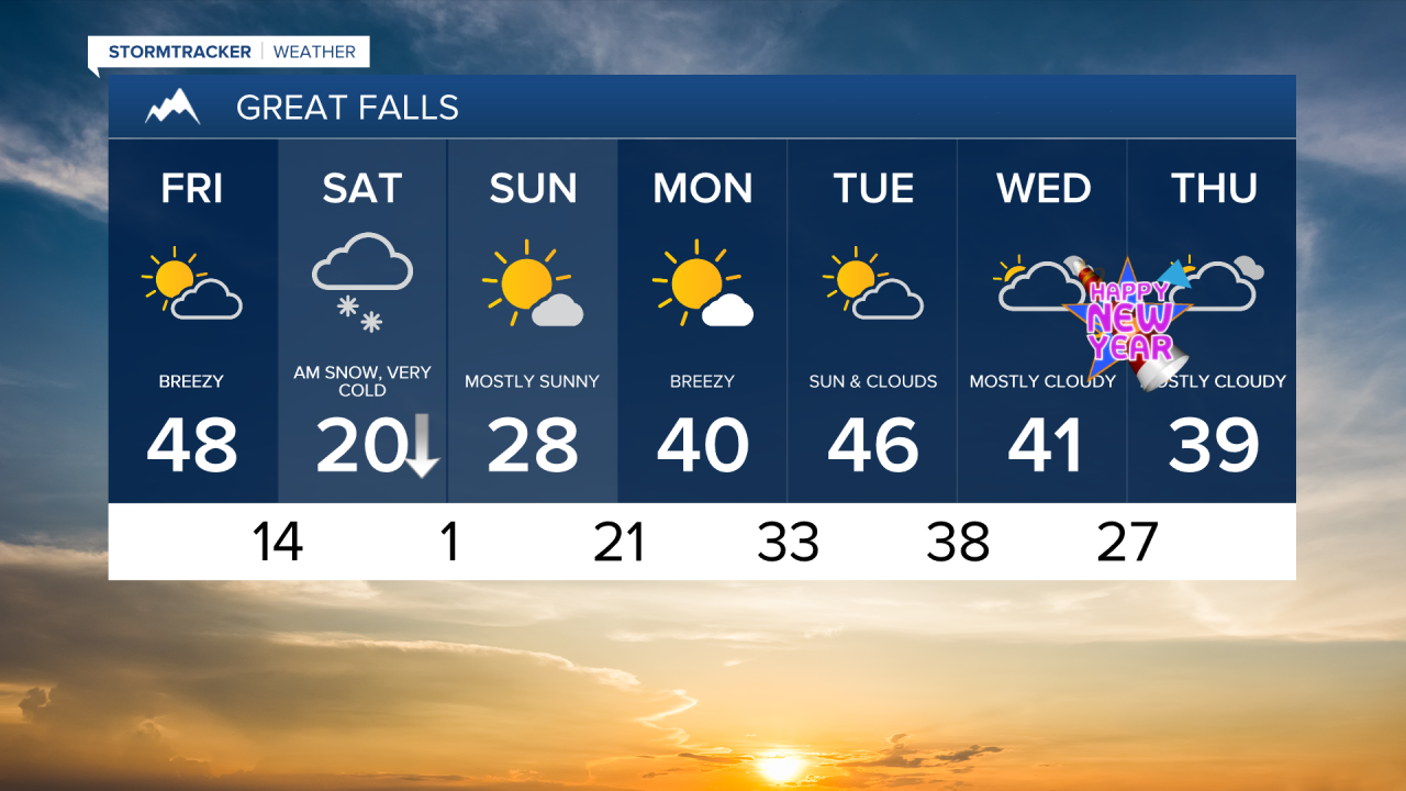
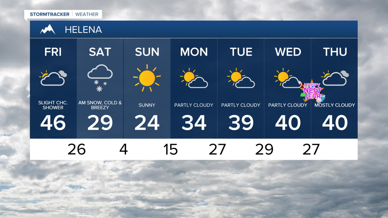
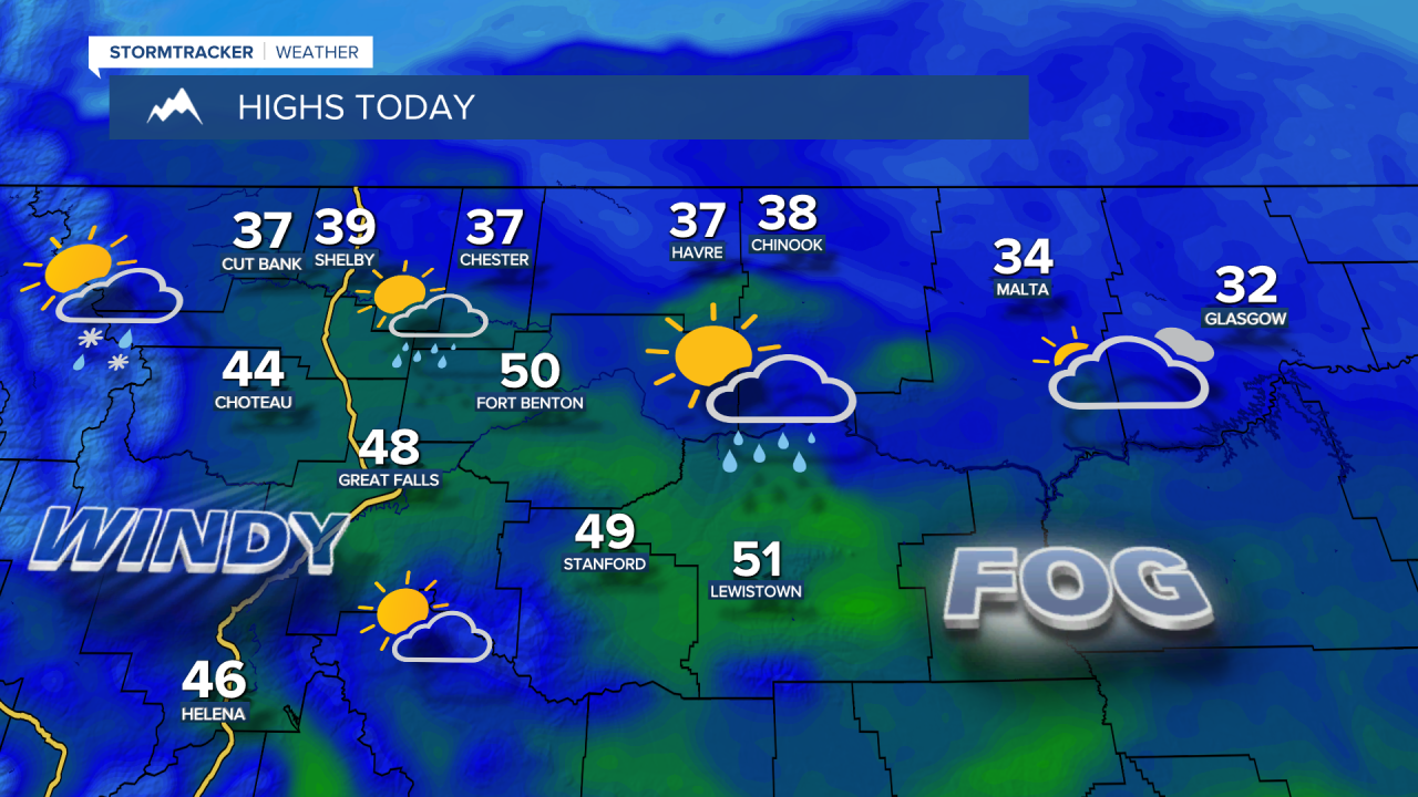
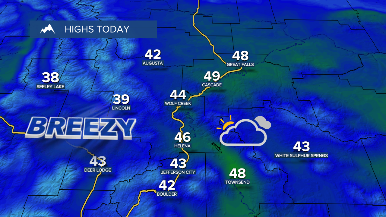
Another pleasant but breezy day ahead on Friday, with high temperatures in the 30s on the Hi-Line and 40s and lower 50s south of the Hi-Line. Widely scattered rain, freezing rain and snow showers around throughout the day.
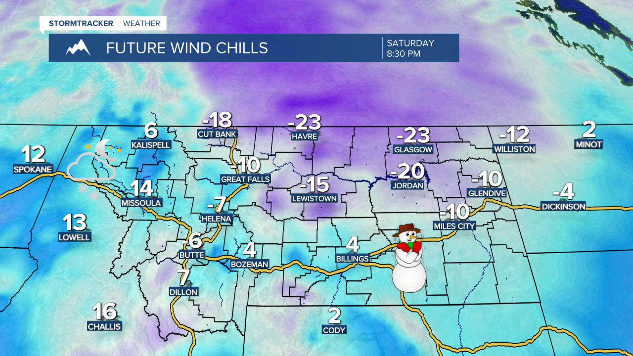
Next up is a blast of arctic air and some snow. Arctic air pours into the state behind a cold front late Friday night into Saturday morning. Highs will drop from the 10s and 20s in the morning to the -0s and 0s by the evening. Gusty winds, sustained at 10-25 mph and gusting over 40 mph, will lead to brutal wind chills as low as -40° on the Hi-Line and -25° south of the Hi-Line.
Snow showers will be around late Friday night into Saturday, and a burst of snow is possible along the cold front. Most areas will receive a dusting to an inch or two of snowfall. Road conditions will deteriorate quickly once the front moves through, so please use caution if you're traveling.

The frigid air stays in place on Sunday. High temperatures will be in the -0s in northeast Montana, 0s and 10s on the Hi-Line and 20s in north central Montana.
The last few days of 2025 will bring mostly cloudy skies, mostly dry conditions, and mild temperatures. It will be windier across the plains, though. Highs will be in the 20s and 30s for the Hi-Line, and in the 30s and 40s south of the Hi-Line.