WATCH THE FULL FORECAST:
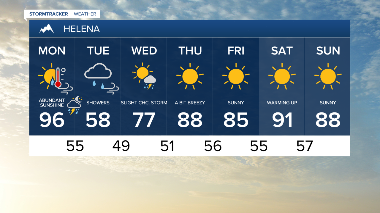
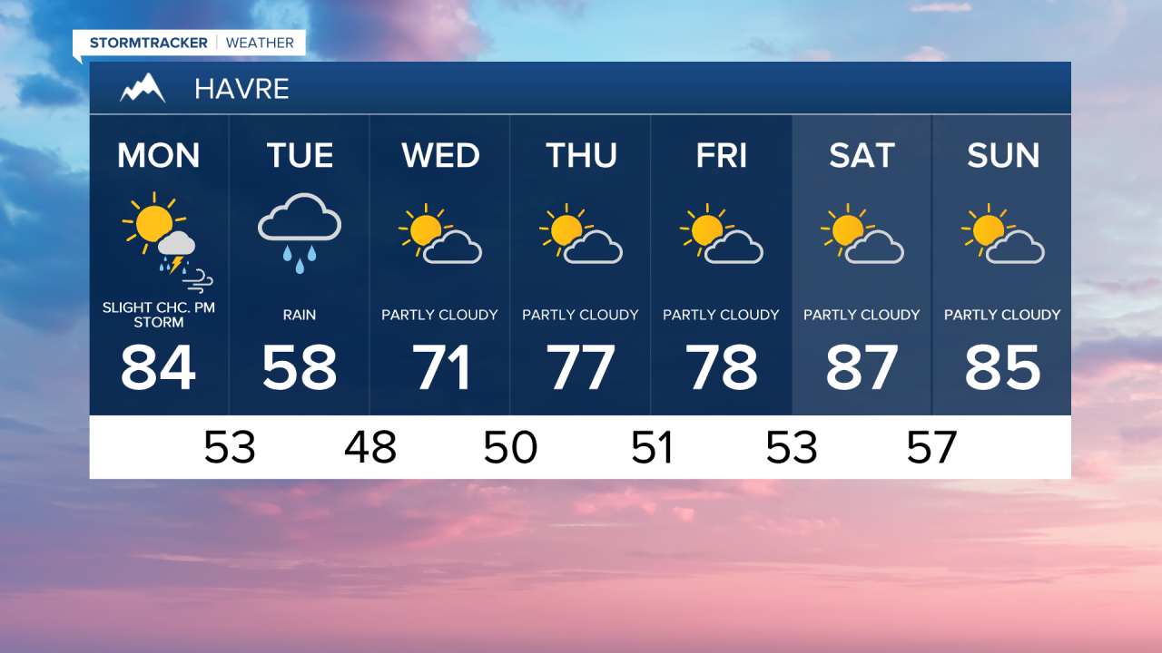
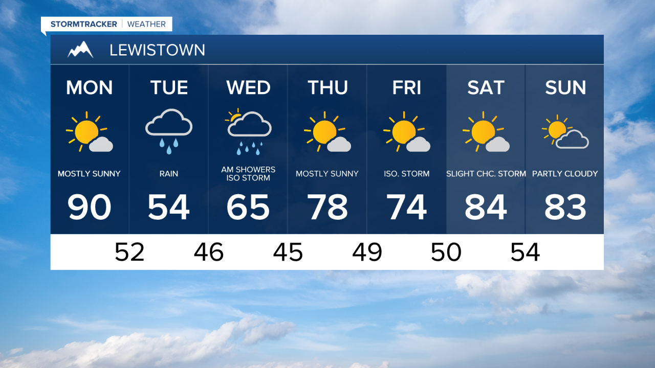
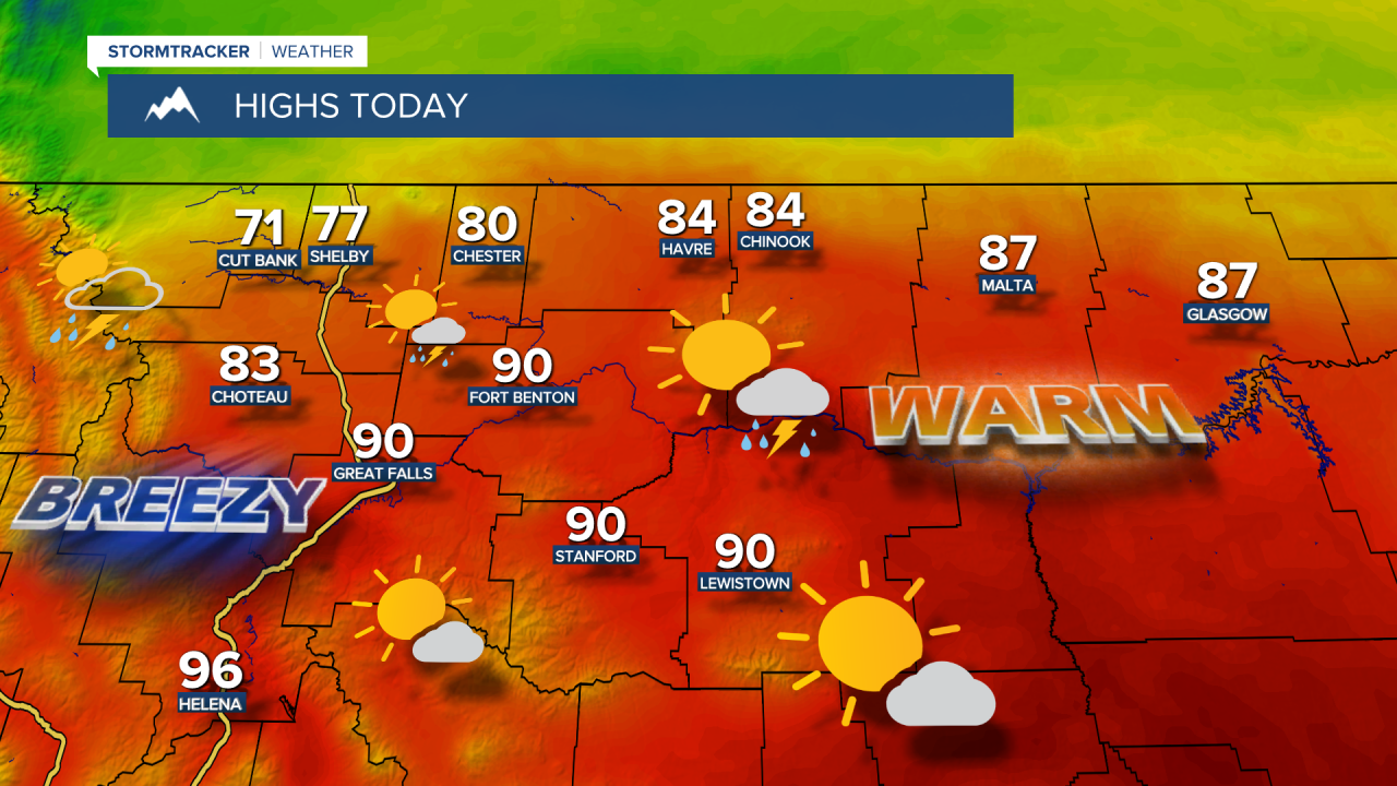
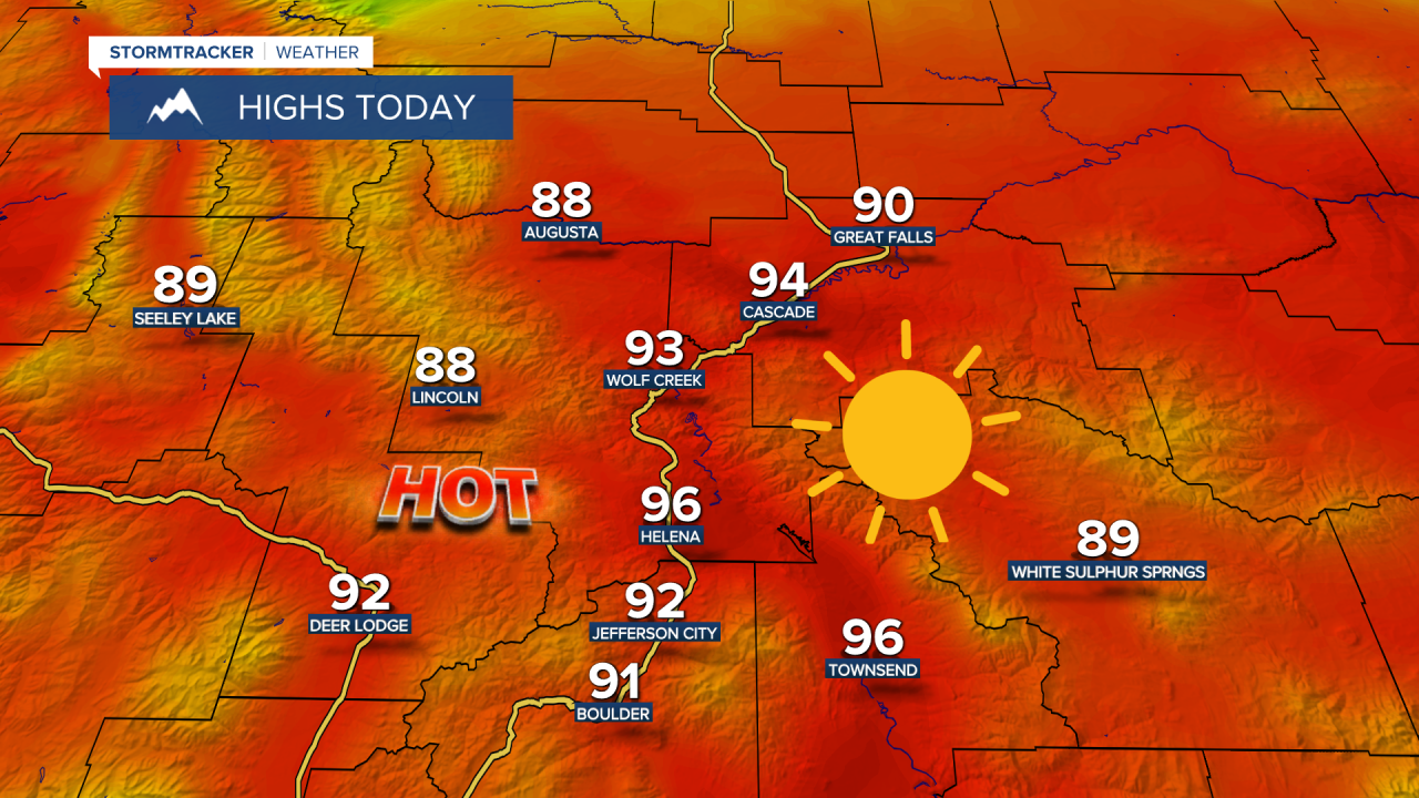
This week starts out warm as temperatures are forecast to reach the low to mid 90s in central Montana and 70s and 80s for the Hi-Line. A strong cold front pushes south out of Canada later this afternoon and evening. Gusty northerly winds will develop behind the front, with gusts potentially reaching 30-40 mph in the mountains and across the plains.

A few scattered showers and thunderstorms develop out ahead of the front. Similar to last night, these storms will move south across the Canadian border into the Hi-Line during the late evening hours. The main impact from the storms will be strong wind gusts over 65 mph, though there could be isolated hail as well.
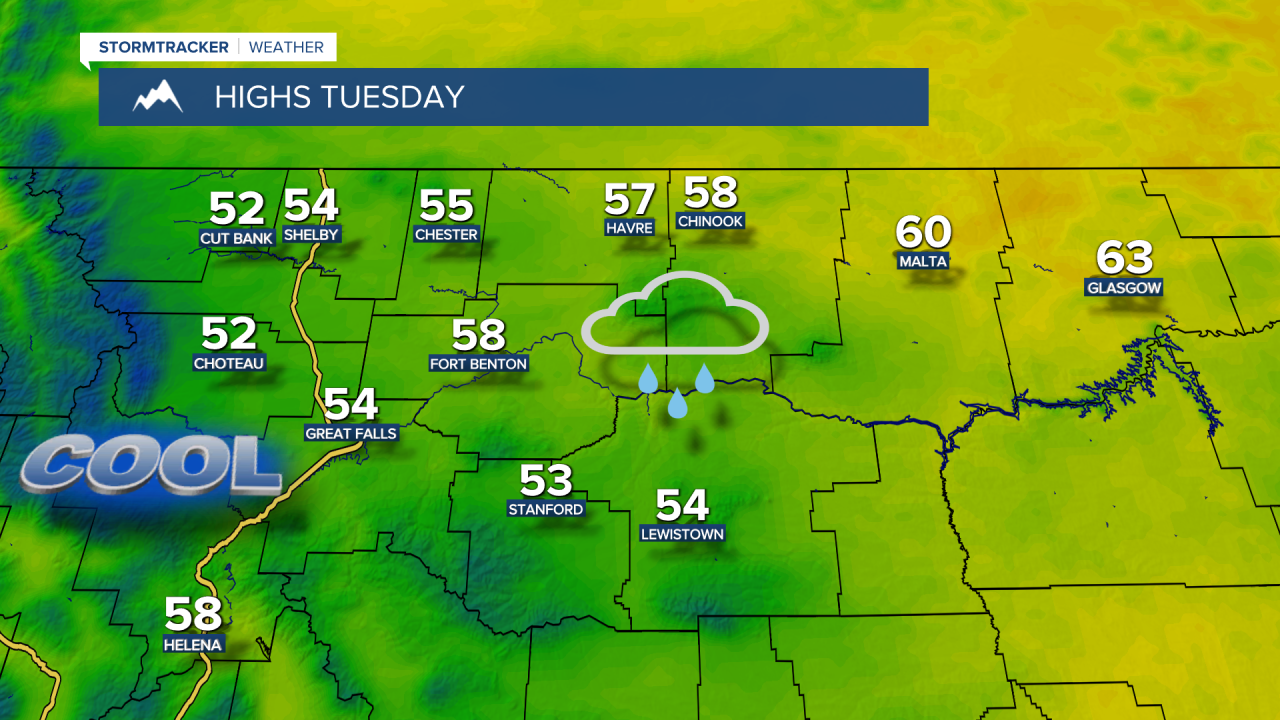
There may be a few thunderstorms through midnight, but a transition to widespread showers and embedded thunderstorms by Tuesday morning, continuing through Wednesday morning. The showers could be heavy at times.
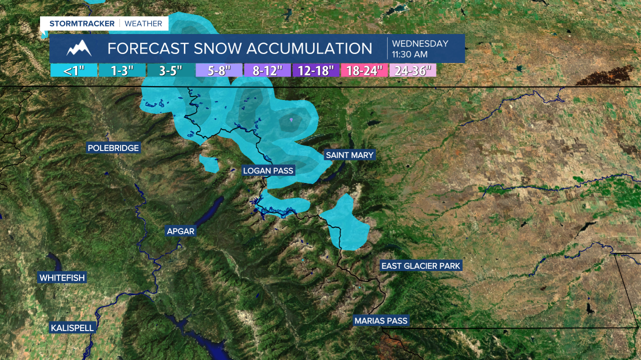
Unseasonably cool temperatures in the 50s and 60s are expected on Tuesday and Wednesday. The highest peaks of Glacier National Park might even see a skiff of wet snow, mainly above 8,000 feet.
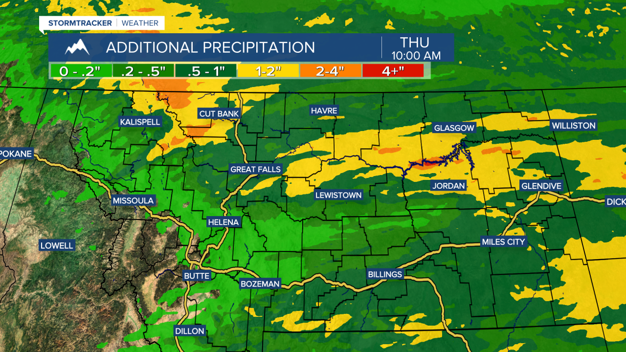
Weather models project beneficial rain across central and eastern Montana. The heaviest precipitation is likely over the Rocky Mountain Front and portions of Judith Basin, Chouteau, and Fergus counties, where over an inch of rain is possible.
Most areas can expect totals between 0.25" and 0.75" by Wednesday morning, though the heaviest totals will depend on where the heavier showers and thunderstorms set up.
A cooler day is expected on Wednesday, with high temperatures in the upper 60s and low 70s. The storm system will exit the region by Wednesday evening, but lingering showers or thunderstorms are still possible.
Temperatures stay below normal, but still very pleasant, in the upper 70s and lower 80s on Thursday and Friday. A weak system is going to bring a slight risk for showers and thunderstorms. Then, temperatures heat up to typical July levels for the weekend.