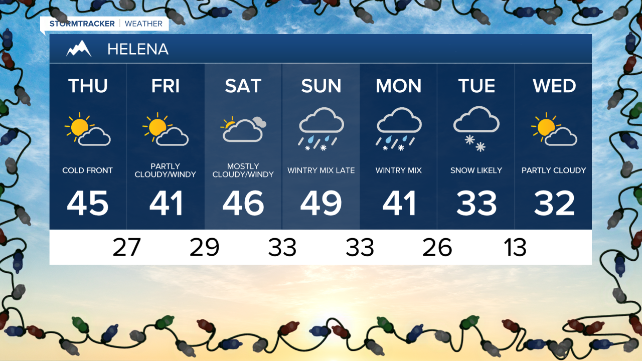
A cold front will pass through the state today allowing for more gusty wind and cooler temperatures overnight.
Temperatures remain well above average with high in the mid 40s.
A few spotty flurries are likely with the passage of this front, primarily in the mountains.
The wind will also remain brisk with gusts around 30 to 40 mph.
Colder temperatures are expected overnight following the passage of this front.
Friday will remain windy and a bit cooler with highs in the low 40s.
Strong high pressure will allow for the very mild temperatures to continue this weekend.
Highs in the upper 40s and low 50s are likely on Saturday and Sunday.
Forecast models are suggesting that the above average temperatures will come to an end early next week.
Colder air from Canada is expected to drop into the state and meet up with Pacific Moisture on Monday.
This will open the door for much colder temperatures and some snow Monday night into Tuesday.
Forecast models are still a bit split on how much snow we'll receive out of this next system.
However as of now it appears over three inches of snow is likely through Tuesday.