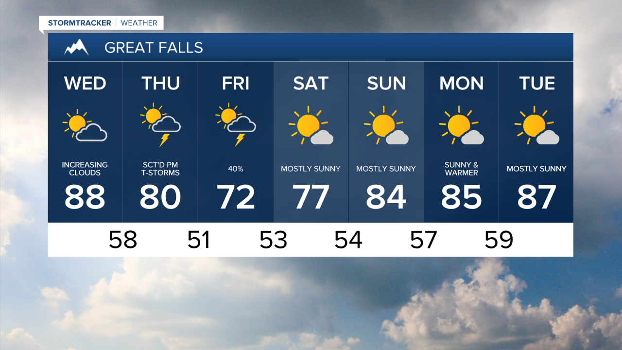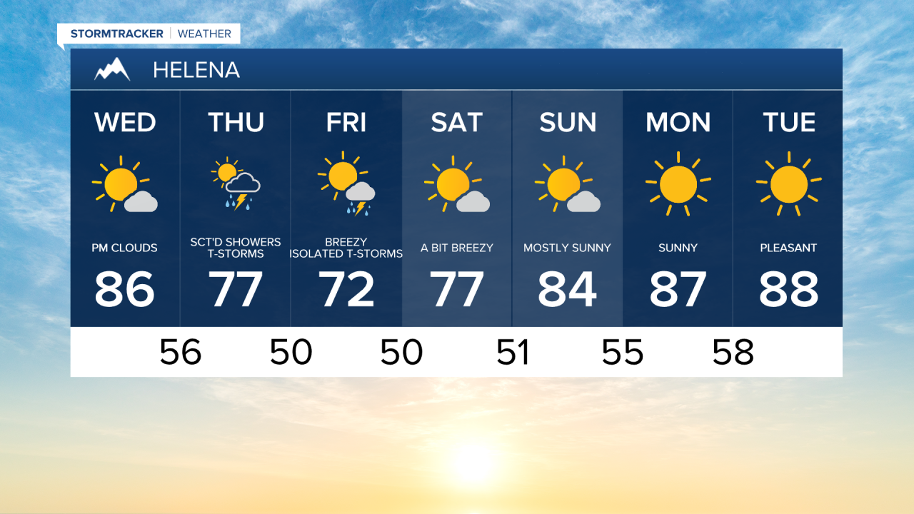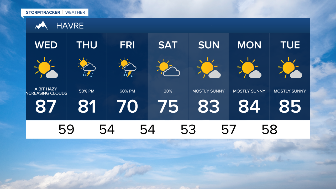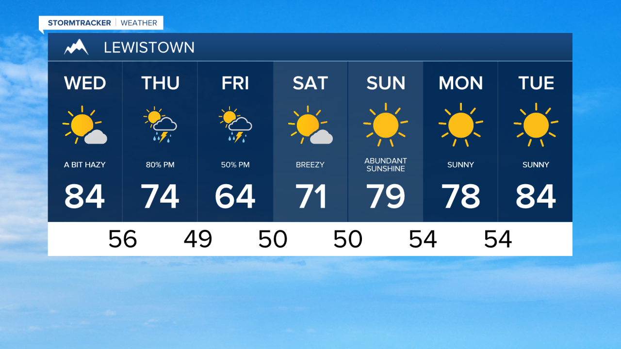


A pleasant day ahead in between storm systems as temperatures warm into the mid to upper 80s. High clouds will move in during the afternoon ahead of an approaching cold front and larger weather system. Later tonight a few showers and thunderstorms will develop with gusty winds and lightning.

Gustier winds are likely into Thursday, with wind speeds between 10 and 20 mph across central Montana and 15 to 25 mph for the Rocky Mountain Front, with wind gusts over 30 mph possible. A cold front slowly slides across the state bringing our next round of showers and thunderstorms, a few of which could turn severe with gusty winds, hail, and heavy downpours.

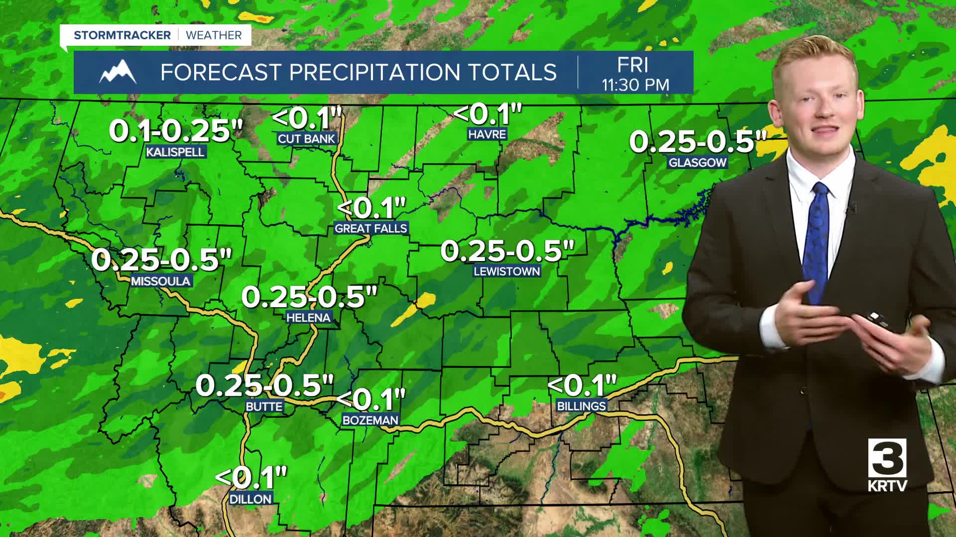
Some more scattered showers and thunderstorms are possible on Friday, especially for north central Montana. Much cooler temperatures with highs in the 60s and low 70s. It'll get gusty for everyone on Friday with wind speeds between 10 and 25 mph gusting as high as 40 mph.
There may be a few lingering showers and thunderstorms on Saturday as the low pressure system slowly makes its way out of the region. Otherwise, it's going to be a gorgeous Saturday with sunshine and comfortable temperatures in the 70s. It looks like we finally get a drier stretch of weather this weekend and for most of next week. Temperatures will gradually warm into the 80s and low 90s by early next week.