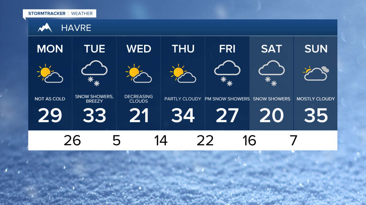
After the first major snowstorm of the winter, temperatures were frigid throughout the weekend, struggling to rise above 0° for the Hi-Line. A warm front lifted through overnight, and temperatures are considerably warmer than yesterday to start our Monday, with readings in the 10s and 20s.


Today's forecast:
Increasing clouds and breezy conditions ahead for today, with wind speeds ranging from 10 to 20 mph across the plains and 20 to 30 mph along the Rocky Mountain Front and adjacent plains. Gusts may occasionally exceed 40 mph. Watch out for blowing snow, especially in areas west of I-15. Daytime highs will reach the 10s in northeast Montana, the 20s along the Hi-Line, and low to mid-30s in central Montana.

Another round of accumulating snow develops tonight through Tuesday in central Montana. Winter Weather Advisories have been issued for Cascade, Judith Basin and Fergus counties along with portions of Lewis & Clark and Meagher counties for late tonight through Wednesday morning. The Rocky Mountain Front is also under a Winter Weather Advisory starting at 5 p.m. this evening through 11 p.m. Tuesday. Generally, 1-4 inches of snow in the lower elevations and 5-10 inches of snow over the passes and the higher terrain.
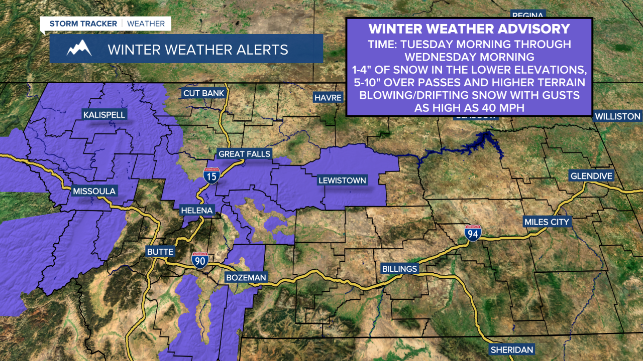
Snow will be falling intermittently starting tonight and continuing through early Wednesday morning. The Tuesday evening and Wednesday morning commute will have the greatest impact with slippery roads and gusty winds causing blowing snow and low visibility.


Behind this system, quieter but breezy weather is expected on Wednesday and Thursday. Wednesday is going to be a bit chilly with highs in the 10s for northeast Montana, 20s for the Hi-Line and low to mid 30s in central Montana, then it warms up on Thursday as the winds pick up as highs get into the 30s for everyone.
A system moves in Friday into Saturday bringing another round of snowfall to the area.