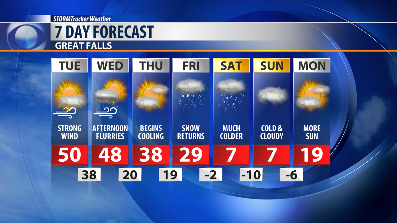
Very strong westerly wind will once again take over Central Montana on Tuesday.
In anticipation of the strong wind the National Weather Service has issued a High Wind Warning for most of North Central Montana.
This warning will take us through Tuesday and the first portion of Wednesday.
Sustained wind around 30 to 40 mph is likely for a good chunk of our area.
Gusts in upwards of 60 mph are likely with much stronger wind along the immediate vicinity of the Rocky Mountain Front.
The wind will help to drive daytime high temperatures to the low 50s for a good portion of the state on Tuesday.
A cold front is on track to drop through Montana tomorrow afternoon.
The wind will likely increase just ahead of this frontal passage and then diminish after its passing.
A brief round of snow is also likely as this front settles in.
Some snow accumulation is expected with this front, likely under an inch for most.
An even more aggressive weather system will move in on Friday.
This next weather maker will significantly drop temperatures and bring another round of snow through the weekend.