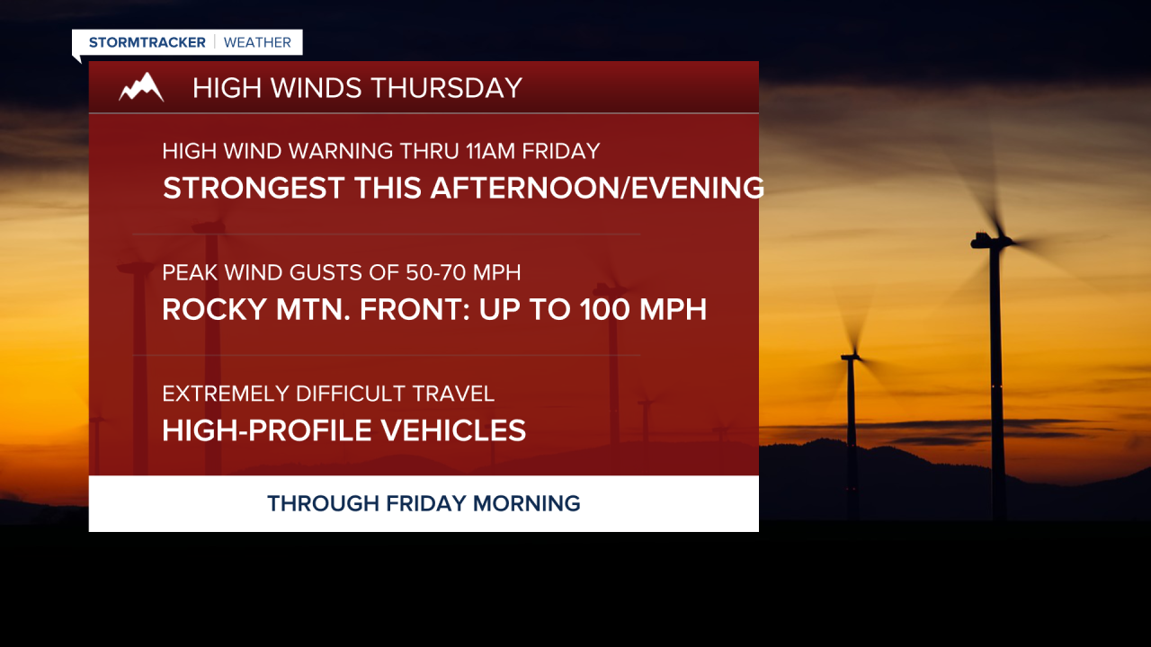
Another round of powerful winds is sweeping across Montana this morning. Wind gusts are already clocking in at over 60 mph in Great Falls. The worst of the wind is expected during the afternoon and evening, with peak gusts reaching 50-70 mph, and up to 100 mph along the Rocky Mountain Front. Travel will be very difficult for high-profile vehicles and those towing trailers. Today will be mostly sunny to partly cloudy, with highs in the 40s and lower 50s.
Today's Forecast:
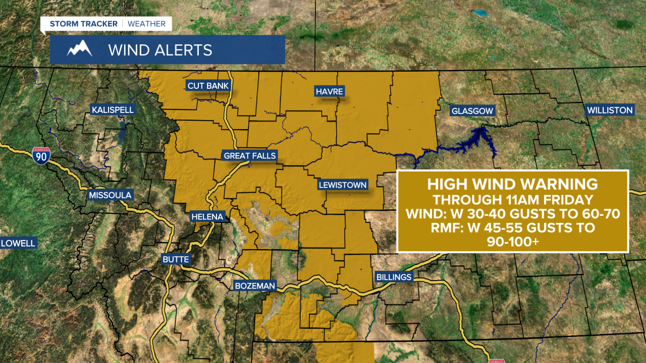


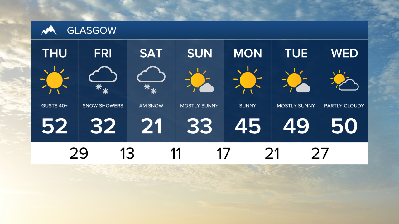
A cold front moves down from Canada into the Hi-Line on Friday, but will not quite reach Great Falls. Winds will ease behind the front but remain gusty ahead of it on Friday. Temperatures will cool to the 30s on the Hi-Line, while remaining in the 40s and 50s in central Montana and near Helena.
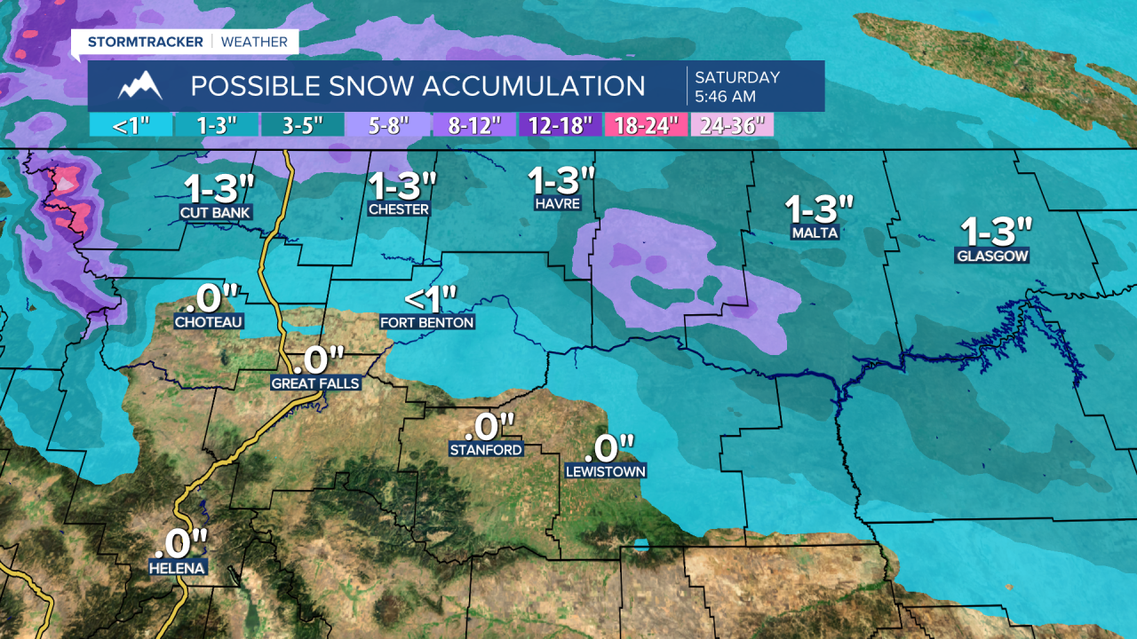
The cold front will bring some snow to the Hi-Line and eastern Montana Friday night into Saturday, with scattered snow showers further south across central Montana. The Hi-Line can expect 1-4 inches of snowfall, with less than an inch elsewhere. Saturday will see a brief cooldown, with highs in the 20s on the Hi-Line, 30s in central Montana, and around 50 in Helena.
Sunday will be cool but pleasant, with mostly sunny skies and high temperatures in the 30s and 40s, marking the start of Meteorological Spring (March 1st). A warmer, drier weather pattern is expected to develop for the first half of next week, with highs in the 50s and lower 60s and plenty of sunshine.