

Discussion: A cold front quickly moves across the state Tuesday morning and afternoon. Widespread rain showers are likely for western Montana with widely scattered showers for central and eastern Montana. The front will also cause an uptick in wind speeds Tuesday afternoon and evening for central Montana and Tuesday night through Wednesday morning for eastern Montana. Gusts up to 75 MPH are possible for the Rocky Mountain Front and western portions of the Hi-Line, up to 55 MPH for the rest of central and eastern Montana.
There is a brief reprieve from the active weather on Wednesday with abundant sunshine and calmer winds expected. However, a brief snow shower is possible for the Hi-Line with a low pressure center to the north of the state in Saskatchewan.
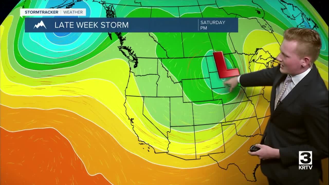
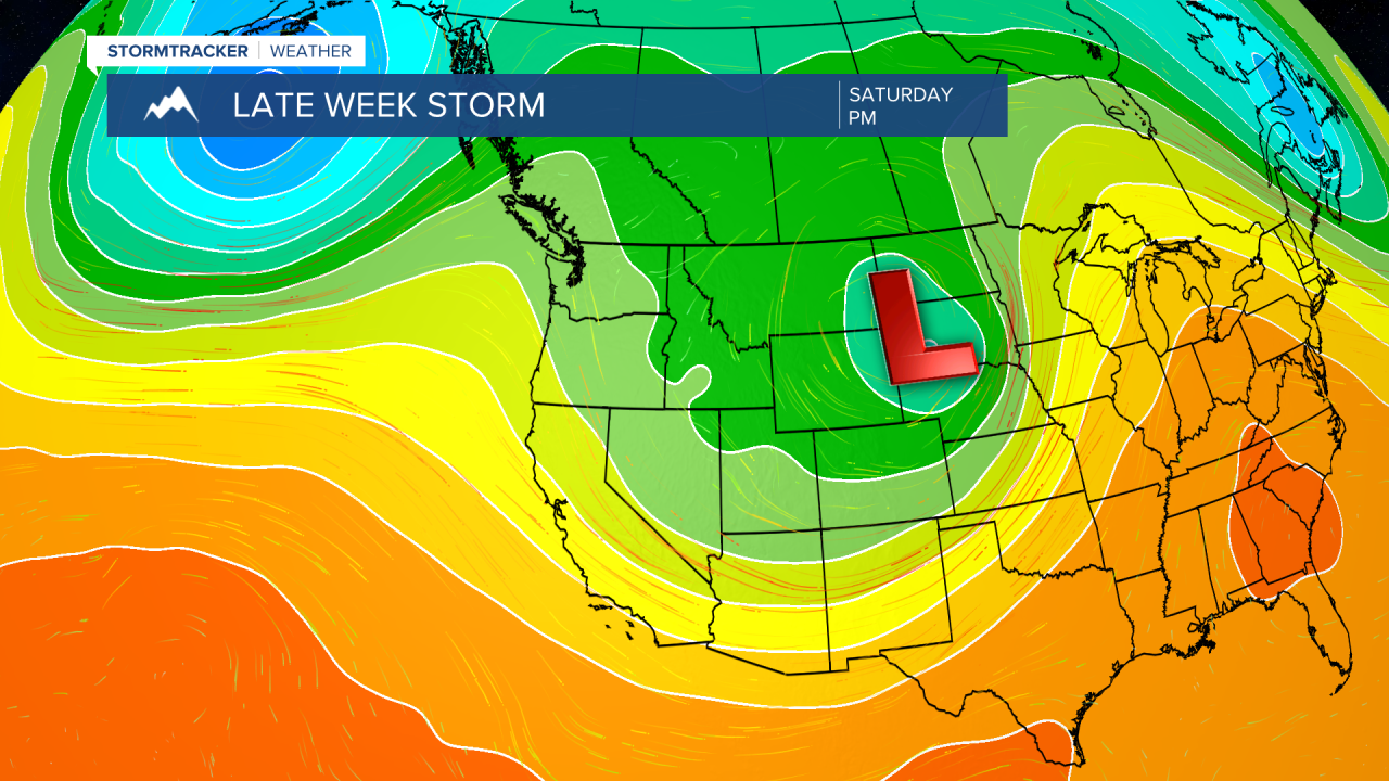
The focus shifts to a late week and weekend storm system that has the potential to bring impacts for portions of the state. There are still some discrepancies between long-range models in exact track and strength of the storm which will ultimately determine where the heaviest precipitation sets up.
Given that it's mid-April, timing of the precipitation will also factor into what we end up receiving (night vs. day). First image depicts the Euro model indicating a weaker and slightly further east storm system (lesser precipitation amounts in central Montana). Second image depicts the GFS model indicating a more potent storm system and a further west track (greater precipitation).

Monday night: Mostly cloudy and milder than recent nights. Overnight low temperatures in the low to mid 30s. SSW wind at 10-15 MPH.

Tuesday: Scattered showers in the morning, more activity in the Helena area. Gradual clearing for the afternoon and evening. Windy, WSW wind sustained at 25-35 MPH gusting to 55 MPH. Gusts up to 75 MPH possible for the Rocky Mountain Front. High temperatures in the upper 40s and low 50s. Overnight low temperatures in the mid 20s with mostly clear skies.
Wednesday: Mostly sunny and breezy. Wind NW at 15-20 MPH gusting to 35 MPH at times. A few snow showers featuring bursts of heavier snow are possible for north central Montana. High temperatures in the mid to upper 40s. Increasing cloud cover overnight as temperatures fall into the mid to upper 20s.
Thursday: Mostly cloudy. Southerly wind at 5-10 MPH. A few, spotty rain and mountain snow showers are possible. High temperatures in the low to mid 50s. Overnight low temperatures in the lower 30s.
Friday: Rain and snow showers. High temperatures in the mid to upper 40s. Travel impacts possible for portions of the area, particularly at night. Overnight low temperatures in the upper 20s and low 30s.
Saturday: Rain, mixing with snow for lower elevations. Steadier snow for the mountains. Breezy. High temperatures in the mid 40s. Overnight low temperatures in the mid to upper 20s.
Sunday: Lingering rain and snow showers. Gradual clearing during the evening. High temperatures in the mid 50s. Partly cloudy skies overnight as temperatures fall into the upper 20s.
Monday: Mostly sunny. High temperatures in the mid to upper 50s.
